TOLEDO (WTOL) - Starting today, you’ll notice changes to WTOL’s interactive radar on the website that makes it even more customizable for your personal weather needs.
This change does not impact anything related to the news or weather apps. However, you will notice the changed format if you view the web on a desktop or mobile device.
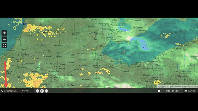
On the bottom toolbar, you can set whatever location you wish to view, though the default will be the northwest Ohio/southeast Michigan area.

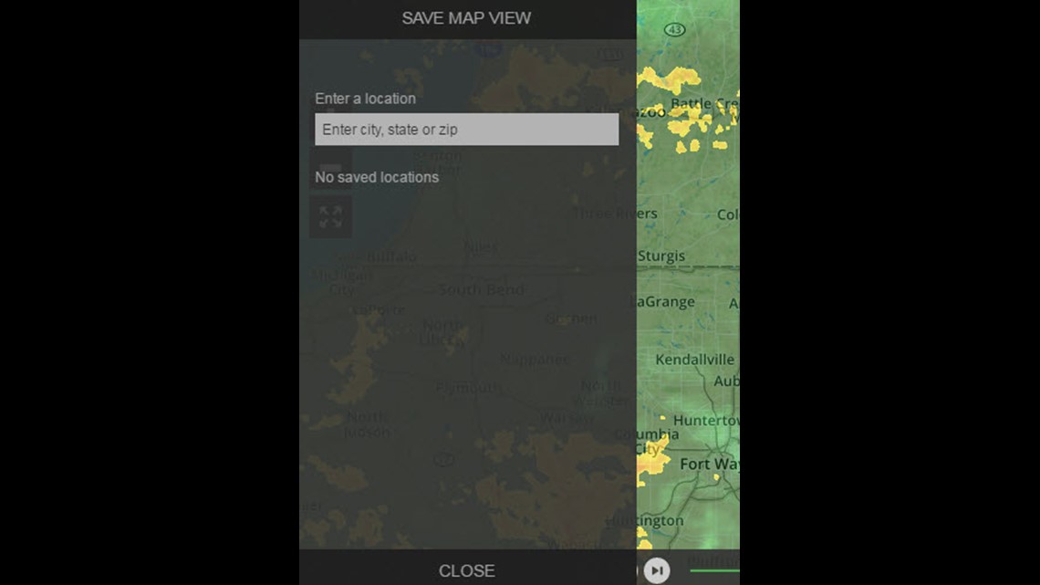
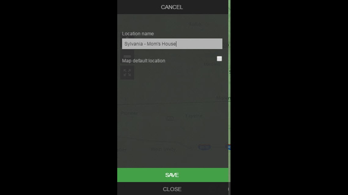
After you have the map centered where you want it, you can save the location by your own choice of name (city name, Home, Mom’s house, etc). (LOCATION WEATHER SAVE NAME PIC)
When a location is set as default, the Star icon is filled in for that location name. This icon is selectable from this panel to set it on/off, so control over default location can be done from this panel after a Location(s) has been saved. Selecting a location from this panel re-centers the map.
You can use the Past/Future options to select whether the radar shows Past radar history (most current view included) or a predicted Future radar view.

The time slider at the bottom then controls what point in time for the radar view. The radar data is presented in five-minute increments.
The slider handle is interactive as are the play and forward/reverse buttons. The forward and reverse buttons move the radar one timeframe increment at a time (five minutes). The time of the radar data is presented to the right of the slider control.
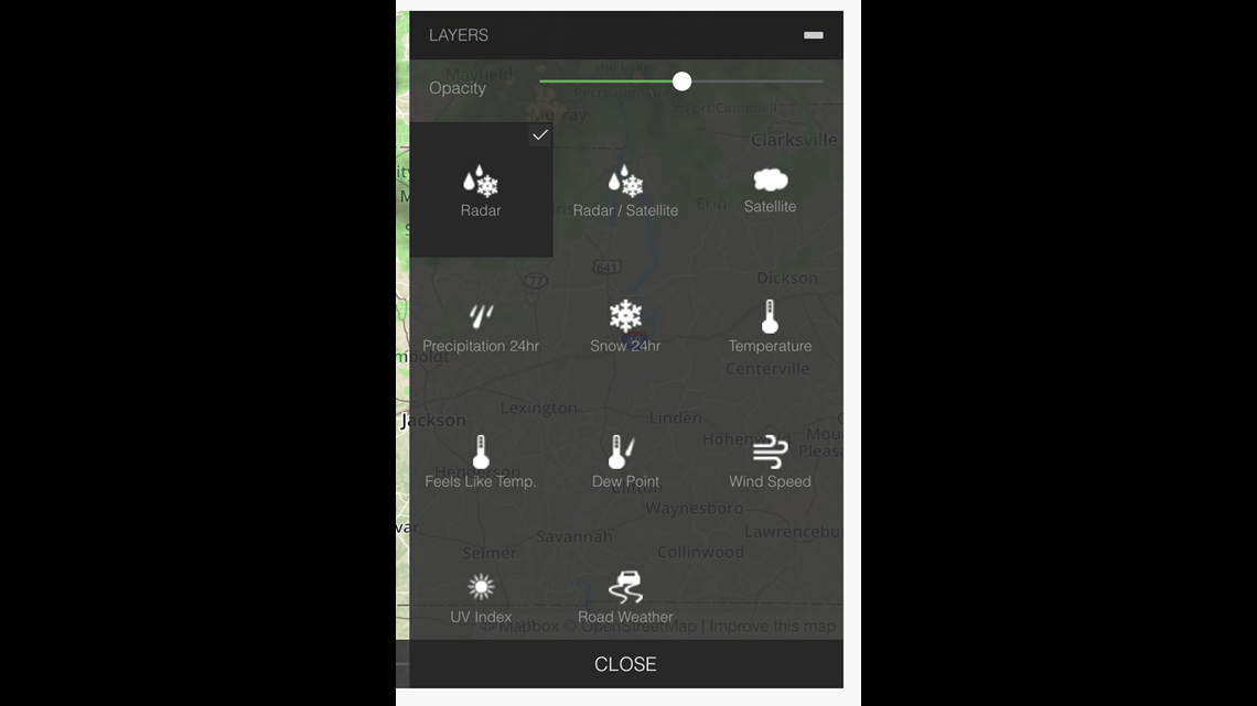
The Layers feature allows you to select numerous different options for display on the map as overlays and control over the opacity. This map does display radar as the topmost level so changes to opacity can affect how well city names and road names can be viewed.
The Layers are organized into four sections - Layers, Overlays, Alerts, and Map Type. You can enable/disable layers to achieve the look of the radar you desire.
These settings are not available to be saved individually for each user for repeat sessions, however. Radar layers are displayed by default.
If you have any questions or need a helping hand, send a message to dotcom@wtol.com