TOLEDO, Ohio — As northern Ohio and southeast Michigan prepare for the winter season, we have a close eye on several weather phenomena that could shape the region’s upcoming cold months. From La Niña to the Polar Vortex, and the ongoing influence of climate change, the forecast suggests a mix of familiar winter conditions — along with some potential surprises.
This forecast also comes with a reckoning that we are experiencing a warming winter climate and an overall downward trend in seasonal snowfall. Take last year’s historically low seasonal snowfall total of 9.5 inches and record setting warmth as a recent example of the shifting climate trends toward warmer winter weather.
Here’s what you need to know about the winter weather outlook for the region.
La Niña: A Player in the 2024-2025 Winter Forecast
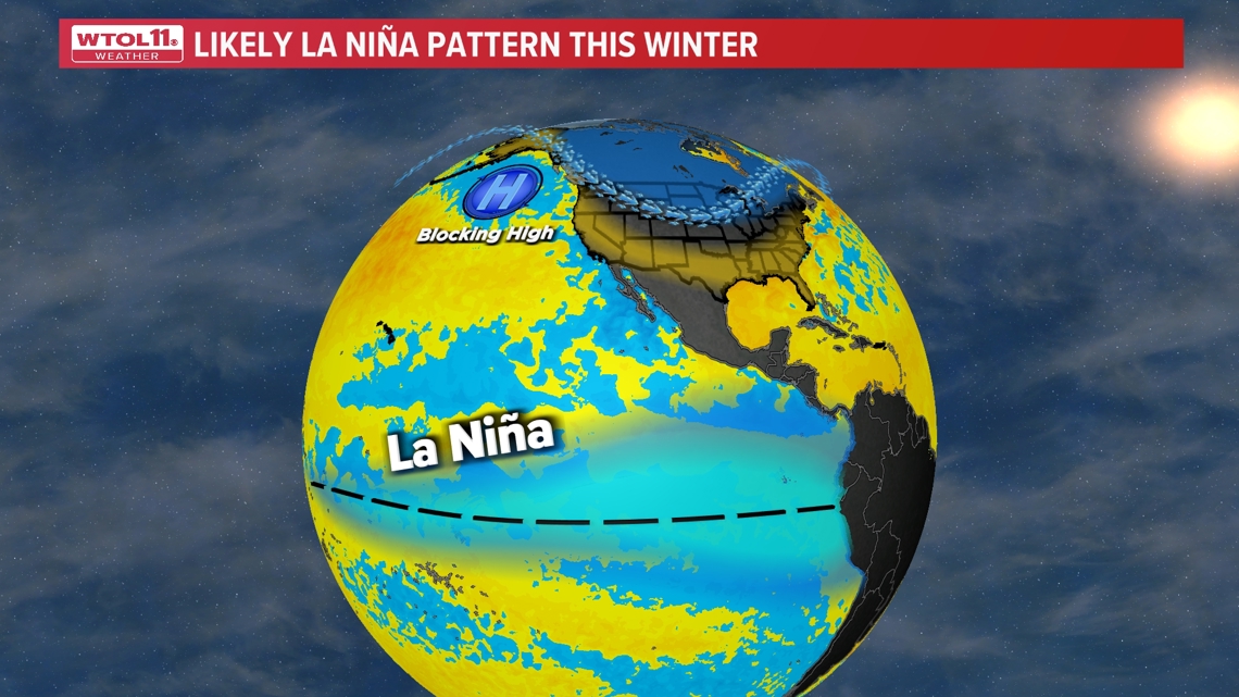
The first influence on northern Ohio’s winter weather this year is the ongoing La Niña pattern in the Pacific Ocean. Albeit this will be a much smaller influence than last year’s very strong El Niño. This is the opposite phase of last winter season.
La Niña is characterized by cooler-than-average sea surface temperatures in the central and eastern Pacific, which can have significant ripple effects on weather patterns across North America, including the Great Lakes region.
For northern Ohio, La Niña can bring colder conditions than usual, however the strength and location matter significantly. In the end, this may be a factor but likely not as significant a player with a weak La Niña this winter.
In this winter ahead, the jet stream, which drives much of the winter weather in the U.S., tends to shift northward during La Niña years.

Polar Vortex: Wild Card for Extreme Cold
Another weather phenomenon to watch this winter is the Polar Vortex — a large area of cold, dense air that usually sits over the Arctic.
When the vortex weakens or is displaced, it can send arctic air plunging southward into the U.S., including northern Ohio. The Polar Vortex remains one of the largest wild cards this winter season and has become more unpredictable in recent winters.
At this time, the Polar Vortex remain stable. The month of January will be make or break on if we make a turn toward harsh wintry weather. These outbreaks of cold and snow are often influenced by disruptions in the Polar Vortex.
If the Polar Vortex dips southward, northern Ohio could experience periods of extreme cold, with temperatures potentially reaching well below freezing for extended stretches. These cold spells could bring dangerous wind chills, snowfall, and significant travel disruptions. The unpredictability of the Polar Vortex means that northern Ohioans should remain prepared for both brief but intense cold snaps that still may happen in overall more moderate winter temperatures.
Eurasian Snow Cover: A Potential Indicator for Winter Severity
Meteorologists also track snow cover in Eurasia as a potential indicator of winter severity in the Northern Hemisphere.
Research suggests that large, early-season snowfalls over parts of Siberia and northern Asia can influence the development of the Polar Vortex and the timing of cold air outbreaks in North America.
In particular, an earlier and more extensive snowpack across Siberia has been linked to a greater likelihood of colder weather in the U.S. during the winter months. Early season Eurasian snow cover is slightly above average. This remains a breeding ground for colder Arctic air.
However, it remains to be seen if the cross polar flow allows this air to intrude into North America. If so, this could impact the second half of our winter.
Great Lakes Water Temperatures and Ice Cover Trends
As the winter season approaches, the warmer-than-average water temperatures in the Great Lakes are a key factor to watch.
Currently, the surface temperatures of the lakes remain above historical averages. Warmer waters have a significant impact on lake-effect snow events, as they provide additional moisture to the atmosphere when cold air moves over the lakes.
Historically, the Great Lakes would typically see substantial ice cover during the coldest months of winter, which could limit lake-effect snow and protect shorelines from extreme cold. However, in recent decades, the region has seen a noticeable decline in ice cover, with some winters experiencing almost no ice at all.
This reduction in ice cover is attributed to warmer air and water temperatures, along with earlier springs.

The Pacific Decadal Oscillation and Its Potential Impact
Another important factor to consider in the winter weather forecast for northern Ohio is the Pacific Decadal Oscillation (PDO), a long-term climate pattern that operates on a timescale of 20 to 30 years.
The PDO refers to variations in sea surface temperatures in the Pacific Ocean, with two primary phases: a "warm" phase (positive PDO) and a "cool" phase (negative PDO).
Currently, the PDO is in its negative phase. In this phase, the jet stream tends to shift further north, often leading to milder conditions in the Ohio Valley with drier, less snowy winters. This phase can enhance the typical La Niña pattern, contributing to more frequent dry spells and potentially less consistent snowfall.

The Impact of Climate Change: Milder Winters, but More Extremes
While the winter weather outlook for northern Ohio includes familiar patterns, the warming climate is continuing to change the dynamics of how and when winter weather occurs. Global temperatures have been rising for decades, and while this does not eliminate the presence of winter storms, it can lead to milder overall winters, especially in terms of average temperatures.
Over the past several decades, northern Ohio has seen an increase in average winter temperatures, which can mean less overall snow accumulation and more precipitation falling as rain, particularly in the early winter months. Warmer winters can also cause snow to melt more quickly, shortening the duration of the snowpack and limiting opportunities for sustained snowfall.
Since the historic winter of 2013-2014, which recorded 86.3” of snow, winter weather in northern Ohio has been sparse. In fact, every January except one (2019), has had below average snowfall. January remains a pivotal month for overall winter weather. Generally, the past decade has been tame from a snowfall standpoint.
The warming climate also brings the potential for more extreme winter events. A warming atmosphere can hold more moisture, and when a cold snap does occur, it can bring heavier, more intense snowstorms. This means that even as winters may be overall milder, there could still be more severe and disruptive storms, with short periods of intense cold and heavy snow becoming more likely.

What to Expect for 2024-2025
For the 2024-2025 winter season, northern Ohioans should expect a winter with the following general trends:
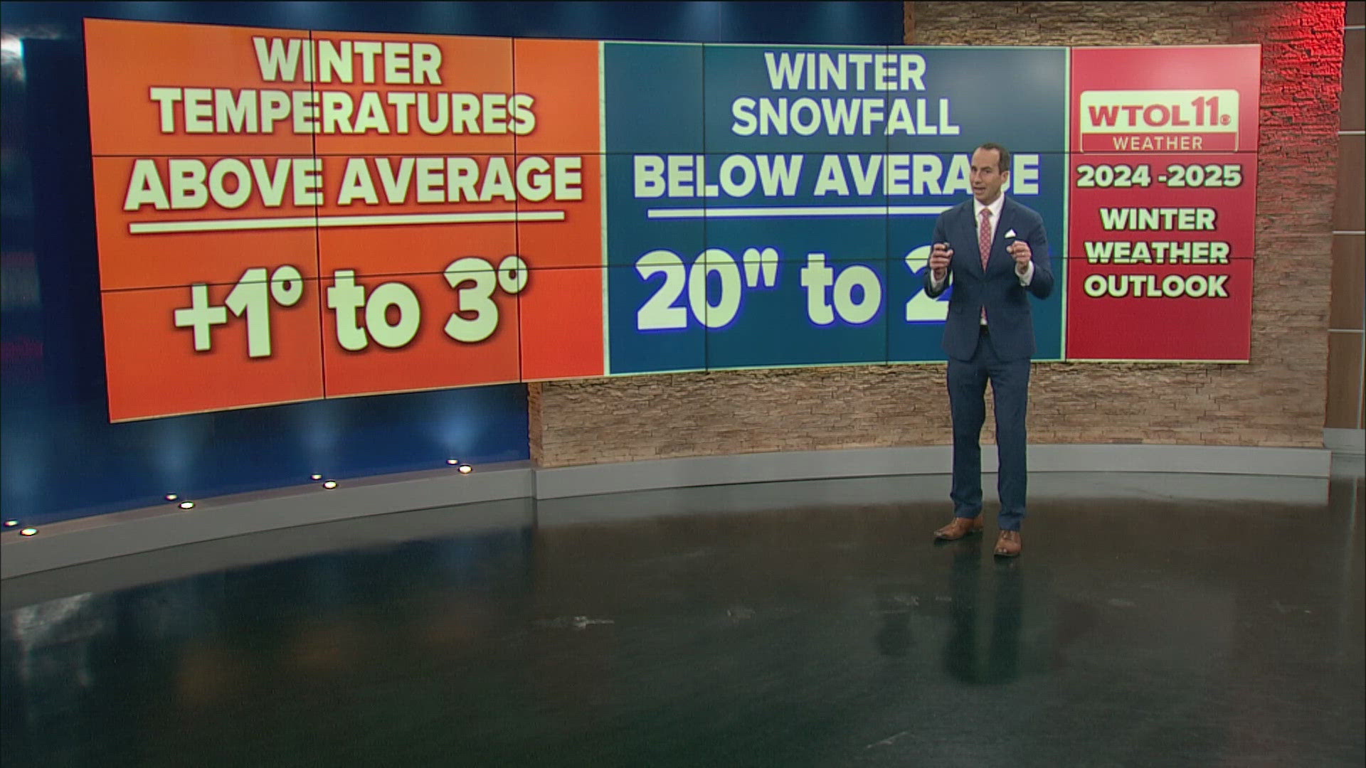
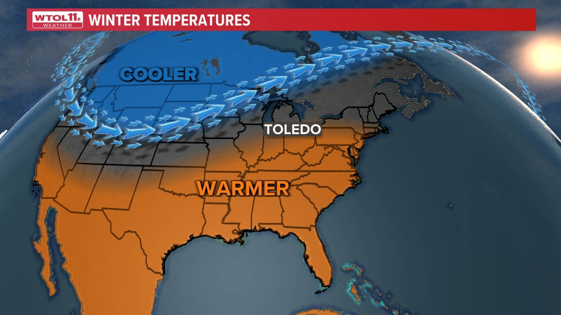
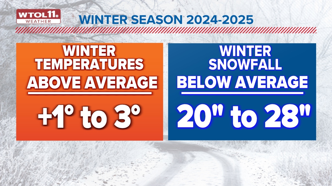
Warmer than average temperatures with potential of some cold snaps, especially if the Polar Vortex shifts southward in January and February. This winter season may average several degrees above average (1 to 3 degrees).
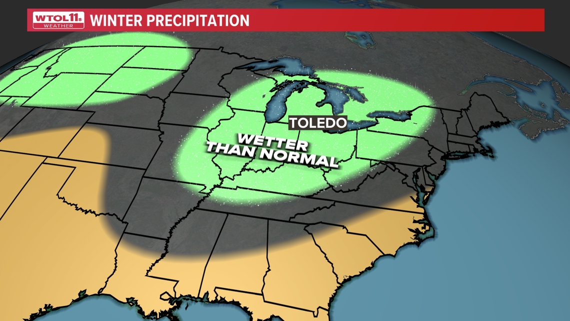
Below average snowfall most likely. Overall precipitation may be at or above average, but that does not equate to more snow in a milder winter. Our average snowfall is around 37” for a winter season. Expect this to be below average with 20 to 28” of snow more likely. This may come with more frequent rain events, and perhaps ice storms this winter season.
More extreme weather events — including heavy snowstorms, freezing rain or ice storms, windstorms and significant cold snaps — are all still possible in a winter season even in the midst of a warming climate. It is important to note, hitting on “The Big One” can define any winter season as a memorable one.

