Where is the rain? Historic dry stretch developing in NW Ohio, SE Michigan
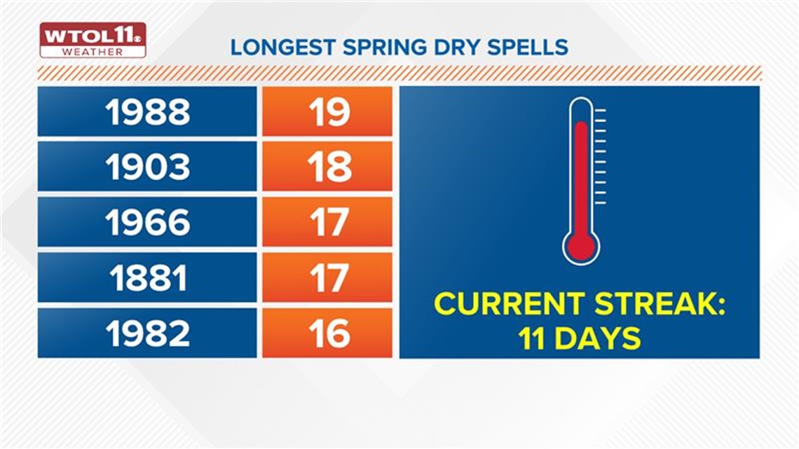
The longest spring dry spell to date was in the summer of 1988.

Chapter 1 Where is the rain?
It’s not unusual for our area to experience it’s share of dry (and wet) stretches of weather. For that matter, periodic stagnant cold and warm patterns also frequently develop. That’s just part of living in this region of the country, experiencing more of those temperature swings. The past two months, specifically the last two weeks is unusual for what is common, even in this back-and-forth area.
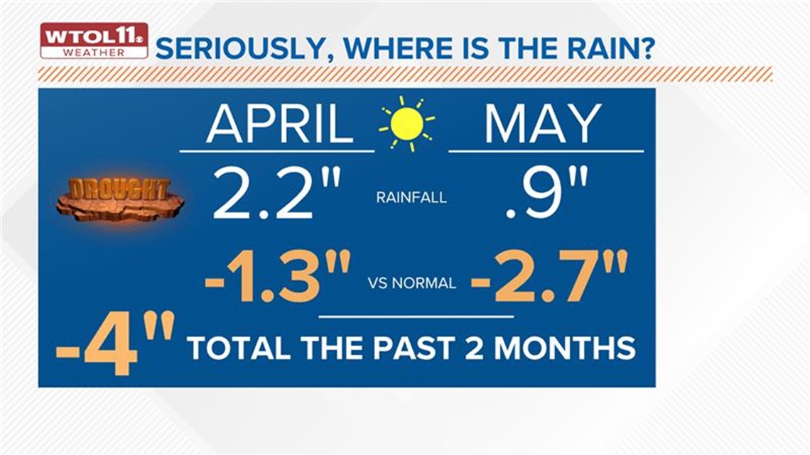
Looking back two months at April, it was an unusually dry month with a little over 2 inches of rain. That’s over an inch below normal for that month’s typical rainfall but a far cry from something that would cause significant concerns. Then the dry pattern intensified as May went along. We talked about the possibility for a ‘Flash Drought’ earlier this month.


This May was the 6th driest ever with less than 1 inch of rainfall reported. That added nearly 3 inches to the rainfall deficit, meaning in just the past two months we are down roughly 4 inches compared to normal. That’s a big shortfall in a short period of time.
Chapter 2 Dry spell streaks over the decades
May is, on average, our wettest month of the year followed by April and June. For that fact alone, just talking about a dry stretch this time of the year is unusual. While this has been a long stretch so far, it isn’t historic … yet. Any time we talk dry weather and history, the mind must immediately go to the summer of 1988.
That year was an all-time dry growing season which led to widespread crop failure or minimal output. The Maumee River nearly ran dry in places, too. So, it should come as no surprise that it tops the list when looking at longest dry streaks in the spring season. If the current outlook holds, we will end up not only on this list but potentially near the top.


Chapter 3 How long will the dry weather stay?
Let’s acknowledge that very isolated showers are possible on a few days this week with a lake breeze or high afternoon heat. But those quick, small showers don’t do much for widespread developing drought conditions. And with how dry the atmosphere is, even these isolated (miracle) showers will struggle to develop. What we need is a pattern change on a national scale which allows for more moisture to return.
The near term into early next week shows few, if any, signs of that happening as our stagnant pattern holds. In fact, there are signs that the pattern may go slightly backward (also known as retrograde) which only prolongs dry air sitting overhead.


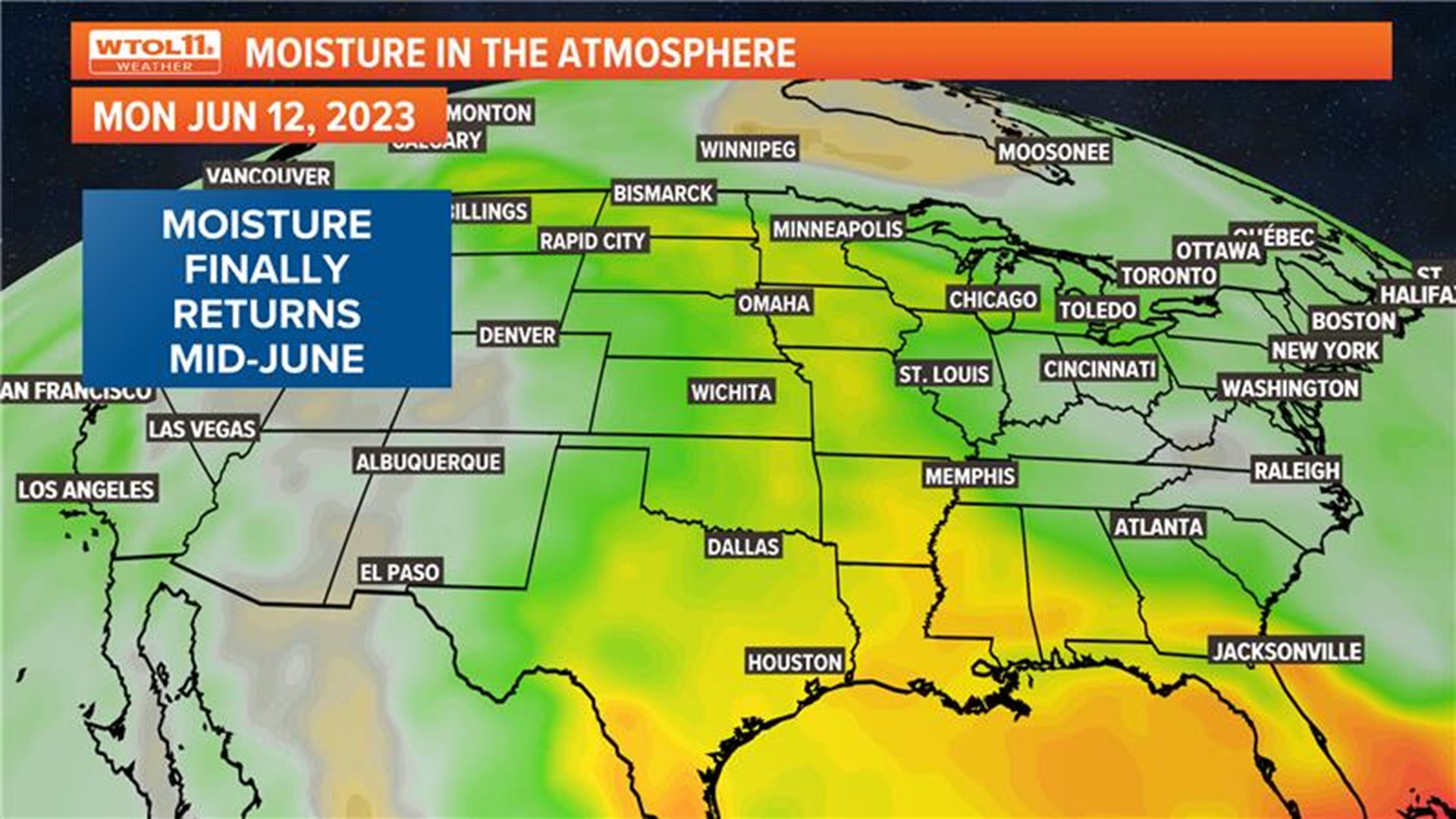
There are indications that a more favorable jet stream alignment for a wet pattern will develop by mid-June but that is a long time to wait if the skies remain dry until that flip. In the meantime, dry days will continue to pile up leading to more frustration for those who need the rain.
MORE FROM WTOL 11 WEATHER

