
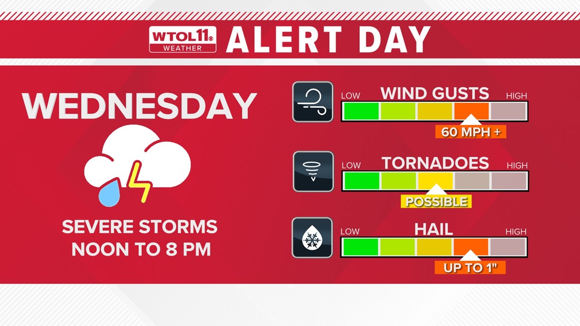
TOLEDO, Ohio — April started off with severe weather, and another storm system is poised to bring gusty winds and severe thunderstorms to the region this week. The WTOL 11 weather team was the first to issue an Alert Day for Wednesday due to the storm risk and wind threat.
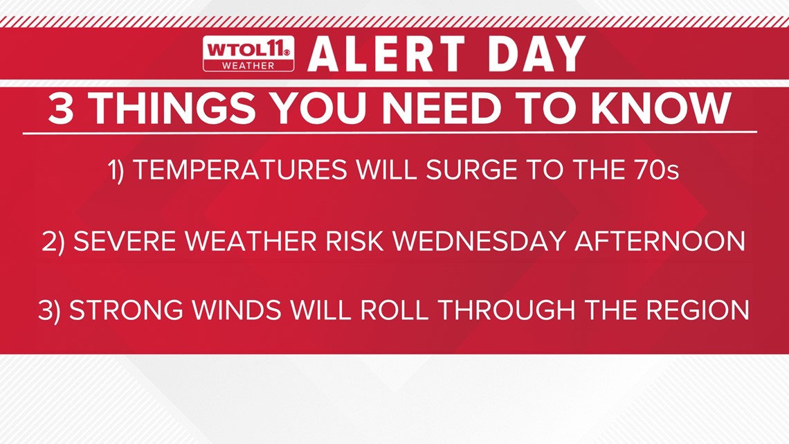
Meteorologist John Burchfield breaks down three things you need to know ahead of the Alert Day.

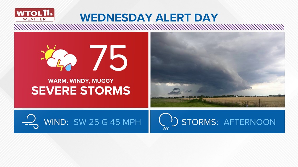
1) Temperatures will surge to the mid-70s on Wednesday
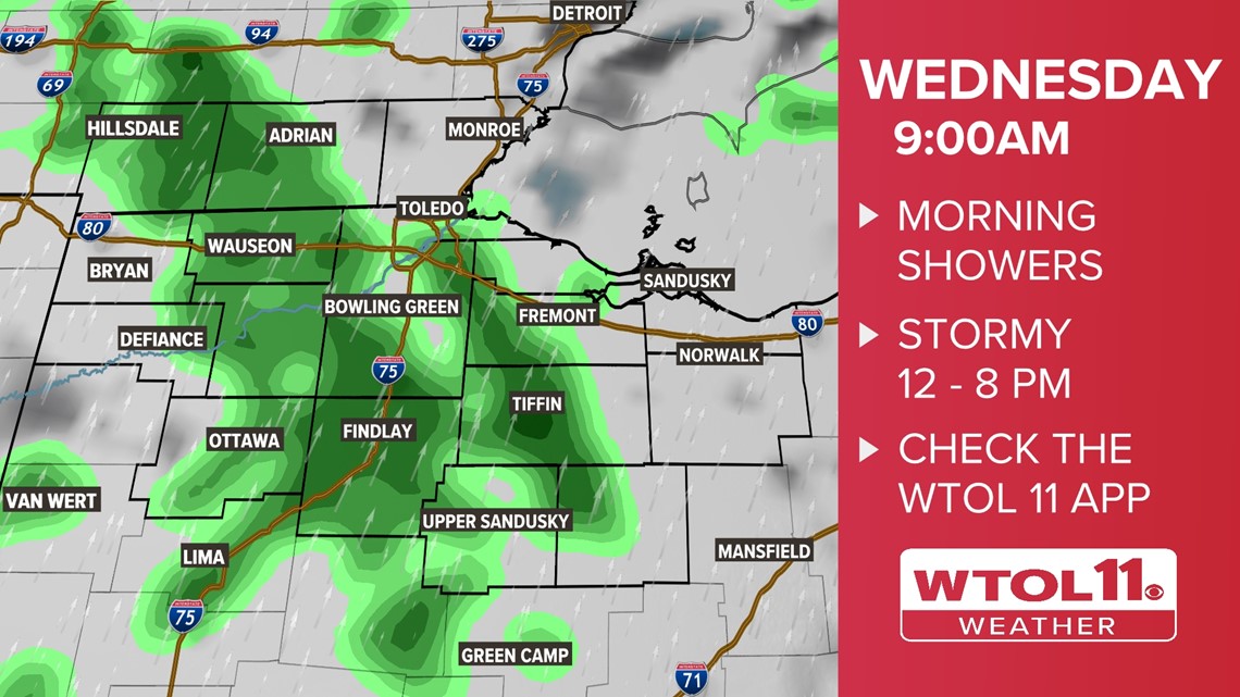
A strong warm front will lift north Tuesday night, elevating temperatures to the mid-60s by daybreak. Pockets of rain will also move in along with the front, and you’ll wake up to warm and wet weather Wednesday morning. When you head into work and prepare the kids for school, temperatures will already be in the mid-60s!

A few thunderstorms are possible Wednesday morning, but severe weather is not expected. Pack the umbrella as you begin your day and check radar on the free WTOL 11 weather app. Even though this morning round of rain will not bring severe weather, stay on high alert through the afternoon, as a stronger round of thunderstorms will roll in after lunchtime.
The warm and humid airmass with temperatures in the 70s will fuel instability in the atmosphere, priming it for thunderstorm development.

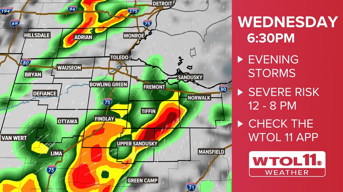
2) Severe weather risk is possible Wednesday afternoon
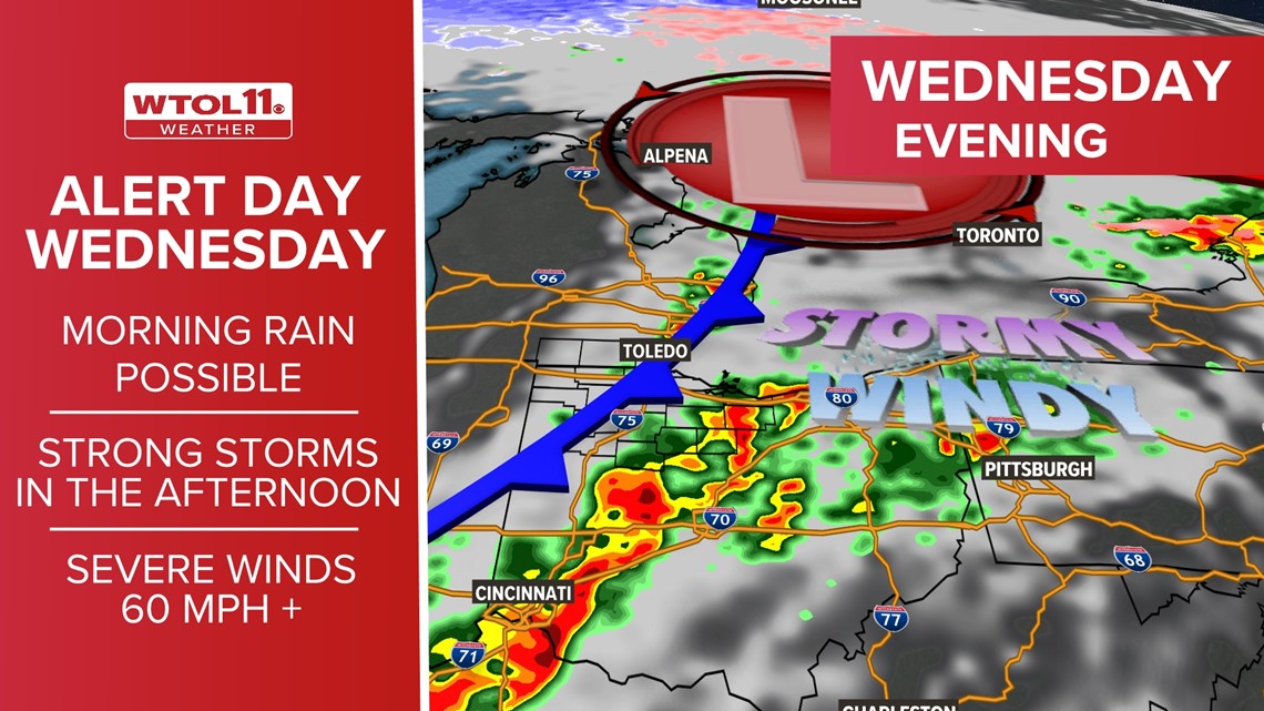
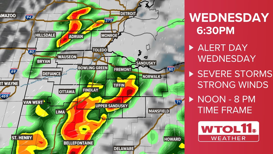
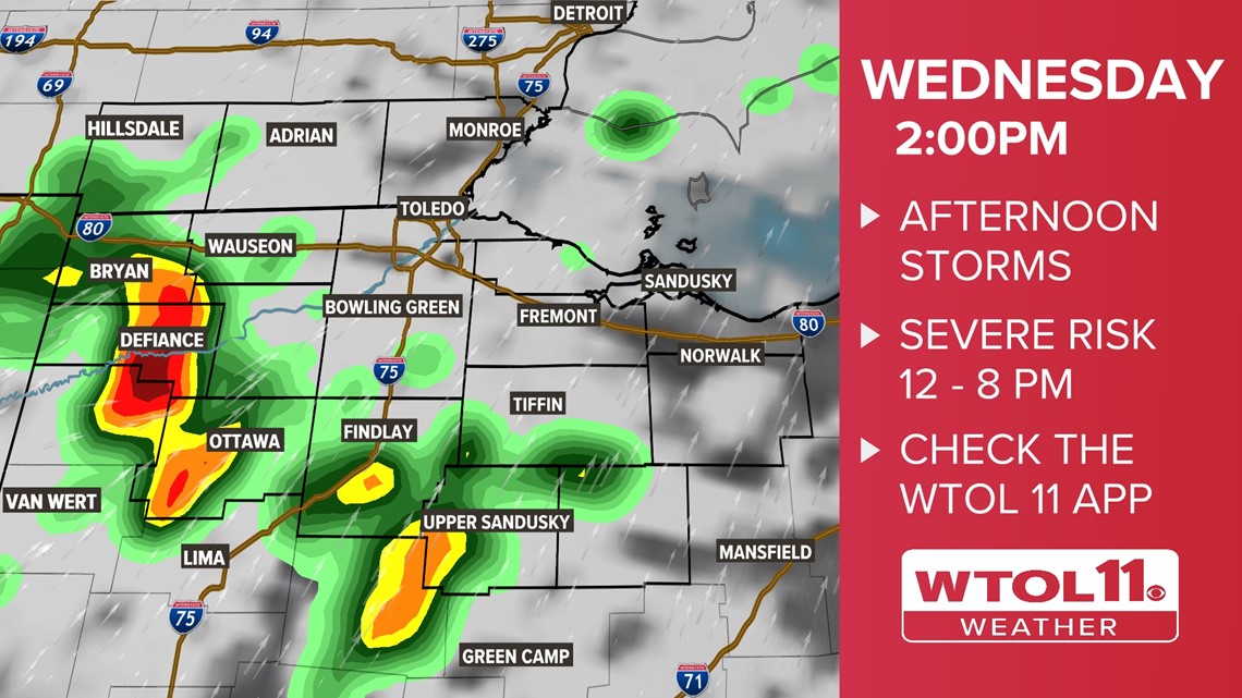
A strong cold front will bring another round of rain and thunderstorms Wednesday afternoon. Ahead of the front, temperatures will skyrocket to the 70s, fueling rising, warm air in the atmosphere.
You’ll feel a muggy setting with dew points climbing to the 60s, a sign of an unsettled airmass. When the cold front rolls in, gusty thunderstorms will develop. During the afternoon and early evening, straight-line winds of 40-60 mph may damage trees and structures.
Heavy downpours are also possible in these thunderstorms.
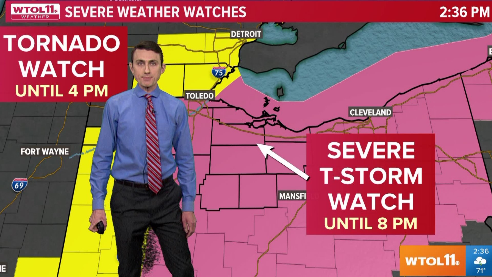
Severe winds with the potential for tornadoes accompany this storm system. While the risk is low, a few spin-ups are possible. The WTOL 11 weather team will keep you safe and updated with any weather risks that this system poses as it develops.
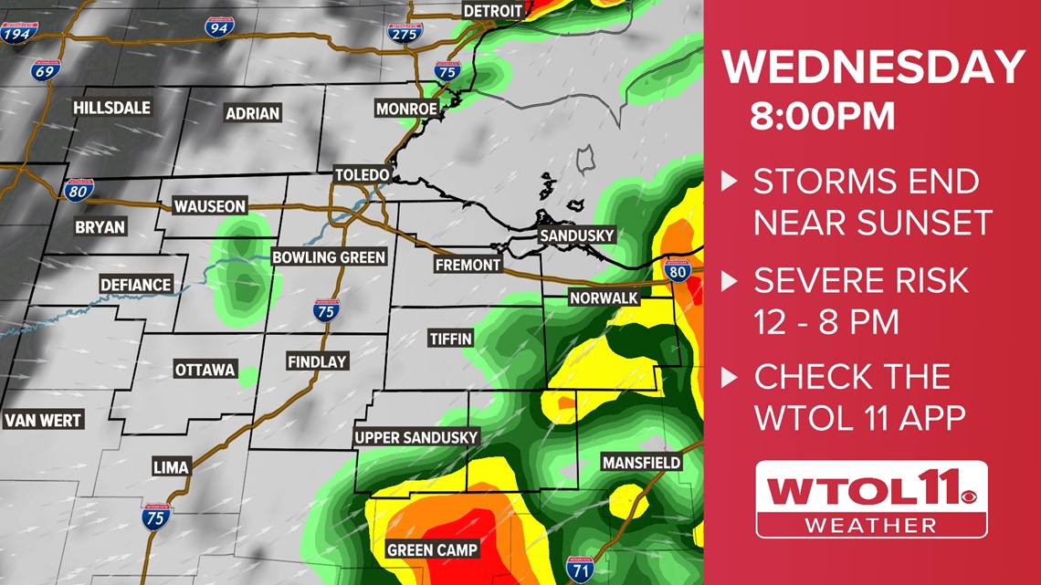
The severe weather threat will diminish by 8 p.m. as the cold front races east.

3) Strong winds will roll through the region
Even during the times when it’s not stormy, Wednesday will bring gusty winds with a mild feel. Southwesterly winds may exceed 45 mph independent of thunderstorms. Storms will elevate wind speeds Wednesday afternoon and evening. Winds will gust out of the southwest, shifting to the west Wednesday evening behind the cold front.
A breezy west wind will continue Thursday behind the cold front as temperatures drop to the low-50s. The storm threat will be done by Thursday, but the breezy weather will linger.

Timing


April kicks off severe weather season in northwest Ohio and southeast Michigan and the WTOL 11 weather team is here to keep you safe and informed. Download the WTOL 11 weather app for exclusive updates from our team of Meteorologists. As Wednesday’s storm system draws closer, this article will be updated with the latest forecast information.
MORE FROM WTOL 11 WEATHER: