TOLEDO, Ohio — Now that May is underway, you may be wondering if the wet weather will continue into the rest of the spring season. After the wettest April on record, frequent showers will likely linger into early May.
In this week’s Climate Friday Newsletter, Meteorologist John Burchfield will recap the historically rainy April and help you plan for May.
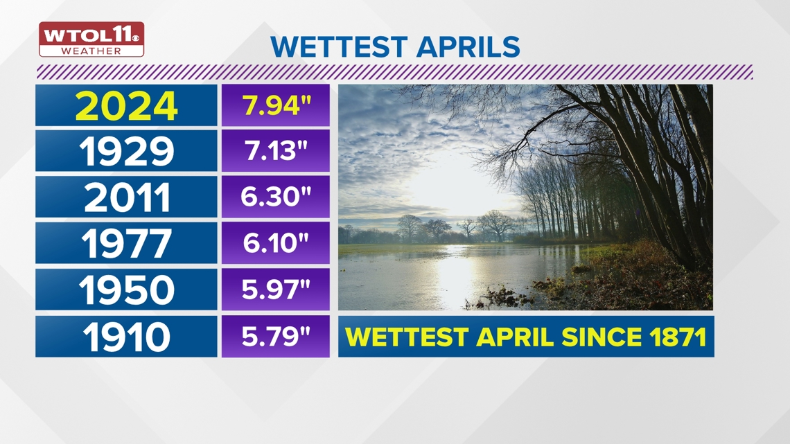
With 7.94 inches of rainfall, April 2024 will go down in the history books as the wettest on record in the Toledo area. Monthly rainfall surpassed the normal amount by 4.49 inches. 2024 shattered the previous monthly record of 7.13 inches from 1929. Ranking number three on the list of wettest Aprils is 2011, which brought 6.30 inches of rain. Not only was rainfall heavy last month, but also frequent. 18 days, or 60% of the month, featured measurable rainfall and only 12 days were totally dry.


April was not only wet but was warm as well. The average temperature of 53.6 degrees ranks as the eighth warmest on record. The average high temperature of 63.7 degrees ranks as the 11th warmest on record. April will go down as a historically rainy month with above-average temperatures.
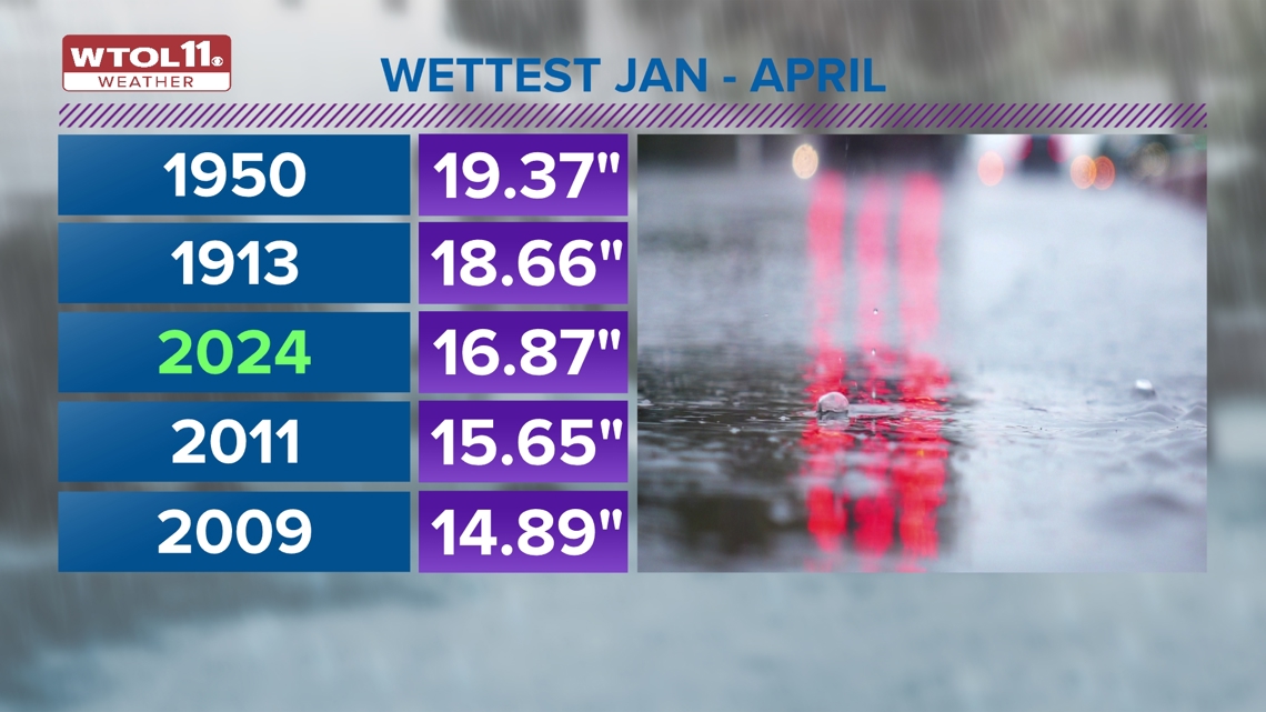
This warm and wet trend has characterized 2024 thus far. January through April have brought unusually mild and damp conditions. With 16.87 inches of total rain, this year ranks as the third wettest on record through the end of April. Only 1913 with 18.66 inches of rain and 1950 with 19.37 inches featured more rainfall through the first four months of the year. 2011 ranks fourth on the list with 15.65 inches and 2009 rounds out the top five with 14.89 inches through the end of April.


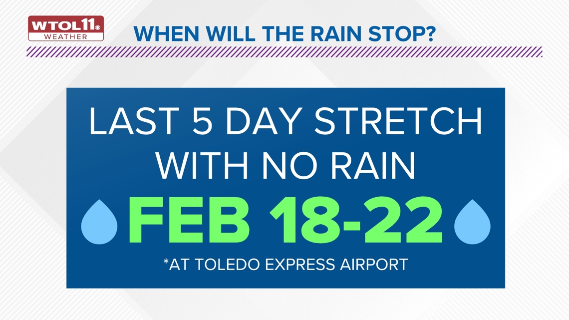
This year has brought both heavy and frequent rainfall: the last five-day stretch without rain occurred from Feb. 18-22. Both rainfall and temperatures have stood out this year, and the first four months of 2024 rank as the third wettest and second warmest on record.
With an average temperature of 41.3 degrees, 2024 falls only behind 1880, which featured a mean of 41.6 degree during this time frame. 1880 was not nearly as wet, however, and brought only 11.23inches of rain through the end of April. This year has featured an unusual combination of warm and wet weather conditions.
So will this wet weather continue into May? Many area farmers and gardeners would appreciate some dry days to begin spring planting. With frequent rounds of steady rain, the soil is saturated across most of northwest Ohio and southeast Michigan and river levels remain elevated.


While April rainfall is not always predictive of what is to follow, sometimes the weather pattern from one month can bleed into the next. May 2011, following the third wettest April on record, brought a whopping 5.9 inches of rainfall, nearly double what is normal. 2011, like 2024 featured several consecutive months of very wet weather.
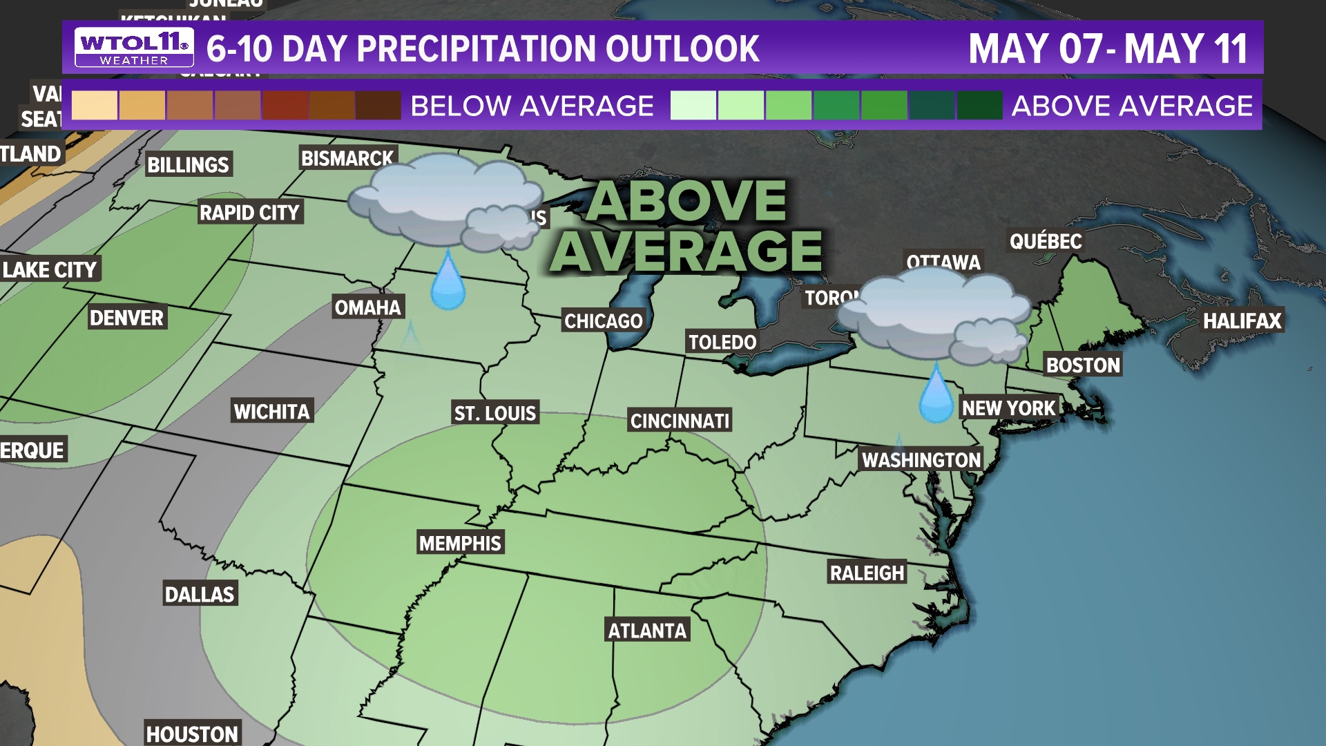
So what can you expect for May? After several sunny days to start the month, frequent rainfall is expected to return this weekend and next week. In fact, if you’re reading this Friday, you may be seeing raindrops out the window right now. The green color on this map shows the six to 10-day precipitation outlook extending through May 11.


For much of the Midwest and New England, the next couple weeks will bring above-average precipitation with an active storm track. You’ll see numerous chances for rain showers and spring storms next week in the WTOL 11 10-day forecast. This doesn’t mean that every single day will be a washout, but frequent rain could still delay spring planting and contribute to localized flooding. As this wet May weather pattern unfolds, stay tuned to the WTOL 11 weather team for the latest weather forecast!
WATCH PREVIOUS EPISODES OF CLIMATE FRIDAY

