TOLEDO, Ohio — May is a month of change, marking the transition from spring into summer. While May can feature erratic ups and downs in the weather from summery warmth to frosty nights, and soaking rain to brilliant sunshine, it provides hope that summer is not too far away.
So what can you expect for the rest of the month of May? And how is climate change impacting May weather? Meteorologist We'll answer those questions and more in this week's edition of Climate Friday.
Watch previous episodes of Climate Friday on the WTOL 11 YouTube channel
May delivers a rapid rise in temperatures as spring transitions into summer. At the start of the month, the average high temperature is only 68 degrees. The average low? Only 46.
Chilly spring weather is commonplace in early May, and frost and freeze often impact outdoor gardens. By Mother's Day, temperatures start to warm up as the average high surpasses 70 degrees. The second half of the month brings a rapid uptick in temperatures, and by May 31, the normal high surges to 78, feeling more like summer.


The average low climbs to 56 by the end of the month as frost and freeze concerns usually fade away.
Overall, May is growing much warmer due to climate change. The month of May is significantly warmer in the 21st century than it was in the 20th century, and the mercury is going up by the decade.
Every 10 years, the National Oceanic and Atmospheric Association (NOAA) releases a new set of average weather data based on changes that occur in any given location. In the past decade, May in Toledo has warmed up by 2.3 degrees.
Even if that doesn't sound like much, consider that change occurred in only 10 years. Two degrees per decade over the course of half a century marks a whopping 10-degree shift in average temperatures.
Climate change magnifies temperature shifts over time, compounding warmer weather year-after-year. May will continue to grow warmer during your lifetime due to climate change.
What about May rainfall? Even though April is known as a showery month, May takes the cake as the wettest month of the year in northwest Ohio and southeast Michigan. With average rainfall of 3.82 inches, May sits atop the list of wettest months, surpassing April and June, which share the second spot with average monthly rainfall of 3.45.
Though April showers bring May flowers, the rain continues and becomes even more frequent as spring progresses. Additionally, thunderstorms grow more common in May and can dump higher rainfall totals than garden variety spring showers.
Climate change is also making May much rainier, and spring rainfall as a whole is rising noticeably. Warmer temperatures lead to increased evaporation, which fuels heavier downpours and frequent rainfall. Expect May weather to become warmer and wetter in the coming decades.


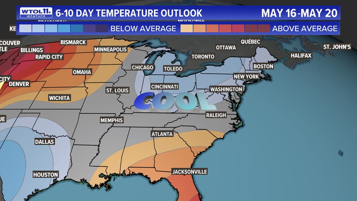
So what's ahead weather-wise? Though average highs are on the rise, the 10-day forecast features seasonably cool weather with high temperatures largely in the upper-60s to low-70s. This may sound nice and pleasant, but remember that our normal high will be 78 degrees by the end of the month.
Even with this cooler-than-normal weather pattern, overnight frost and freeze looks extremely unlikely, which is good news for area gardeners and farmers.
The coldest overnight low in the WTOL 11 10-day forecast will dip down to the mid-40s, far above the threshold for spring frost. As spring soon transitions into summer, warmer weather will become the norm.
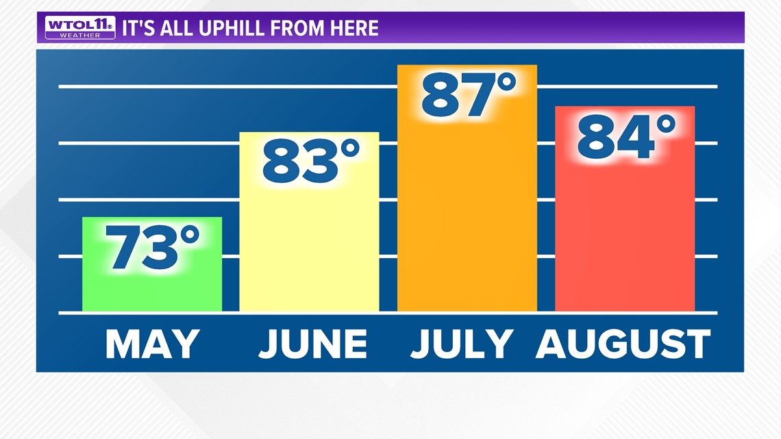
Our average high temperature throughout the month of June is 83. By July, the average high skyrockets to 87, making it our hottest month of the year.
Normal temperatures in August remain a toasty 84 degrees. If you enjoy warmer weather, you have plenty of mild days to look forward to.
Whatever weather Mother Nature throws our way for the rest of May and beyond, the WTOL 11 weather team will keep you updated. Subscribe here for a new Climate Friday Newsletter every Friday.
RELATED VIDEO

