TOLEDO, Ohio — October is a month of change and it often brings ups and downs in the weather as the seasons transition.
This week has exemplified the weather roller coaster of October. Both locally and nationally, this week has featured weather extremes ranging from early season snowfall to summery 80-degree temperatures. These wildly different weather phenomena represent the nature of mid-October.
Fluctuations in the jet stream caused these different weather patterns. Furthermore, climate change may be intensifying weather extremes during the fall months.
Here at home, this week started off with a bitter chill. A powerful cold front caused temperatures to crash down to the 40s, and west winds made for frigid wind chills in the 20s. For parts of northwest Ohio and southeast Michigan, the first snowflakes of the season fell this week.
For others, freeze warnings signaled the end of the growing season. While the weather here was cold and windy, parts of the Great Lakes region experienced a brush with winter.
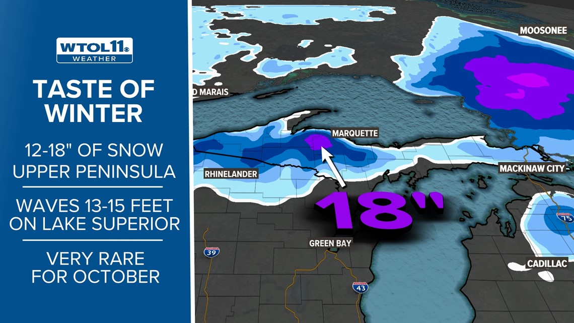
The Upper Peninsula of Michigan recorded historic October snowfall, with areas west of Marquette picking up 18 inches of snow. Widespread snowfall totals over a foot left parts of the Upper Peninsula digging out.


Closer to home, the lake-effect snow machine produced accumulating snow in northern Indiana and eastern Ohio. Areas near Fort Wayne, Indiana shoveled out of a slushy accumulation, and the Lake Erie snowbelt from Cleveland to Erie recorded measurable snow. Portions of the WTOL 11 viewing area, including Findlay, felt the first flakes of the season.
The weather out west was the polar opposite. While Midwesterners felt a taste of winter, folks in the Pacific Northwest experienced summer-like warmth.
Temperatures soared to the 70s and 80s in most of Oregon and Washington. Olympia, Washington recorded a high temperature of 85 this week. Seattle skyrocketed to 88. Most impressive, Medford, Oregon felt the heat with a 91-degree temperature reading.
These temperatures were commonplace out west this week. This time of year typically brings chilly and wet weather in the Pacific Northwest. This week delivered unusually mild and dry conditions.
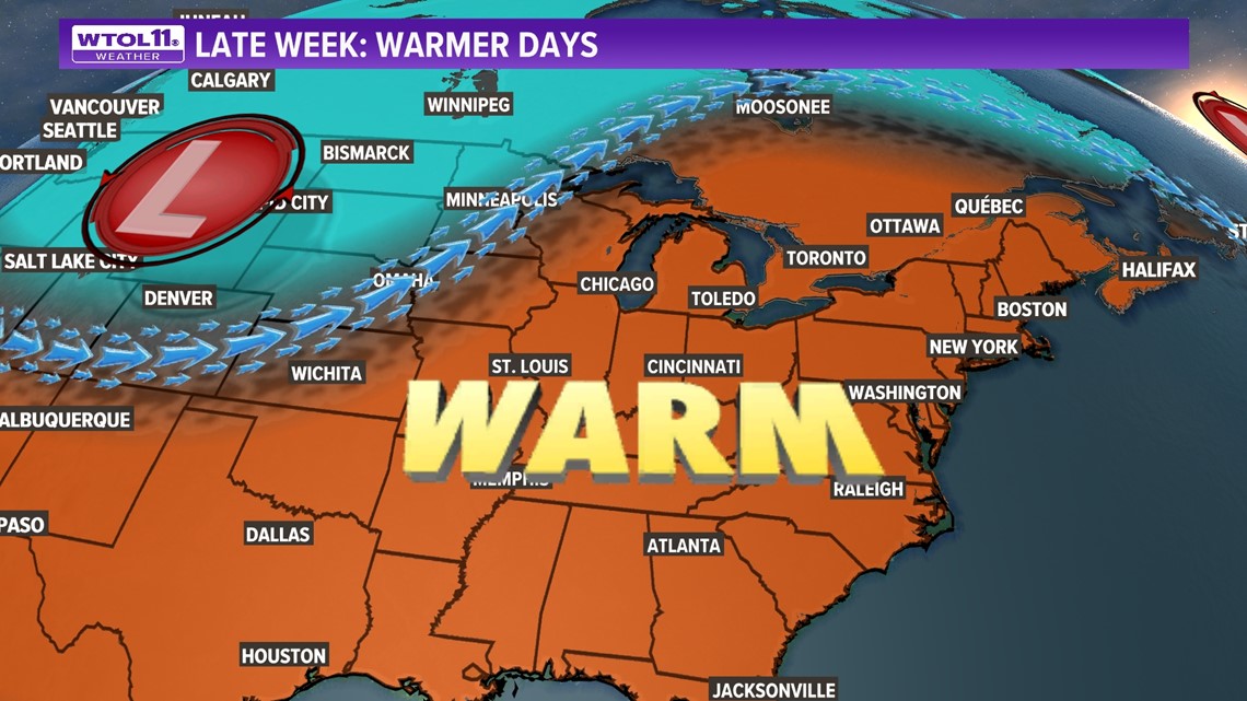
This extreme fluctuation in temperatures and weather was caused by deviations in the jet stream. The Great Lakes region experienced a long-lasting trough in the jet stream, which caused a cold, windy, snowy weather pattern. Contrarily, the Pacific Northwest felt the impacts of a ridge in the jet stream, which produced a warm, dry, summery weather pattern.
This equilibrium in the weather is common, and one extreme often parallels the opposite in a different part of the country. Climate change amplifies extremes in the weather, but does not inherently cause these deviations. While warm spells are growing hotter and dry stretches are becoming drier, these variations in the weather are common in autumn due to fluctuations in the jet stream.
This weekend, the Midwest will finally enjoy the other end of the spectrum. A shift in the jet stream will send temperatures soaring to the 70s. Dry, mild, sunny conditions will continue this weekend and beyond as a ridge in the jet stream brings the Midwest region and milder feel.


Meanwhile, the Pacific Northwest will finally feel some cooler days and wetter weather, more characteristic of a normal October.
This equilibrium in the weather is often associated with a change in the jet stream. Long story short, after a frigid start to the workweek, temperatures will warm up nicely for the weekend.
Be sure to stay tuned to the WTOL 11 weather team for the latest 10-day forecast and subscribe to the Climate Friday newsletter.
RELATED VIDEO

