TOLEDO, Ohio — Ohio and Michigan can't catch a break from the April showers, and even more rain is in the weekend forecast. This spring has been one of the wettest on record, and 2024 is off to one of the rainiest starts in Toledo history. Additionally, much of the region experienced a spring frost this week with temperatures near freezing.
In this week's Climate Friday Newsletter, Meteorologist John Burchfield will break down the numbers behind this historically wet year and explain how common a spring frost and freeze are.
2024 has been the fourth wettest start to the year on record. 15 inches of rain have fallen in less than four months. Looking at January to April rainfall, 1950 is the wettest in Toledo history, recording an impressive 19.37 inches of rain. 1913 ranks second with 18.66 inches.
2011 follows at number three on the list with 15.65 inches. 2024 could potentially overtake 2011 with additional showers likely in the final days of April. Rounding out the top five is 2009, which brought 14.89 inches of rainfall. A wet weather pattern will likely continue into the start of May, continuing this historically wet start to the year.


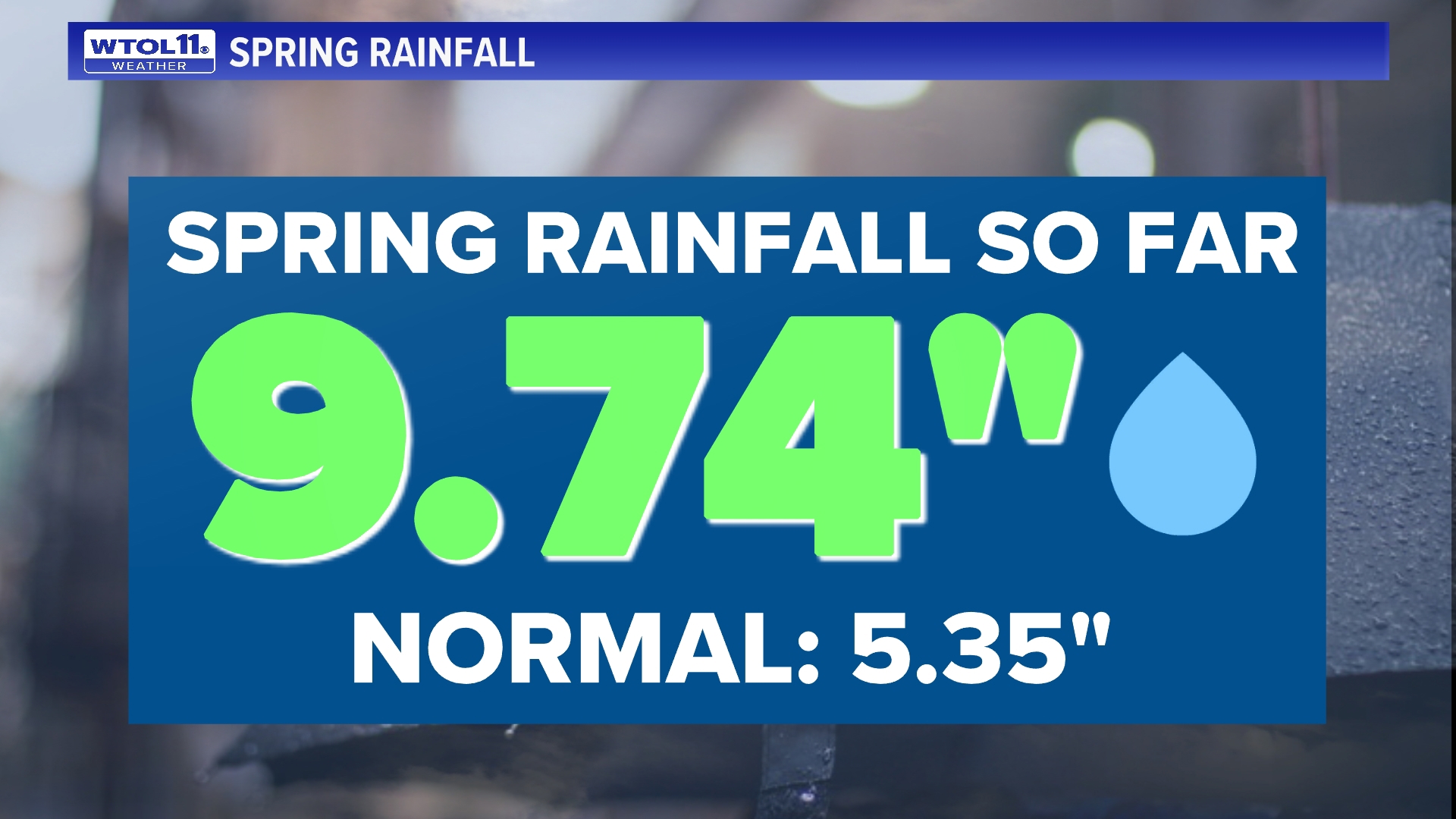
What about rainfall over the entire spring season? Our spring rainfall total so far sits at 9.74 inches, nearly double what is normal. Rainfall has been so frequent this spring that we haven't gone even five days without rain since February. The last time Toledo saw a five day stretch without rain was February 18-22.


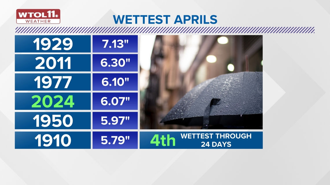
While spring as a whole has been incredibly rainy, April has been historically wet. If April ended today, it would be the fourth wettest on record. With 6.07 inches of rain, this month is a whopping 3.23 inches above average. The April rainfall surplus will continue to grow over the next several days as the damp weather continues through the end of the month.
The wettest April on record occurred in 1929, which brought a substantial 7.13 inches of rain. April 2011 dosed out 6.30 inches of rainfall. April 1977 is the third wettest on record with 6.10 inches. This April falls just shy at number four. 1950 takes the fifth spot on the list with 5.97 inches. April 1910 rounds out the top six with 5.79 inches. Weekend showers and thunderstorms will add to our already historical April rainfall total, possibly pushing this month up the list.


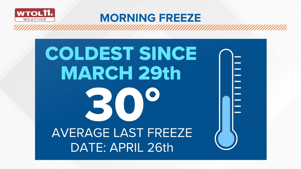
While the rain has been the big story this spring, the frost has also impacted area gardeners this week. With temperatures dipping down to the low-30s Thursday morning, many areas saw frost and freezing conditions. On Thursday, Toledo Express Airport logged the month's first sub-32 degree day.
Despite the mild start to spring that has prompted an early bloom, frost and freeze are very common in April and May. Our normal last frost (36 degrees) of the season occurs on May 8. The normal last freeze (32 degrees) of the year typically occurs on April 26.


Thursday morning's frosty and freezing conditions are nothing out of the ordinary, and frost and freeze normally occur well into April. After a bitterly cold Thursday morning, temperatures will turn much milder for the weekend with highs surging to 80 degrees.
The historically wet start to 2024 will likely continue into May with a damp weather pattern ahead. Stay tuned to the WTOL 11 weather team for the latest 10-day forecast and subscribe to the Climate Friday Newsletter for new content every week.
PREVIOUS EPISODES OF CLIMATE FRIDAY

