TOLEDO, Ohio — On average, July is the hottest month of the year. You will likely remember this July as a month lacking in major heat and frequent rainfall. As we round the corner into August, the final month of summer, Meteorologist John Burchfield recaps the numbers from July.
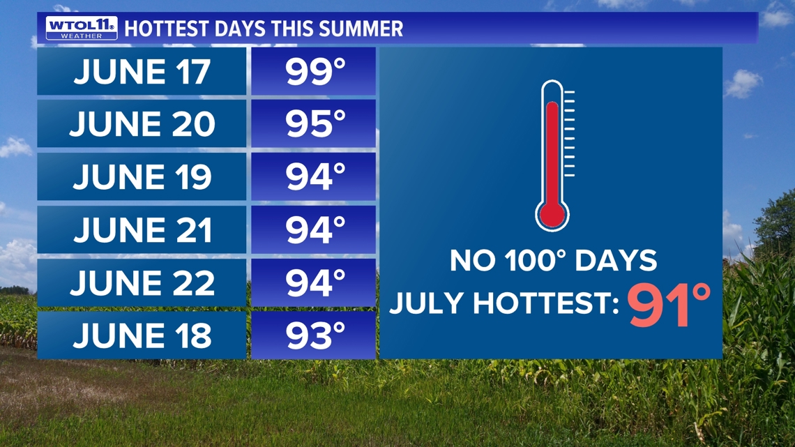
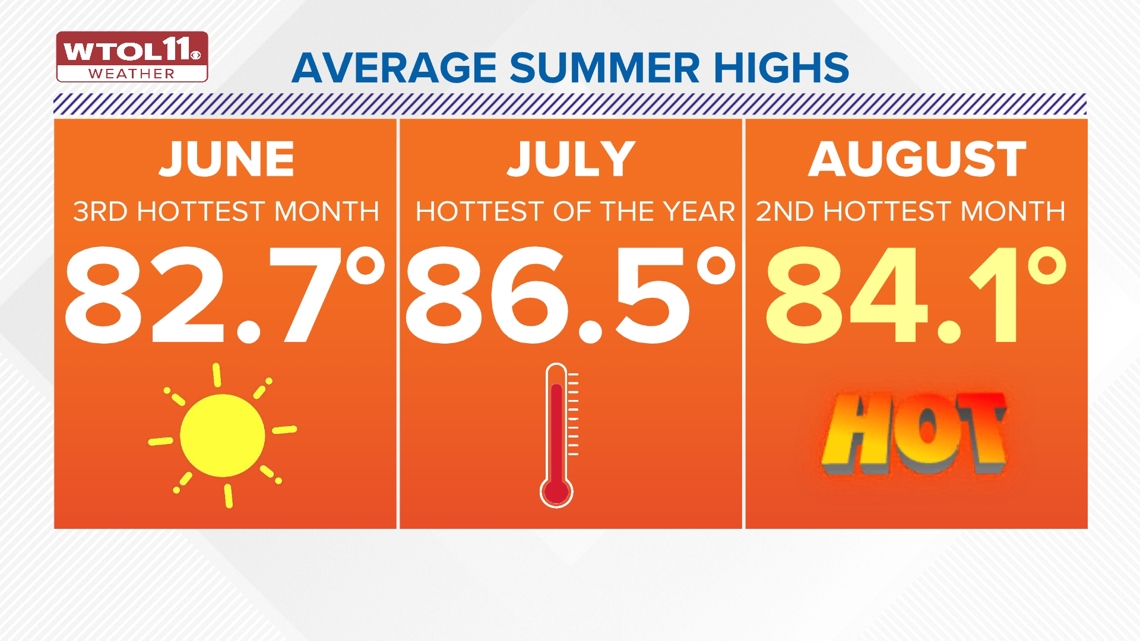
July failed to deliver any major heat for over three weeks, and the first 90 degree day of the month didn't arrive until July 28. Wednesday brought another dose of 90 degree temperatures, tallying on just the second 90 degree reading of the month. This lack of 90 degree temperatures is uncommon, especially considering the average high over the course of the entire month if 86.5, the hottest of the year.

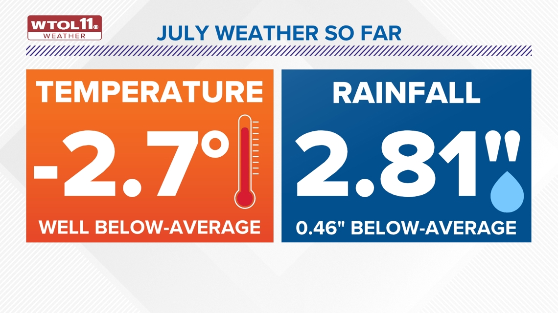
This July featured an average high temperature just above 83 degrees, over 3 degrees below-average. This relatively cool average is representative of lack of 90 degree days. Though July only added a pair of 90 degree days to the yearly total; 2024 as a whole has brought 12 so far. A typical year delivers 19 days at or above 90 degrees, so 2024 is still on pace to match or exceed the norm.

READ MORE: High temperatures lead to dehydration, heat exhaustion for firefighters: How departments prepare
The record number of 90 degree days in a year occurred in 1988 with a whopping 44 days in the 90s. The hottest stretch of the summer so far occurred in June, spanning seven consecutive days from June 16-22. That week featured a historic average high temperature of 94.1 degrees.
Though July couldn't match this heat wave, August is likely to deliver additional 90 degree days. August is statistically the second hottest month of the year with an average high temperature of 84.1 degrees. This exceeds the month of June, which on average ranks as the third hottest month with a mean high of 82.7 degrees. The long-range outlook features mild conditions into the start of August, but the WTOL 11 Weather Team is not seeing any significant heat on the horizon.

How did July stack up in terms of rainfall? With 2.81 inches of rain, July fell slightly below-average in the precipitation department. July started off relatively wet as the remnants of Hurricane Beryl brought tropical moisture to the region, dosing out 2.25 inches in just 24 hours between July 9 and 10.
EARLIER COVERAGE: How much rainfall did the Toledo area get from Beryl and how does it impact the algal bloom? | Climate Friday
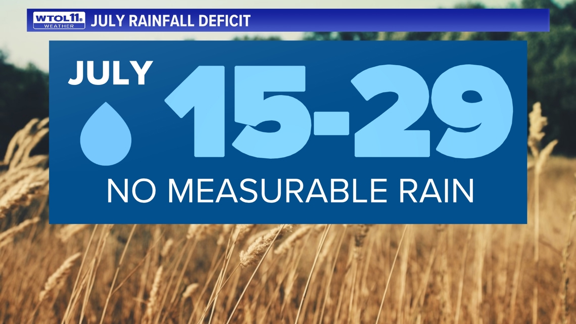
After that storm, July featured just over half an inch of rainfall in three full weeks. The span from July 15-29 came without any measurable rainfall, moving the needle from a rainfall surplus to a deficit. The latest drought monitor is released every Thursday, and the WTOL 11 Weather Team will update you throughout the rest of the summer as dry conditions impact area farmers and gardeners. As of Aug. 1, northwest Ohio is not in a drought.

Despite dry conditions in July, the summer as a whole remains wetter-than-average with a rainfall total of 8.76". Summer rainfall is over two inches above-average, largely thanks to an exceedingly wet June that brought almost half a foot of rainfall to the Toledo area.
Though July brought abnormally cool and dry conditions, August could flip the script and bring the return of summer. The 10-day forecast includes periodic rain chances an an overall mild feel. Stay tuned for the latest Climate Friday Newsletter as we head into the final month of summer.
WATCH MORE FROM CLIMATE FRIDAY

