TOLEDO, Ohio — Drought conditions have significantly impacted the Midwest region this summer, affecting farming, landscaping and natural ecosystems. The dry September weather pattern that has intensified drought conditions in the Buckeye State over the last few weeks will continue into the middle to latter half of the month.
In this week's edition of Climate Friday, Meteorologist John Burchfield breaks down new data quantifying the magnitude and severity of the growing drought.
Every Thursday, an updated national drought monitor is released as a collaborative effort of the National Drought Mitigation Center, the United States Department of Agriculture and the National Oceanic and Atmospheric Association. The newest weekly data accounts for the historically dry late summer weather pattern that has left many Ohioans and Michiganders desperately in need of rainfall.

Severe drought conditions have spread into northwest Ohio, impacting southeastern Lucas County, northern Wood County and western Ottawa and Sandusky Counties. A secondary area of severe drought has developed west of Toledo in portions of Williams, Fulton, Defiance, and Henry Counties, locations with many acres of farmland. For much of the rest of northwest Ohio, moderate drought continues to impact area farmers.
In practical terms, what do these drought conditions mean for you and your community? Moderate drought conditions financially impact the landscaping business, leaving area lawns and plants extremely dry. Hay yield is low during moderate droughts, which can lower supply and raise prices.

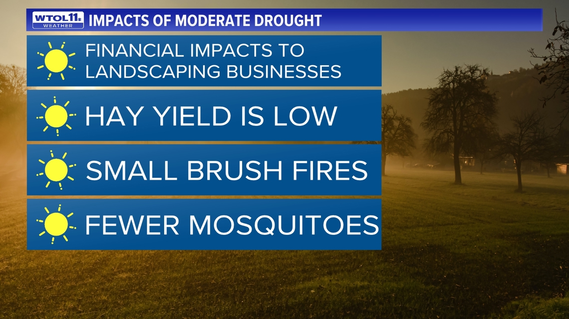
Additionally, brush fires are more common during moderate droughts and outdoor burning is highly discouraged. Lastly, fewer mosquitoes are noticed during moderate drought conditions, though mosquito populations may still proliferate near bodies of water such as the Maumee River and area ponds.
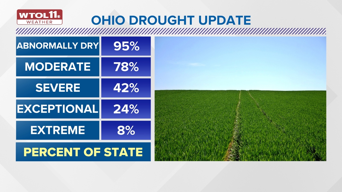
Severe drought represents the next level of impact, which may include dried creeks, suffering crops, parched and cracked soil, and an increased risk of wildfires. Parts of northwest Ohio are now included in a severe drought based on the latest data, joining the 42% of the state that is under severe classification or worse.

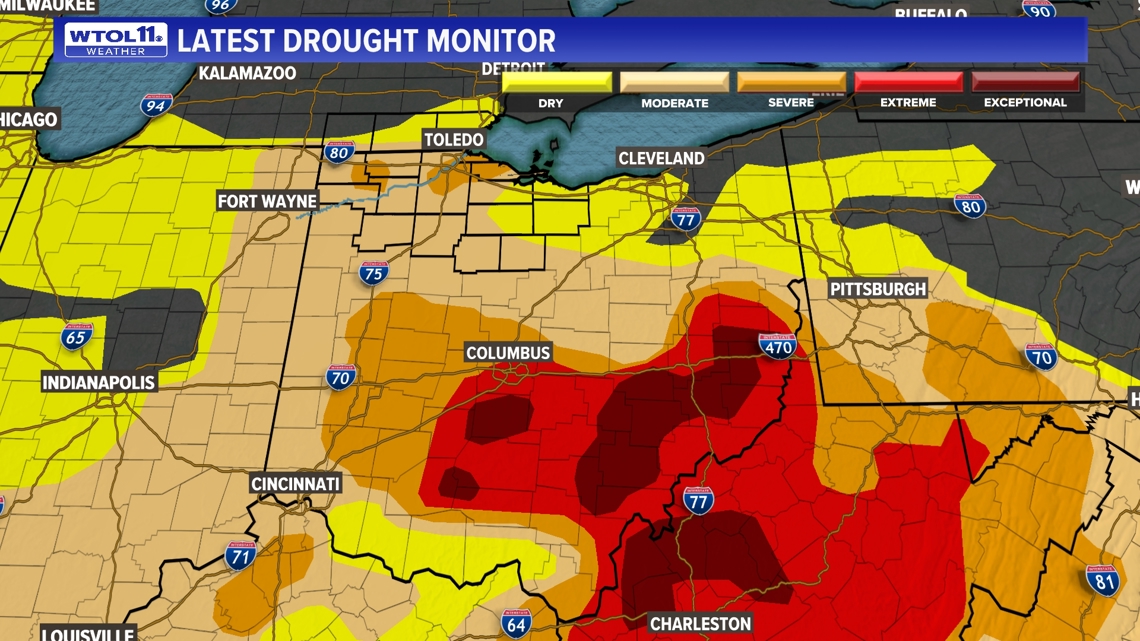
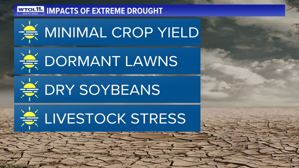
Extreme and exceptional droughts represent the worst-case scenario for area farmers. Almost a quarter of the Buckeye State has been affected by these extreme drought conditions. During an extreme drought, crop yield is minimal and area farmers will be significantly impacted financially. Soybeans are incredibly dry and yield is low. Lawns are dormant and mowing is unnecessary as grass does not grow in these conditions.
Livestock will be stressed by the heat, and drought increases grain prices and reduces the availability of naturally-occurring forage. Feeding livestock during a drought becomes exponentially more expensive and less practical whether grain or grass-feeding. Agriculture has been impacted significantly by the summer drought, and these effects will likely continue through the fall harvest.

While drought conditions have intensified across northwest Ohio, other parts of the Buckeye State are in more dire need of rainfall. Exceptional drought conditions in the central and southeastern part of the state have totally stunted crop growth and financially devastated some local farmers. The growing season has been devoid of rainfall for much of the state. Locally, Toledo has only received 0.24 inches of rain so far this September with just 0.90 inches of August rain, though some data is missing due to an outage with weather sensors at Toledo Express Airport.
The early portions of summer featured a much wetter weather pattern. Toledo picked up 5.95 inches of rainfall in June and tacked on another 2.81 inches in July. While summertime has been very dry for northwest Ohio, the calendar year has actually brought above-average rainfall totals. As of September 12, Toledo was 4.56 inches above average for the year.
Other Ohio cities have experienced annual drought with rainfall totals substantially below-average. Cleveland is over half a foot below-average in the rainfall department this year. Columbus, located near the epicenter of the Ohio drought, is now 6.39 inches below average in terms of rain. Cincinnati is 4.31 inches shy of normal precipitation. Akron is closer to normal, but still over an inch below-average.
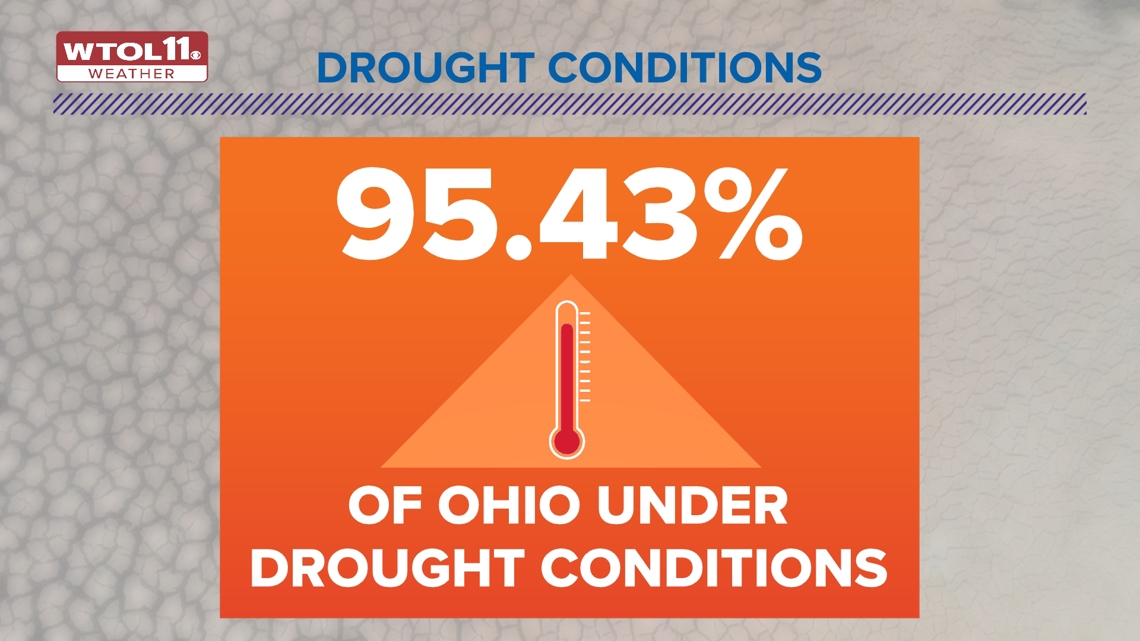
As a whole, Ohio is experiencing unprecedented drought that is afflicting almost every single county in the state. Over 95% of Ohio is experiencing some sort of drought conditions with below-average summer precipitation. Over 78% of the state, including most of northwest Ohio, is under a moderate drought or worse. 42% of the state, now including parts of the Toledo metro, has felt the impacts of a severe drought. Almost a quarter of the state is feeling the effects of an exceptional drought and 8% of Ohio is afflicted by the most significant extreme drought conditions.

Drought conditions will continue to expand and worsen as the dry and warm weather pattern continues into mid to late September. The long-range outlook features above-average temperatures and sparse precipitation into the middle to latter half of the month.

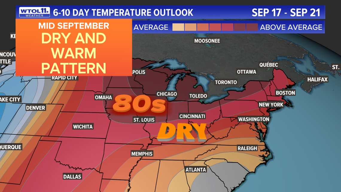
The WTOL 11 10-day forecast features mainly dry conditions for the next week-and-a-half. Unfortunately, Ohio and Michigan will not be able to tap into any of the tropical moisture from the remnants of Hurricane Francine. How has the drought impacted you and your community?
Subscribe to the Climate Friday Newsletter for new information every week straight to your inbox!
WATCH MORE FROM WTOL 11

