
TOLEDO, Ohio — October ended with a taste of winter, and record snowfall impacted Halloween plans for trick-or-treaters in northwest Ohio and southeast Michigan. Now that November is here, winter weather may be on your mind.
Will we see any more early season snowfall, and how is climate change impacting November? Meteorologist John Burchfield answers those questions and more in this week's edition of Climate Friday.
Halloween delivered more of a trick than a treat in the weather department with a record-setting 0.7 inches of snowfall. This holiday snowfall shattered the previous Halloween record of 0.1 inches shared between 1954 and 1917.
This storm system brought the first measurable October snow in 30 years. Just this one single-day snowfall made October the 6th snowiest on record. Topping the list is 1989, which brought two inches of accumulation during the month of October.
How will you remember this October? Overall, the month brought wet conditions with a rainfall total of 3.5 inches and snowfall total of 0.7 inches. As far as temperatures, the average high of 65 degrees ended up warmer than normal.

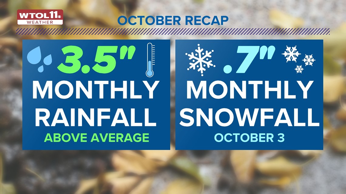
Temperatures surged to 89 on Oct. 3, the hottest day of the month. Overall, October featured warmer and wetter than average conditions with a rare Halloween snowfall. So what can you expect looking ahead to November?
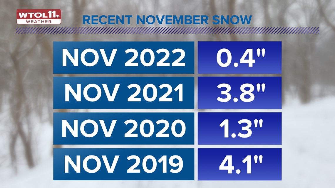
While autumn snowfall is fairly unusual in the Midwest, it grows more common during the month of November, which normally brings 1.7 inches of accumulation. The last few Novembers have been hit-or-miss in terms of snowfall, featuring a broad range of snowfall totals.
Last year, November only brought four tenths of an inch of accumulation. November, 2021 delivered more significant early season snow with 3.8 inches of accumulation. November 2020 featured 1.3 inches of snow. November 2019 brought 4.1 inches of early season accumulation.

Some Novembers bring exceptional early season snow, and 1966 featured a whopping 17.9 inches of autumn accumulation. This was more of an exception than a rule, and most Novembers only bring a fraction of this with less than two inches of total snow. Though this November started off very chilly, you'll see a few milder days with temperatures near 60 degrees in the WTOL 11 10-day forecast.
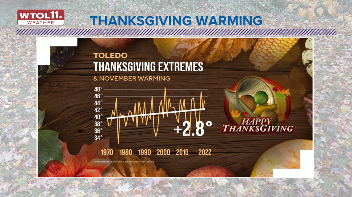
How is climate change impacting November weather and early season snowfall? As a whole, November is growing warmer, a trend that is inhibiting early season snow chances. In the last half century, November temperatures in Toledo have risen by 1 to 2 degrees, a trend that has impacted much of the globe.
Worldwide, 46 consecutive Novembers have brought above-average temperatures when compared to 20th century thermometer readings. November 2022 was the ninth warmest in 143 years of global temperature observations. Thermometers continue to rise as climate change elevates global temperatures, and November weather is expected to follow this upward trajectory in the future.

Time will tell what this November has in store, and you can trust the WTOL 11 weather team for the latest forecast. Subscribe to the Climate Friday Newsletter for weekly content from Meteorologist John Burchfield related to climate change and how it may impact you.
MORE FROM CLIMATE FRIDAY ON WTOL 11