TOLEDO, Ohio — With Halloween in the rearview mirror, it's full steam ahead toward the holidays. Now that November is well underway, many are looking forward to the wintry weather often associated with the festive season.
We are still over a month away from the end of autumn and most of the region has felt unseasonably warm weather conditions this week. Will we feel a change in the weather pattern? Or will the unseasonable warmth continue into the middle of November? Meteorologist John Burchfield has the answers in this week's edition of Climate Friday.
The first week of November started off with spring-like warmth. Monday's high temperatures surged to 73 degrees as a gusty spring-like breeze developed. Tuesday's Election Day high temperature of 76 degrees tied the all-time November 5 record high set in 2022. Temperatures still climbed to 70 degrees Wednesday before more seasonable conditions arrived for the latter half of the workweek.
The average high temperature so far this month has been over 64 degrees; if November ended today, it would go down as the warmest on record by a long shot. Of course, the coldest weather of the month typically arrives near or after Thanksgiving, so this average will inevitably fall in the coming weeks.
The warmest Novembers on record
How does this November compare to the warmest on record? In terms of high temperatures, 2001 is the warmest November on record with an average daytime high of 57.9 degrees. 2020 ranks as number two with an average high of 57.2 degrees. Other Novembers boasting an average high over 55 degrees include 1931, 1994 and 1999.

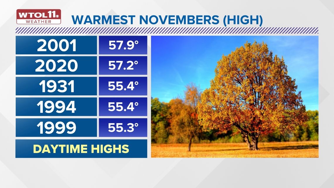
Many of these years also sit atop the list of warmest November mean temperatures, a metric that includes both daytime highs and overnight lows. 1931 has the warmest mean November temperature on record of 49 degrees. 2001, 1902, 2020 and 1909 follow, each with a mean temperature over 46 degrees.
You may have noticed November 2020 near the top of both of these lists. November 2020 brought a historic stretch of record warmth with four consecutive days breaking all-time daily records. Nov. 7 featured a record high temperature of 73 degrees. Nov. 8 shattered the daily record with a high 79.

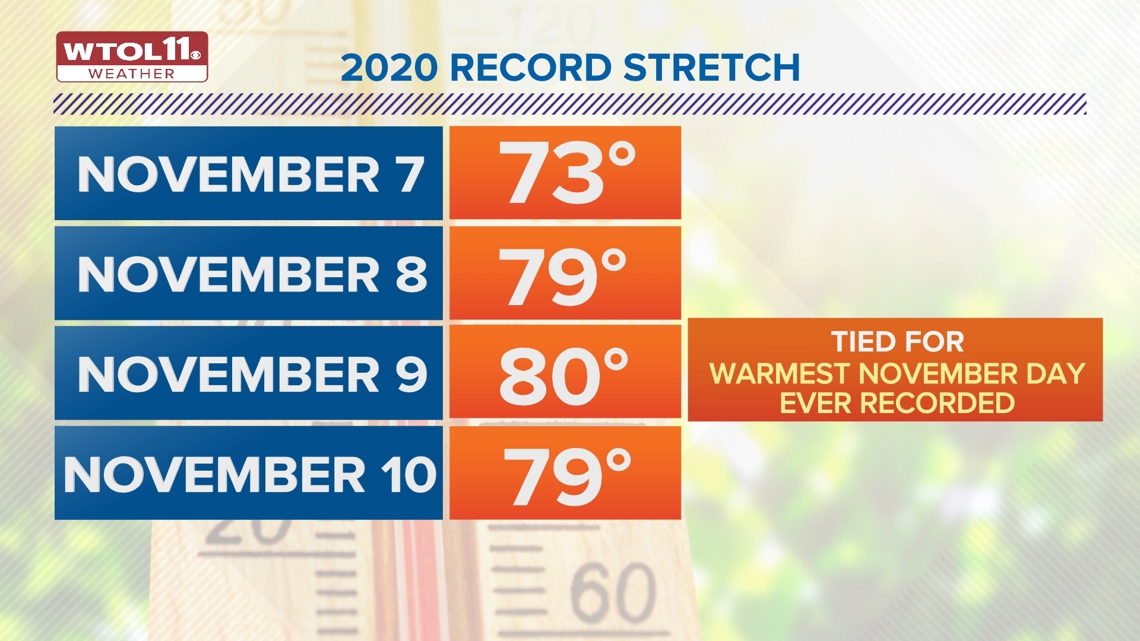
Nov. 9 not only set a daily record, but tied the all-time monthly November record of 80 degrees. Finally, Nov. 10, 2020 set another record high of 79 degrees. Overall, 2020 serves as a reminder than November can still bring a taste of summer with unseasonable warmth.
November snowfall stats
Though November has started off with unusual warmth, this month is notorious for bringing a taste of winter as well. November snowfall is quite commonplace, and the average monthly snowfall of 1.7 inches serves as a reminder that winter is right around the corner. Though last November only brought two tenths of an inch of snow, some Novembers have dosed out over a foot of accumulation.
The snowiest November on record occurred in 1966 with a whopping 17.9 inches of snowfall. Number two on the list is 1940 with 12.3 inches. With exactly one foot of snowfall, 1932 ranks as the third snowiest November. Also noteworthy are November 1950 and 1959 with 9.1 inches and 8.3 inches, respectively.

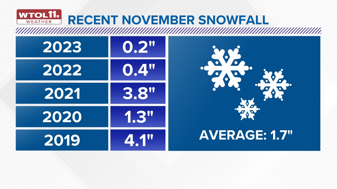
Each of these historically snowy Novembers occurred in the mid 1900s or earlier. As a whole, November is growing less snowy, in part due to climate change. In fact, the top 17 snowiest Novembers each occurred before 2000. Recent November snowfall has been paltry in comparison. Last November brought a meager 0.2 inches of snow. November 2022 brought slightly more with 0.4 inches of accumulation.
With 3.8 inches, November 2021 was the last time we saw meaningful snowfall during the fall season. November 2020 brought 1.3 inches of snowfall despite the historically warm stretch of temperatures early in the month. Lastly, November 2019 delivered 4.1 inches of accumulation, a more significant amount compared to other recent years.
November is getting warmer, less snowy
How has climate change impacted November snowfall and weather as a whole? In general, both November and December have grown less snowy over the years. A new set of climate normals released by NOAA including data from 1991-2020 sheds light on the changes in weather over the past decade.
Based on this new data, November snowfall has decreased by 0.2 inches and December snowfall has dropped 0.9 inches. Overall rainfall has dropped as well; November precipitation has fallen 0.21 inches and December precipitation has decreased 0.24 inches.
In terms of temperatures, November has grown 1.4 degrees milder in the past decade and December has warmed by 3.1 degrees. This late autumn warming trend has been felt across most of the country. A study of 241 cities across the country shows that 82% of locations have experienced November warming in the last half century.

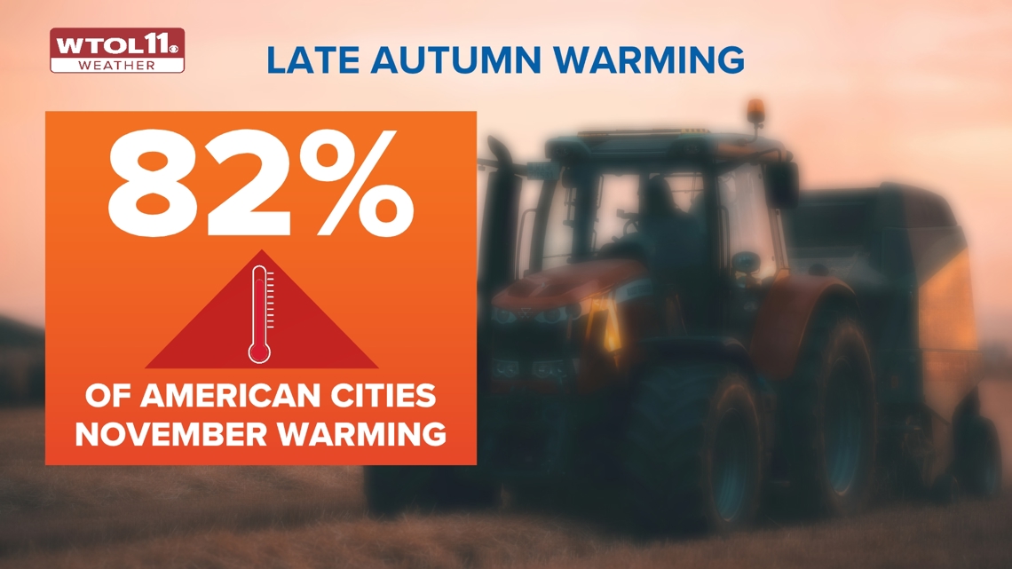
Nationwide, the average amount of warming since 1970 has been 2.1 degrees, fairly similar to what Toledo has experienced. One third of US cities have warmed up by at least 2.5 degrees during the month of November over the last 50 years. 22% of location have warmed up by at least 3 degrees. In general, late fall is turning warmer, thus reducing snowfall totals during November and December.
Not only has snowfall decreased, but precipitation totals have dropped. This mild start to November 2024 has served as a case study in this warming trend experienced across the country.

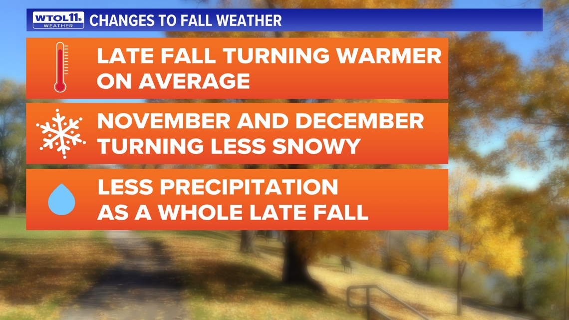
Climate change will continue to manifest itself in terms of warmer and drier November and December weather. Even in an age of warming temperatures, not all years will fit this framework, and cold and snowy Novembers and Decembers will still occur due to anomalous weather patterns.
November 2024 outlook
The WTOL 11 weather forecast features above-average temperatures through the middle of the month. Our normal high has dropped to 55 degrees, and forecast temperatures will remain largely in the 60s.
The WTOL 11 weather team is not seeing any signs of a major cooldown or wintry conditions. Even with the mild trend ahead, November is known for turning on a dime toward chilly and snowy weather. Stay tuned for the latest weather forecast and subscribe to the Climate Friday Newsletter as we move toward the holiday season.

