TOLEDO, Ohio — It happens every year in northwest Ohio. It's just a matter of when.
Winter will be here soon and it has many people thinking about when will we start to see snow. We've already seen cooler temperatures, frost and a freeze. Now it's time for snow.
For Toledo, the average first snowfall occurs on Nov. 17. According to the National Weather Service, the first snowfall measures one-tenth of an inch or more.
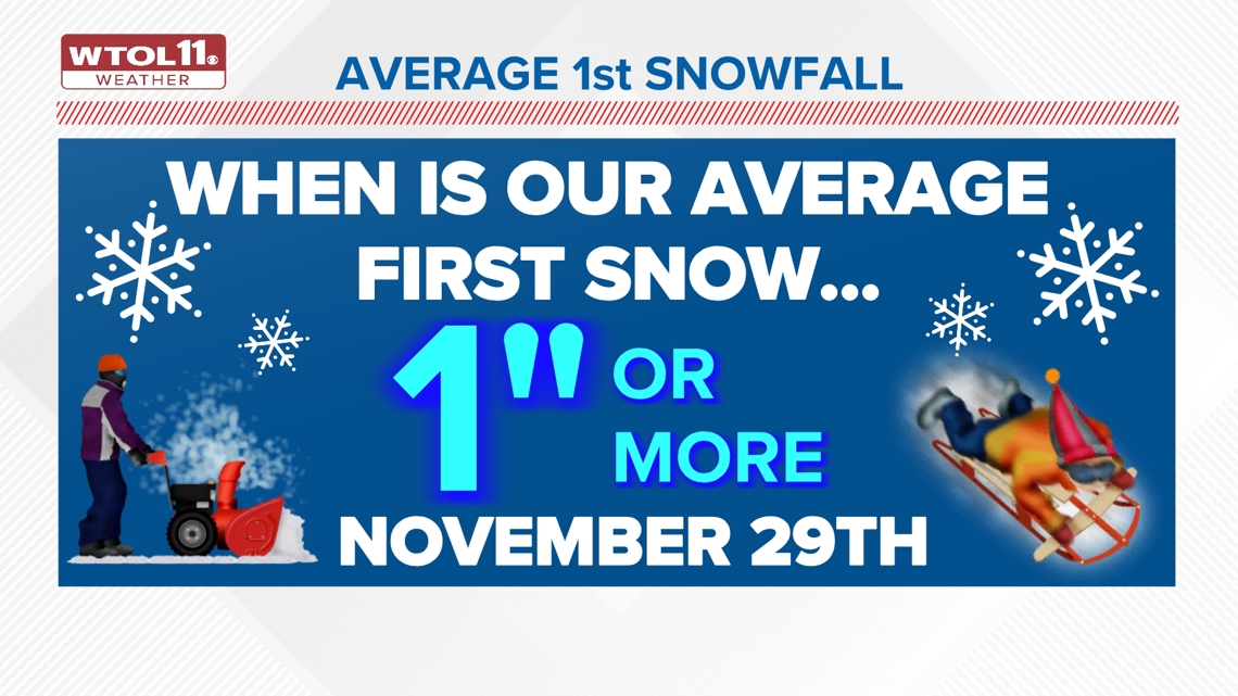
The average first snowfall of 1 inch or more typically occurs on Nov. 29.

Toledo has seen snow as early as Oct. 18 in 1972 with 0.2 inches and as late as Dec. 21 in 2012 with 0.6 inches.
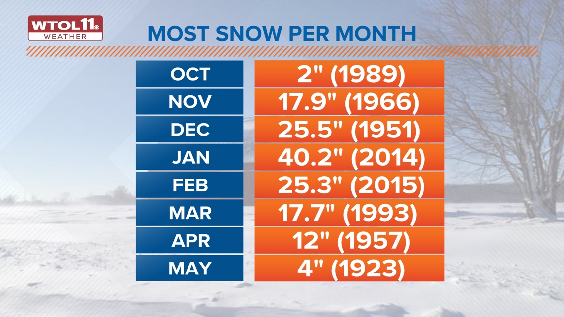
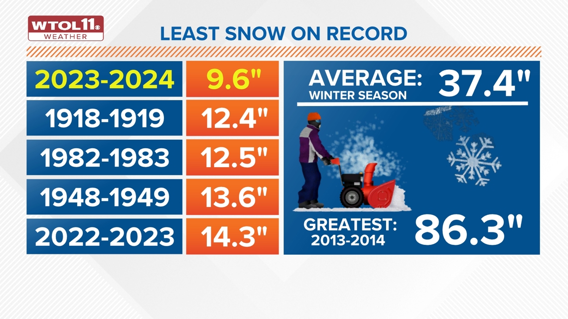
The most snow Toledo has ever seen in one day was 18 inches on February 28, 1900. The most snow Toledo has seen in a winter season was 2013-2014 with 86.3 inches. The same winter also 24 total days with daily snowfall greater than 1 inch over the season. In the winter of 1981-82, there were 55 days of measurable snow.
The least amount of snow in a winter season occurred in 2023-2024 with 9.6 inches of snow.

How much snow should we expect this winter?
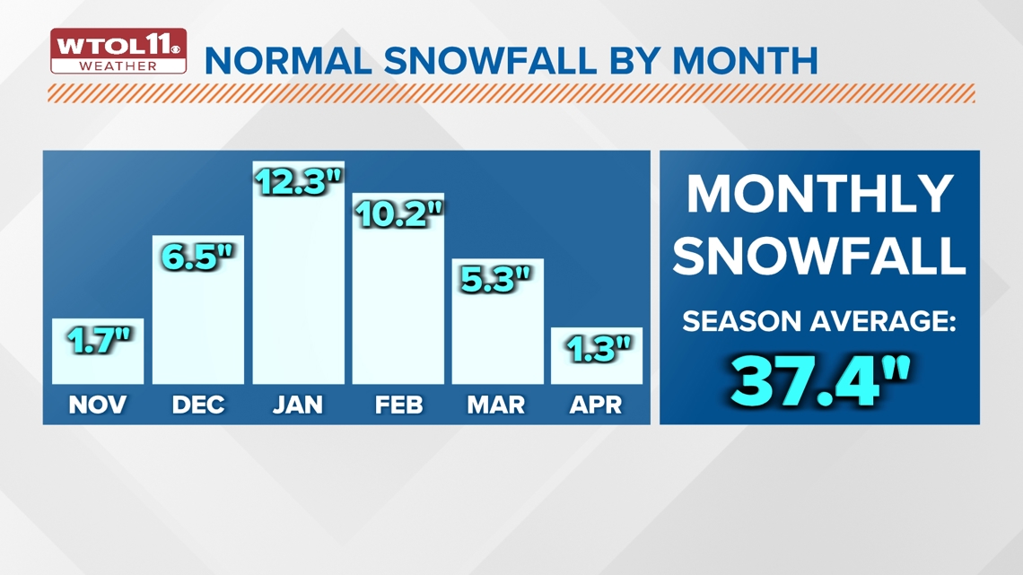
Each winter season has a variety of factors when it comes to snow totals. Typically, Toledo will see around 37 inches of snow a season.
The snowiest month for northwest Ohio is January, where we normally see around a foot of snow.

The past few winter seasons, we have actually seen some of the lowest snow totals since records have been kept. The 2023-2024 season was the least snowy on record.

The earliest snowfall over the last 11 years
- 2023-2024 – Oct. 31 (first measurable)
- 2022-2023 – Nov. 12
- 2021-2022 – Nov. 13
- 2020-2021 – Nov. 1
- 2019-2020 – Nov. 11 (first measurable)
- 2018-2019 – Nov. 9
- 2017-2018 – Nov. 12
- 2016-2017 – Nov. 19
- 2015-2016 – Nov. 21 (first measurable)
- 2014-2015 – Oct. 31
- 2013-2014 – Nov. 8
While it is still too early for exact snow totals, make sure to tune into Chief Meteorologist Chris Vickers on Thursday, Nov. 21 at 5:30pm for the 2024-25 Winter Weather Outlook.

