
TOLEDO, Ohio — Cloudy skies and a few isolated light rain and snow showers are possible early Wednesday evening.
Rain and snow chances will taper off overnight with lows falling back into the upper 20s to near 30 degrees.
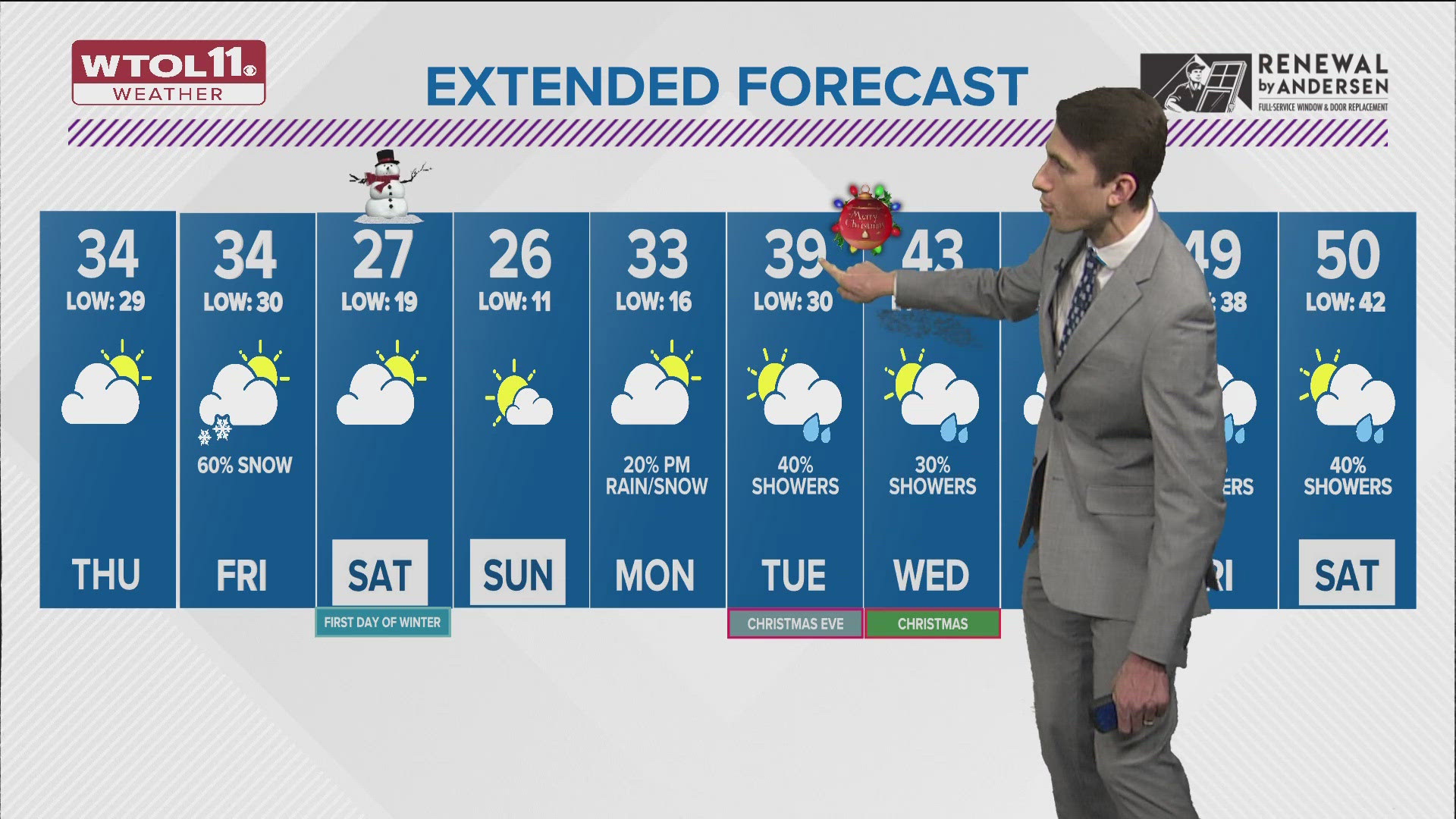
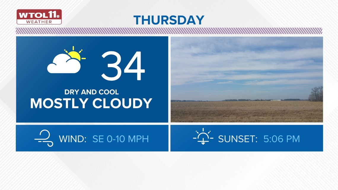
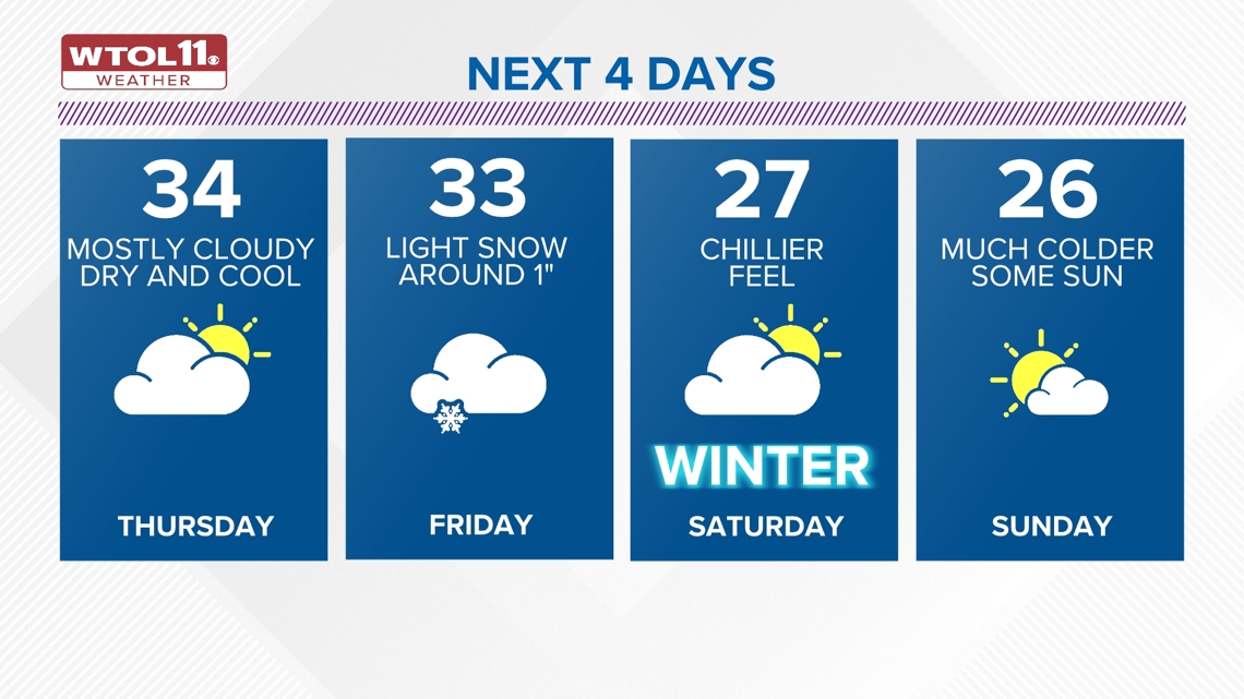
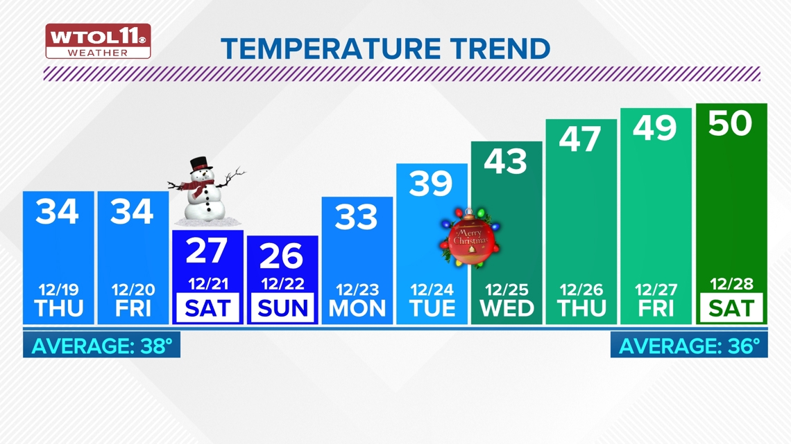
Mostly cloudy skies on Thursday with highs remaining a bit cooler in the low and middle 30s.

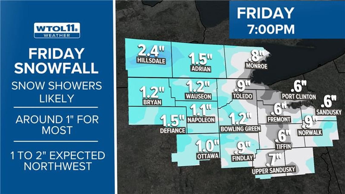
On Friday, a weaker Clipper system will bring the chance of light snow showers to the area. There is the expectation of some light, minor snow accumulations which would amount to around 1" for most areas.

It will turn much colder and brisk into the weekend ahead. Highs on Saturday and Sunday will remain well below freezing all weekend and will only be in the 20s.
Lows on Sunday morning may be as cold as 10 to 15 degrees. More sunshine will return through the weekend.

Highs will only return back into the low 30s on Monday.
Toward Christmas Eve day, temperatures will continue the rise into the upper 30s to near 40 degrees. There is the chance of some scattered rain showers Tuesday night into Christmas morning on Wednesday.
At this time, it appears that this will all be in the form of mostly rain, with little chance of snow early next week heading into the holiday.

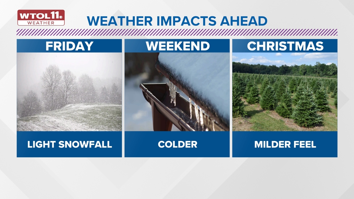
Highs on Christmas Day may reach the low 40s with a few light rain showers.
Very warm weather will be expected for the final days of the year late next week with highs soaring through the 40s and may see a few days that reach into the 50s toward the final weekend of 2024.

Will there be a "White Christmas" this year?
As of now, Christmas Eve and Christmas Day are looking milder and likely dry with high temperatures in the upper 30s or higher.
White Christmas chances are trending down at 5%.
Check out just a few features of the free WTOL 11 Weather app with WTOL 11 Meteorologist Kaylee Bowers:
What's the weather like where you are?
Share your photos by tapping "Near Me" on the WTOL 11 News app navigation bar at the bottom of your screen! Be sure to give us your name and you may just see your photos on air.

MORE weather stories on WTOL:
Want more from WTOL 11 News?
➡️ Download the WTOL 11 news app for Apple here or get it in the Google store here.
➡️ Get a fresh start to your morning and wrap up your day with the latest news and your WTOL 11 Weather forecast delivered right to your inbox!
➡️ Looking for the lowest current local gas prices? Check out the WTOL 11 gas price tracker, powered by Gas Buddy, here.
➡️ Stay up to date on what's happening in your community with a 24/7 live stream and on-demand content from WTOL 11+. Our free WTOL 11+ apps are available on Roku and Fire TV.
WTOL 11+ features the latest breaking news and weather, plus daily talk shows, coverage of your favorite sports teams from Locked On, fact-checking from VERIFY and the latest trending stories.