TOLEDO, Ohio — A significant and potentially historic winter storm will hit northwest Ohio starting Wednesday morning.
This long-duration event will last through Wednesday and all day Thursday. Travel plans will be impacted Wednesday, especially along or north of the Maumee River.
By Wednesday evening travel will become slow or difficult across the entire area. On Thursday, roads may be impassable with steady snow continuing and blowing/drifting conditions.
As the dig-out really begins Friday morning, plan on very frigid air in the single digits.
The entire WTOL 11 Weather team is working together to ensure you have the latest information on this storm. Below are snapshots and descriptions for weather conditions at select timeframes along with snow total maps.
TIMEFRAME BREAKDOWN
Tuesday Night: Tuesday night we saw the beginning of precipitation fall as light rain showers start around midnight. Rain showers continued into the early morning hours of Wednesday.
Wednesday Morning: Around 6 a.m. the transition from rain to snow will start. It may take a few hours for this transition to happen, but expect a very short period of ice between this transition before a complete snow transition by 10 a.m.
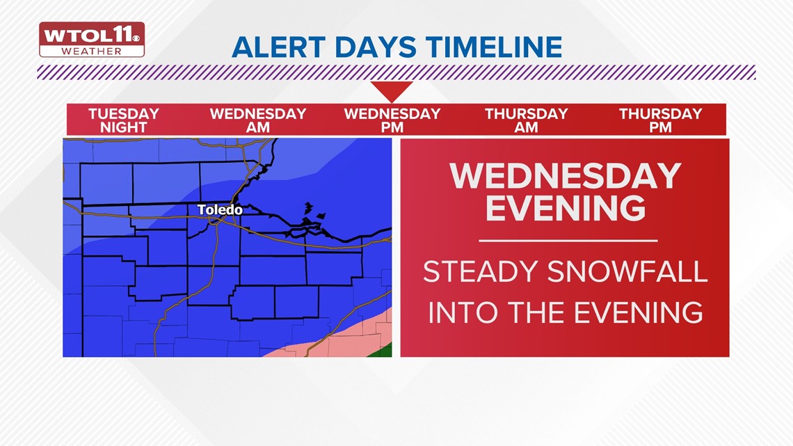
Wednesday Evening: Steady snow showers will bring up our snow totals, as the brunt of the storm rolls through northwest Ohio. Expect to see 6-8 inches as we reach the midnight hour on Thursday.

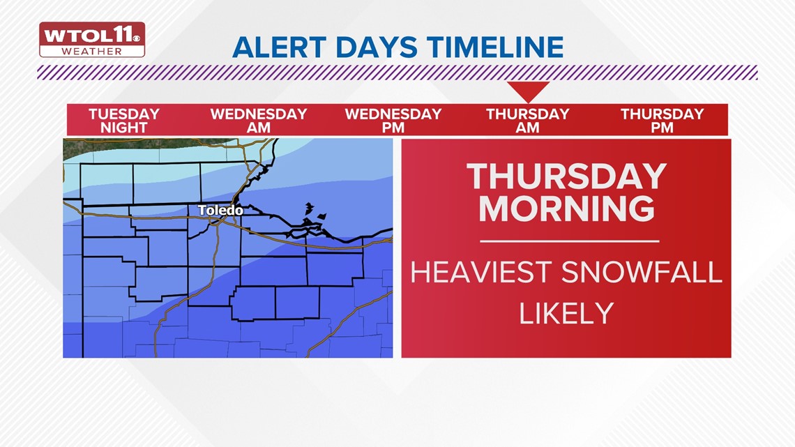
Thursday Morning: By the morning time expect the heaviest snowfall of the entire storm. Road Conditions could be very poor by the start of Thursday. Heavy snow showers will continue through the afternoon.

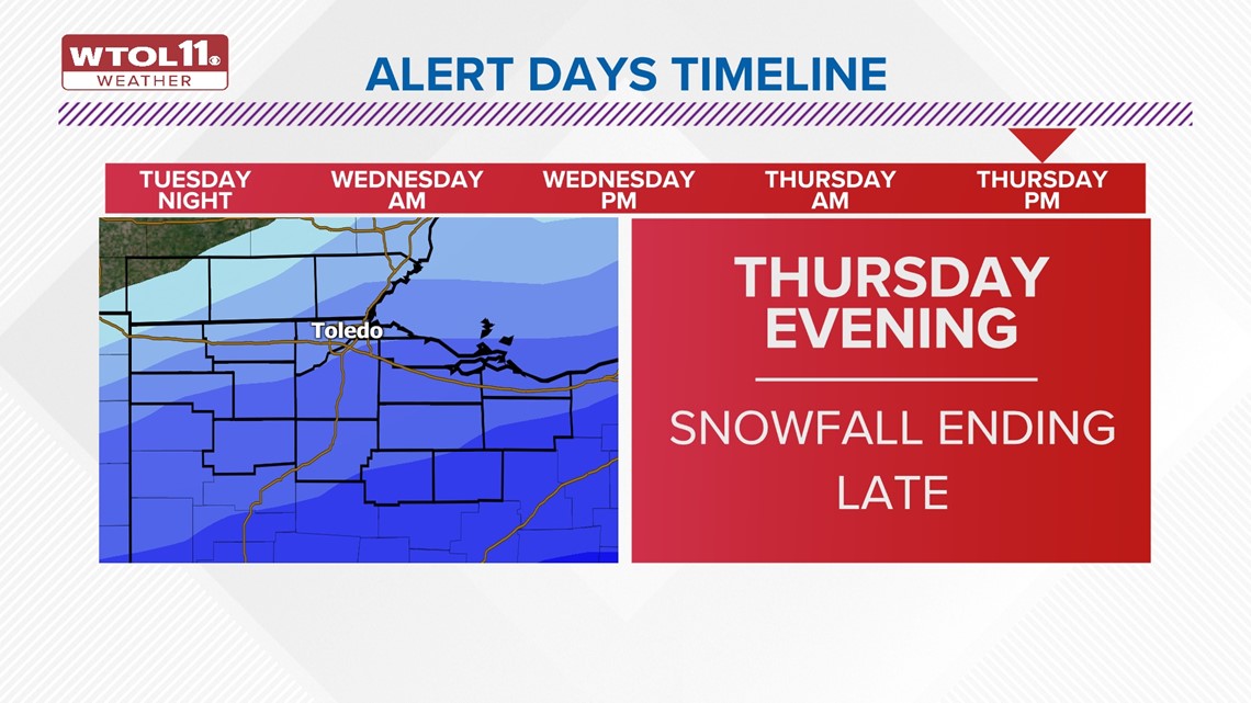
Thursday Evening: Snowfall rates should start to slow down by the evening hours will some lingering snow hanging around into the late evening hours before the snow eventually tapers off completely.

Friday Morning: Road Conditions will be the main concern to start the day. It will be a good time to start shoveling driveways as conditions will clear for all of Friday. Temperatures are expected to be in the upper teens for highs on Friday.
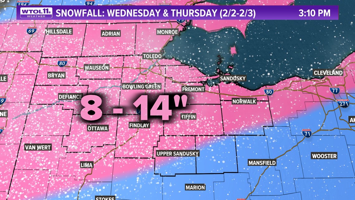
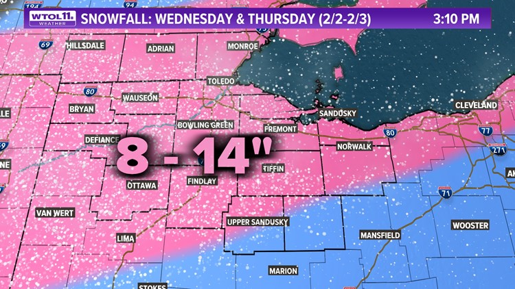
SNOW TOTALS
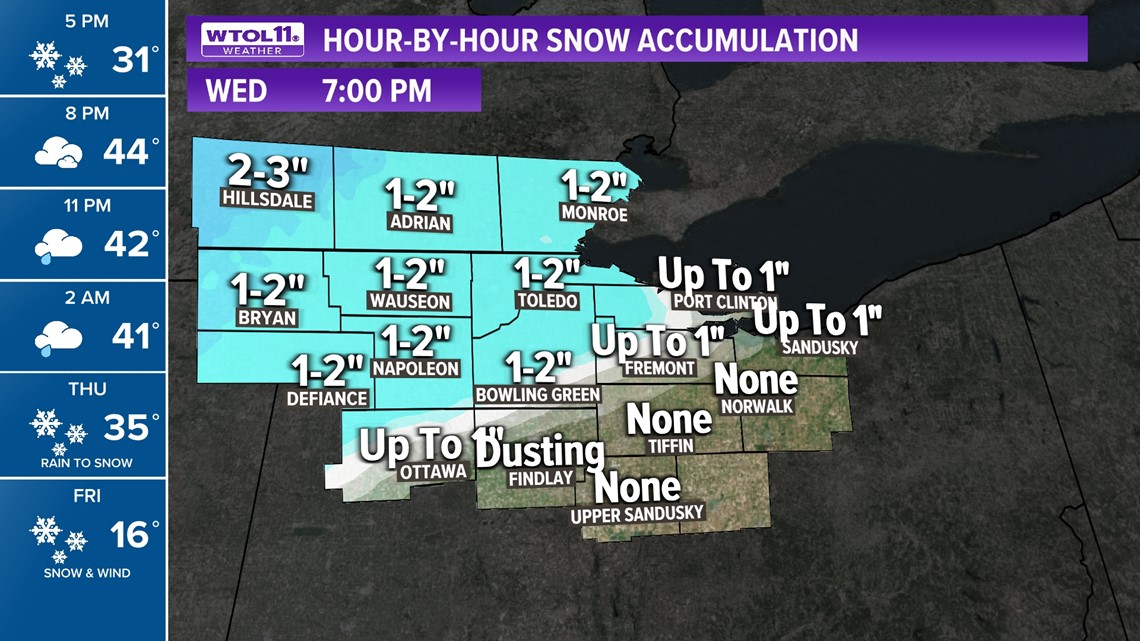
By Wednesday Evening: Snow totals for much of the area could range from 1-2 inches, though some of our southern counties may not have any accumulation by 7 p.m.

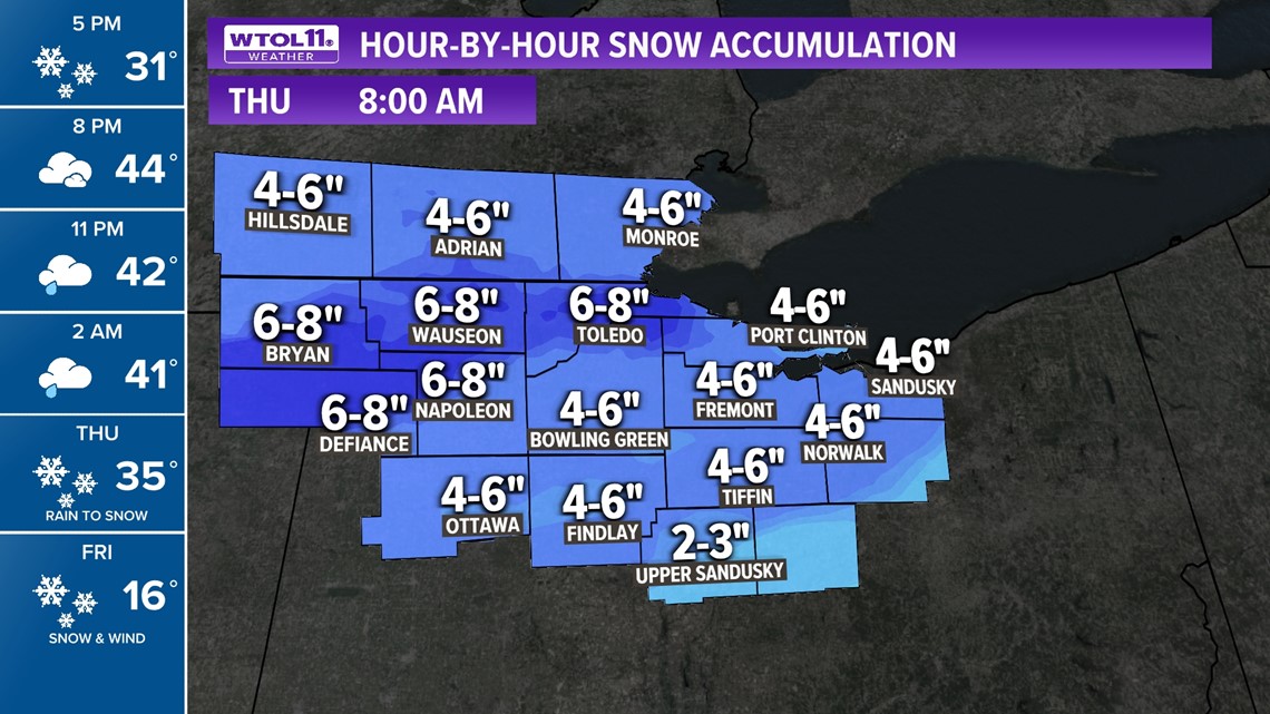
By Thursday Morning: Much of the area can expect 4-6 inches, though some areas could see up to 6-8 inches of snow by 8 a.m. Thursday morning.

By Friday Morning: For Friday total accumulations are expected to be around 8-14 inches.