Near record heat continues as temperatures rise in our area
Meteorologist Ryan Wichman breaks down what spring temperatures will look like for the remainder of April.

How long can these 80s last?
Often, we talk about weather patterns stalling in April but that typically means low pressure systems creating widespread clouds and cooler weather. This time around, it’s a high pressure anchored to our Southeast which is providing plentiful sunshine and near record heat.
Once established, this high-pressure system can be slow to move – which is why we expect the 80s to last into at least the beginning of the weekend.
The warm stretch of weather is expected to end with the arrival of a cold front on Sunday. The timing for this cold front has slowed down a bit which may allow Sunday to be a warmer day before the cold air rushes in. Cloudier and cooler air will certainly be felt by the time we wake up Monday morning.


It’s not just this week
This has been one of the warmest starts to a year in Toledo history. When you average out our highs and lows for every day this year, so far it has been the third warmest year ever. Remember that Toledo weather records date back to the 1870s, comparing almost 150 years of data.
The daytime heat is what most of us experience and talk about but it’s the overnight lows that have been so impressively warm so far this year. The average low has only been 30 degrees, which is about 6 degrees above normal.
January was the 8th, February the 7th and March the 31st warmest months – respectfully – on record.


Outlook for the rest of April
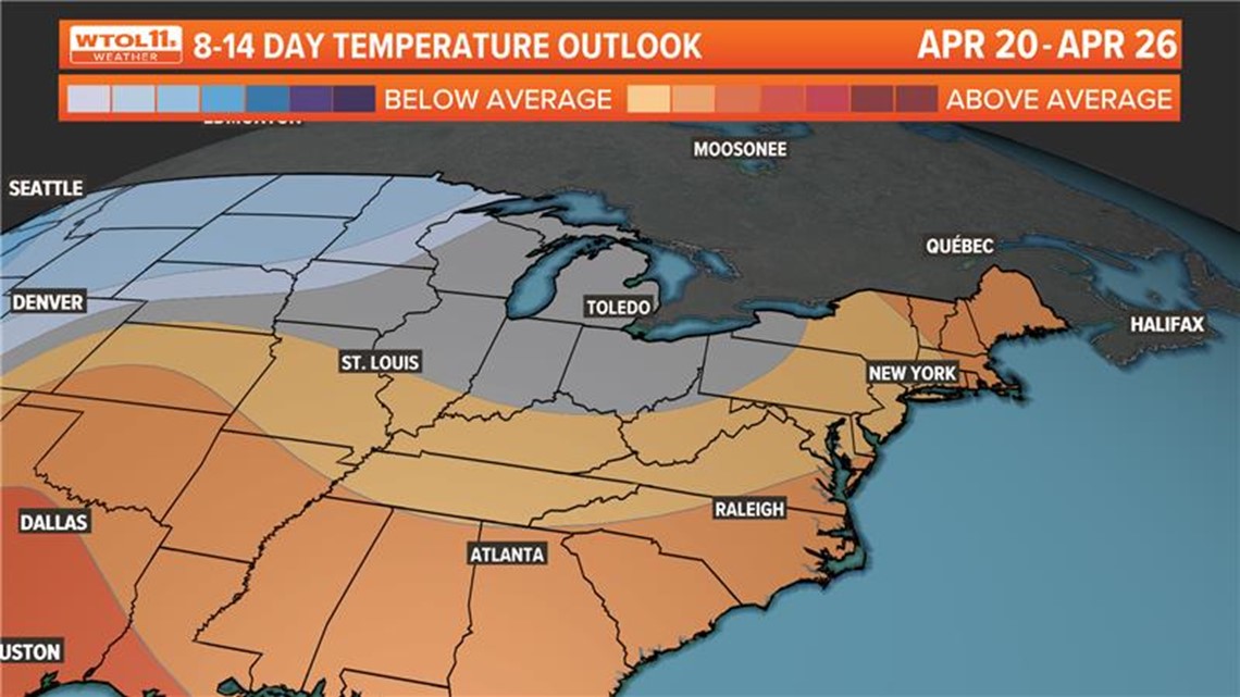
There is no way for this extreme heat to continue for the rest of the month. Reality is that there will be chilly days ahead, so do not get too excited planting any sensitive vegetation just yet.
The first shot of this cold air was discussed above and will arrive late Sunday into Monday. It is likely we could get into a bit of a busier weather pattern with rain chances every few days for the last two weeks of the month. Temperatures will rise and fall with each of these passing systems.


As always, we will need to keep a close eye on any days without a south wind as a lake breeze is always possible. Lake water temperatures are still in the 40s. Average highs continue to quickly climb this time of the year, which ensures that while day to day temperature fluctuations is still expected, the general trend will continue to turn milder. Although, not quite as warm as this near record stretch we’re currently in.

