
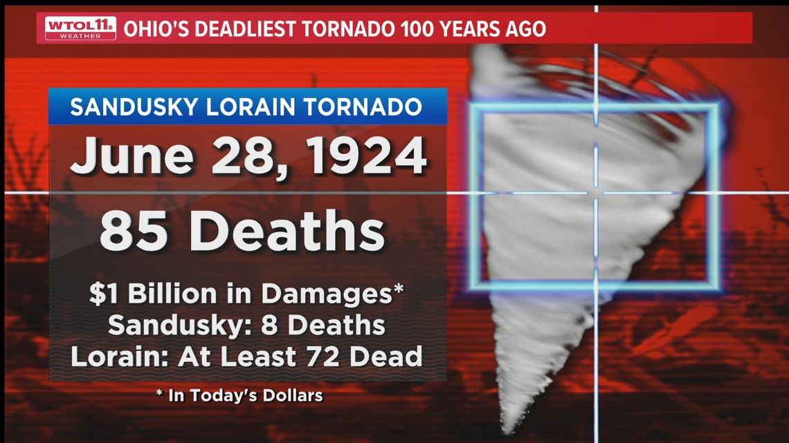
TOLEDO, Ohio — What started as a normal summer day ended in catastrophe. Ohio's deadliest tornado happened 100 years ago on a hot and humid day: June 28, 1924.
Strong storms began to develop in northern Ohio throughout the afternoon and evening. One storm ended up producing a tornado, which went through Sandusky and Lorain.
It first touched down around 4:25 p.m. in Vickery in Sandusky County. It then traveled east-northeast, moving into Sandusky and then continuing onto Lake Erie. It continued its path on the south shore of Lake Erie before moving back onshore in Lakeview Park around 5:00 p.m. The tornado made its way through Lorain, destroying many homes and businesses and reaching its maximum strength of F-4.

The tornado began to weaken as it moved east through Sheffield and Avon.
Eighty-five fatalities were recorded from the tornado, making it the deadliest in Ohio's history. At least 72 of those deaths occurred in Lorain. More than 1,000 people were injured.
One-hundred homes and 25 businesses were destroyed in Sandusky where there were an additional eight deaths. 500 homes and 200 businesses were destroyed in Lorain.
The tornado traveled 52 miles, with half of it traveling over Lake Erie.

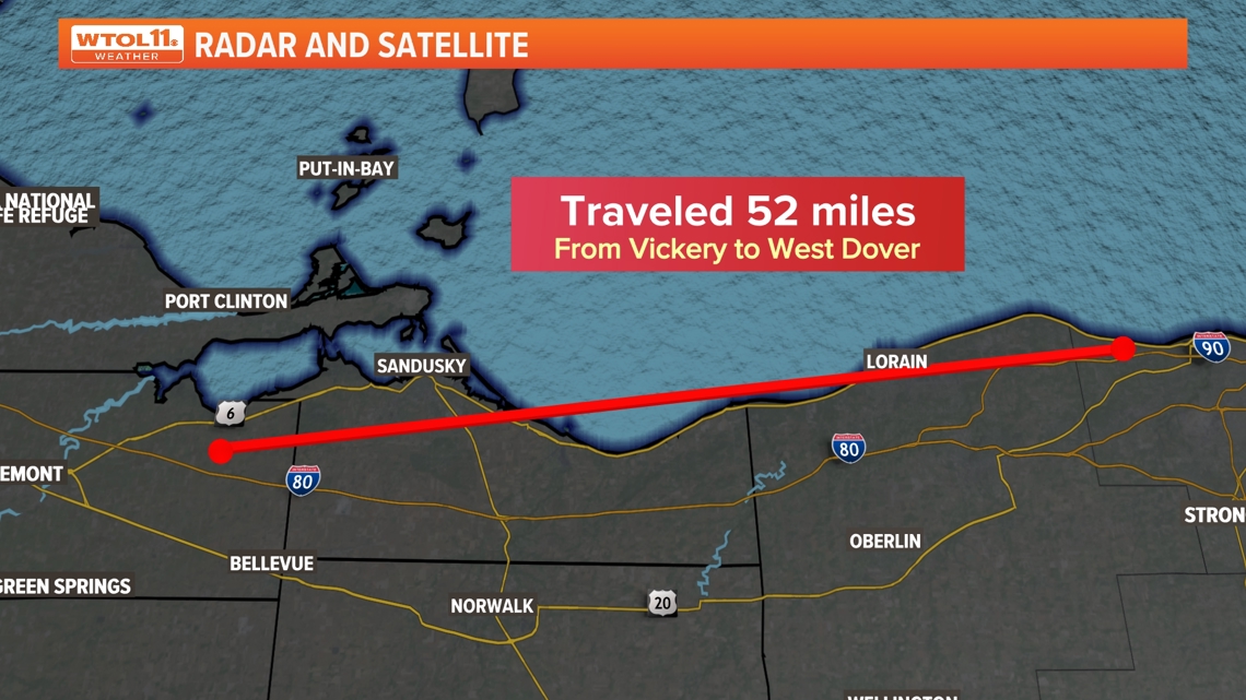
While Lorain saw the worst damage, Whitmore, Castalia, Sandusky, Huron, Sheffield, Avon and West Dover were damaged, too.
The 1924 Lorain tornado was measured using the Fujita scale. The Enhanced Fujita scale started being used in 2007 to help improve the previous scale, causing the numbers and intensity of the scales to shift.
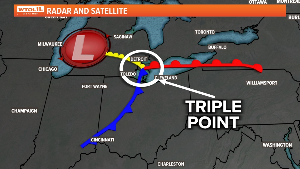
The ingredients were just right for the storm's development.
Northern Ohio and Lake Erie were in the spot where the "triple point" was located. According to the National Weather Service, a triple point is "the intersection point between two boundaries (dry line, outflow boundary, cold front, etc.)." This allowed for the unstable air and strong wind shear to mix together to cause strong thunderstorm development.

Advice warning has seen significant progression in the past 100 years. From the NWS to your local meteorologists at WTOL 11, there are many ways to receive active alerts.
But that was not the case back in 1924 as many had to rely on word of mouth and watching the cloud formation.