Ripple Effect: Lack of Lake Erie ice, plus high water levels could create destructive combination
It remains to be seen what the rest of this winter holds for Lake Erie, but the impacts of weather today may be felt for some time to come.
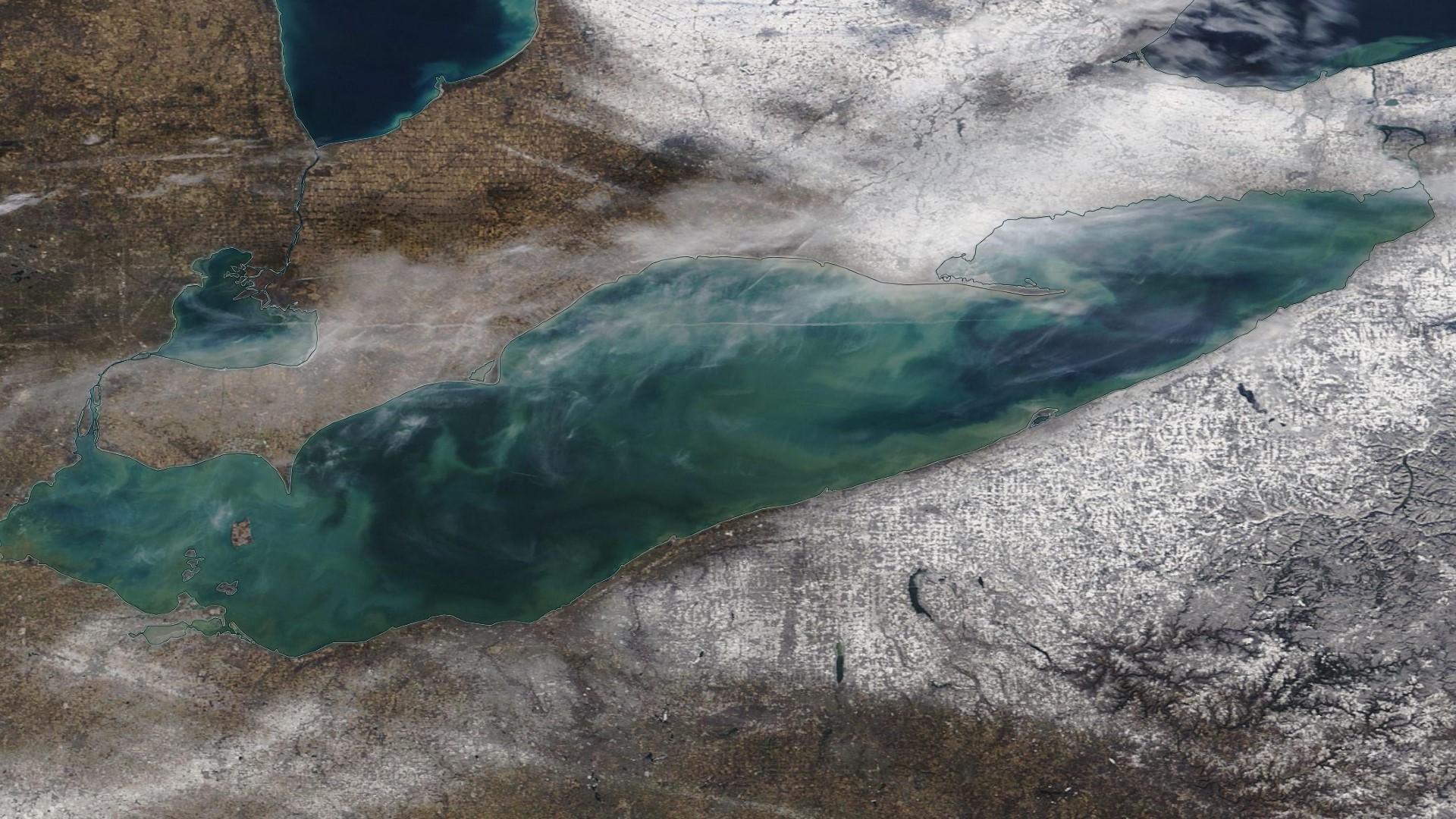
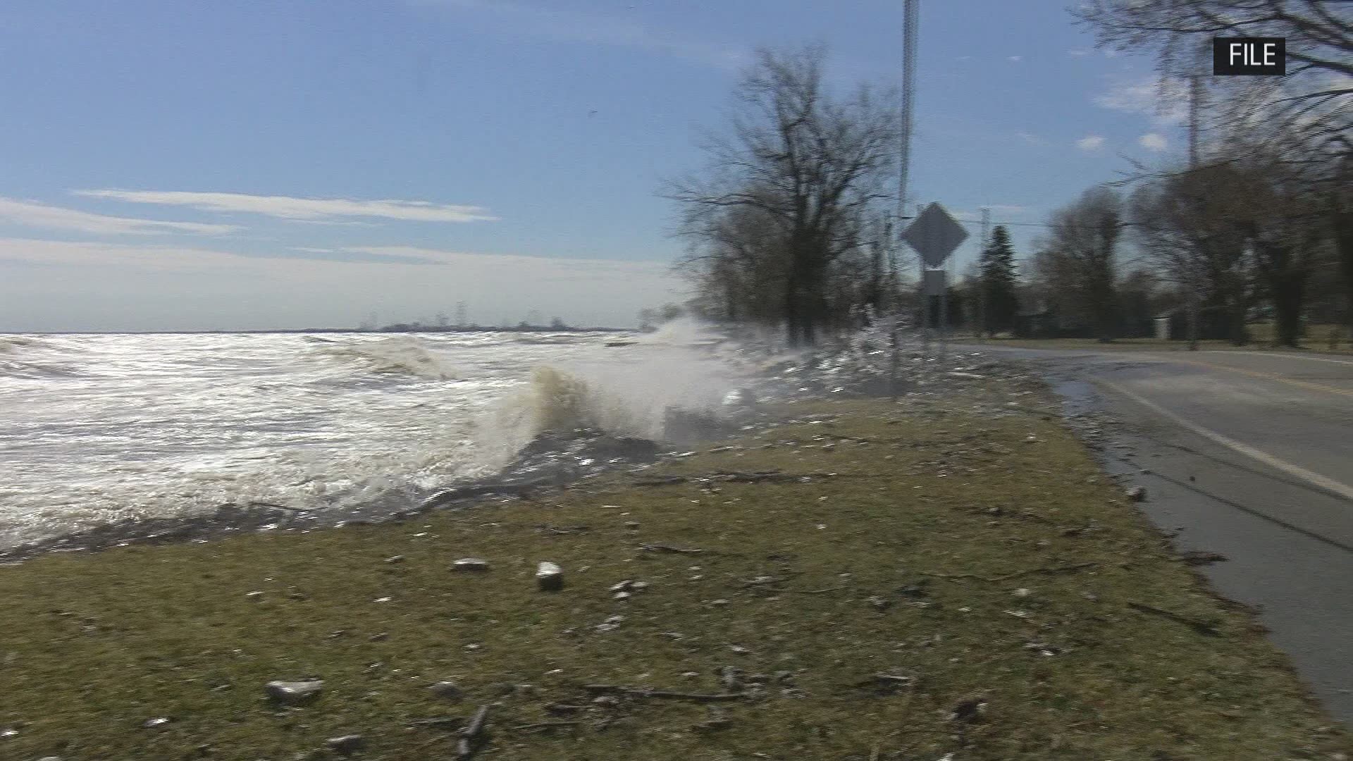
It's been an unusual winter on Lake Erie, with little to no ice so far and some of the highest water levels on record. It could prove to be a destructive combination.
Why do we need more ice on the lake? Less ice on the lake this year leaves no buffer for shorelines
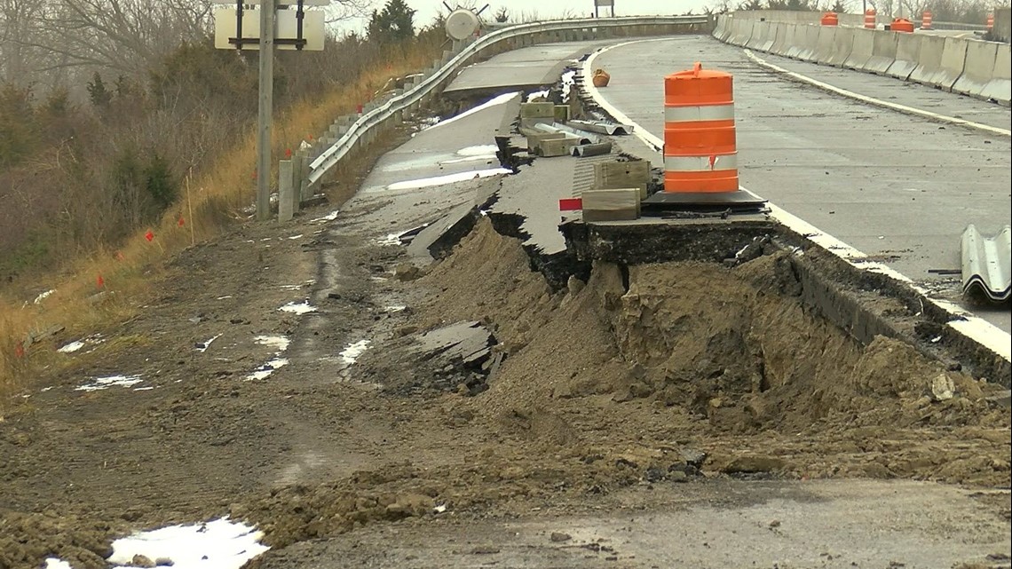
You don't even have to flip the calendar back a full year to see the power Lake Erie waves can have on our lives. Last spring, storms created waves that washed out a highway on the peninsula known as Marblehead Island, flooding state routes and parks along the shoreline. So far this year, there has been less ice to buffer those shorelines.

"(It helps) by forming an ice foot along the shoreline, then when you start to get the warm-up you've at least got that shelf before it melts. You've got some protection, so the wave action isn't continuing right up against the beach onto the dune or cliff. So, it provides a little of a buffer while it's there. Well, we don't have it," University of Toledo geographer, Patrick Lawrence said.
PATRICK LAWRENCE FULL INTERVIEW
Lawrence has studied Great Lakes water level changes and doesn't expect a swift turn around back to normal.
"We do go through these cycles every 10,12,14 years where we peak, and then it will ebb back to an average and then it will go low again. Those occur and it's just part of the way the system long term responds to those long term variables in temperature, evaporation and precipitation," Lawrence said.
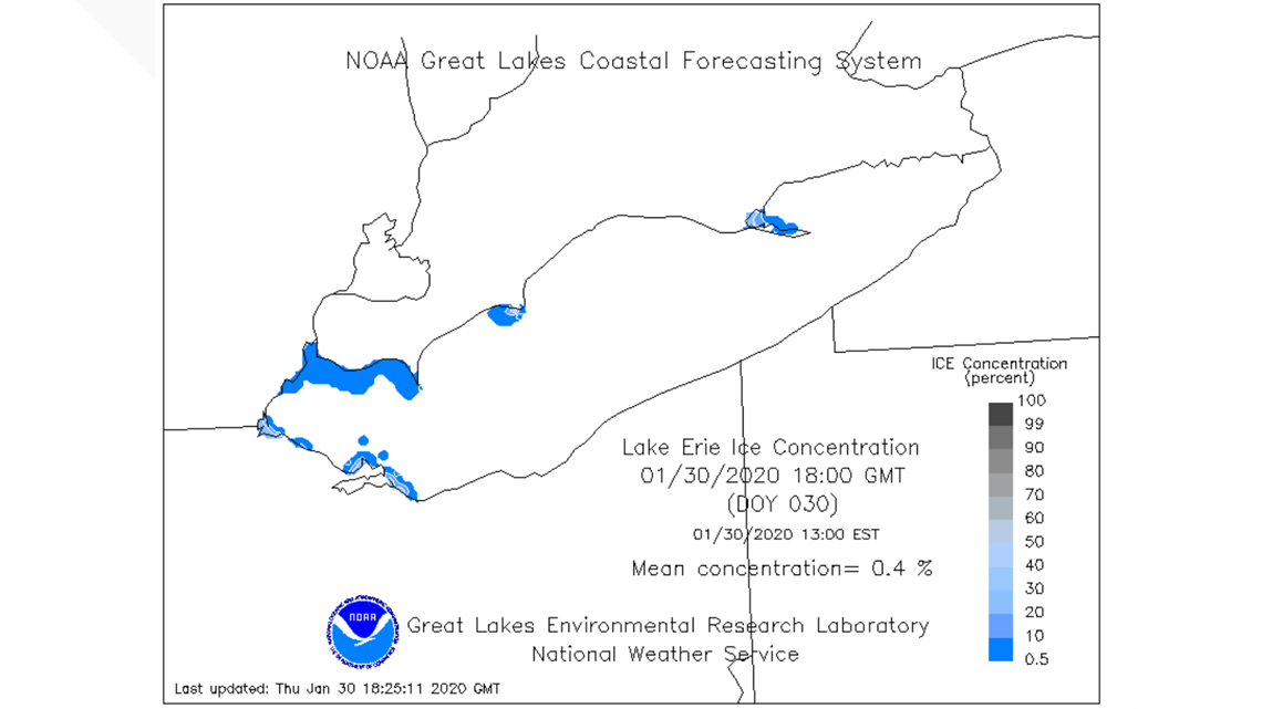
All winter long, lake ice has been near historic lows. The high lake levels don't impact how ice develops, but our lack of cold weather certainly does.

We went to NOAA's Great Lakes Experimental Research Lab in Ann Arbor to talk with lead ice scientists about this unusual winter.
According scientists, just because the lake has been slow to grow ice, it doesn't mean this year is a total bust just yet.
"That will usually occur in March. In some years, early March has the maximum. So mid-March, but this is a year-to-year change," NOAA GLERL research ice climatologist, Jia Wang said.
What does history tell us? If the current trend does continue, it will impact much of northwest Ohio — even those that live far away from the shores of Lake Erie.
When we think iced over Lake Erie, the winters of 2014 and 2015 come to mind. Ice was at record highs during those brutal winters. But, cold months like those have become a rarity. Long-term trends point to less Lake Erie ice.
"Yes, we've seen a long-term decrease in the trend of ice on Lake Erie. However, after the 2014-2015 high ice coverage, the trend had been decreased significantly but still had a downward trend," Wang said.

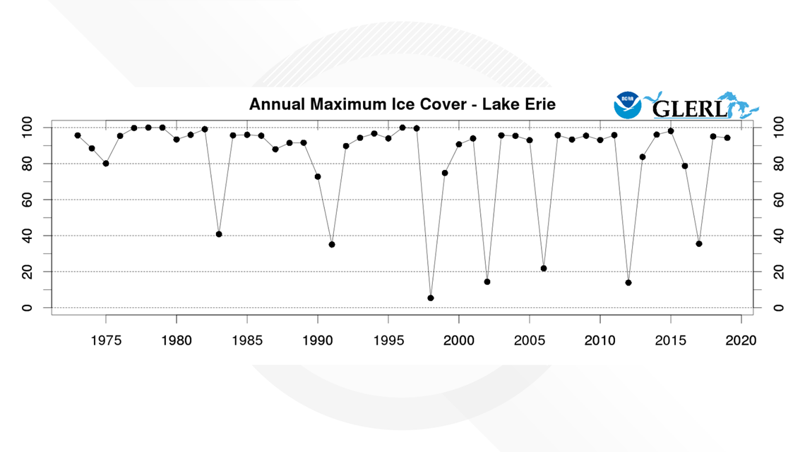
If that trend does continue, it will impact much of northwest Ohio — even those that live far away from the shores of Lake Erie.
Winters that have low ice are followed by warmer than average spring seasons.
Looking at the three lowest ice years since the 1970s, spring was, on average, nearly two degrees warmer. That might not sound like much, but it's the difference between a frigid, long spring and an early, warm breakout from winter.
It remains to be seen what the rest of this winter holds for Lake Erie, but the impacts of weather today may be felt for some time to come.
How are Lake Erie forecasts created? Instruments and sensors from across the globe are used to forecast what will happen each winter

For three seasons of the year (fall through spring) experts watch Lake Erie closely for how ice develops, thickens and eventually breaks up —that is, in a normal year.
This winter has been anything but normal, with little to no ice development.
"Lake Erie is only 6% covered or so about right now. Usually, at this time it should be 50%," Wang said.
NOAA’s Great Lakes Experiemental Research Lab takes instruments and sensors from across the globe to forecast what will happen each winter on Lake Erie.
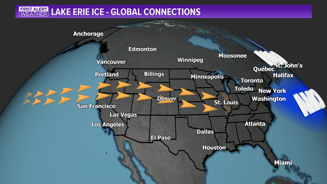
It may seem far away, but ocean trends in the Atlantic and Pacific play a big role.
"If tilted like this, then Canadian arctic air will bring here more ice. If it's tilted like this, then Pacific warm water will come into our Great Lakes. And then we will have warmer weather," Wang said.
What Wang explained is called teleconnection and the see-saw effect that different weather patterns around the globe can have on the jet stream over our heads; basically, connecting weather patterns from far away to us.
There are four weather patterns that are watched closely for Great Lakes ice forecasting: El Niño or La Niña and Pacific Decadal Oscillation are both in the Pacific Ocean to our west, the North Atlantic Oscillation and Atlantic Multidecadal Oscillation monitor weather patterns to our east.

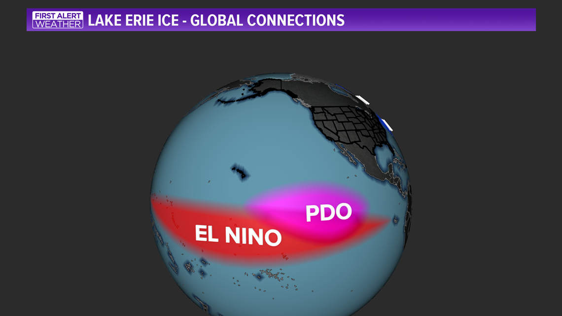
Each of those indicators tells us a different thing. Whether it's ocean temperature variations or high pressure placements, they all impact the global jet stream and therefore directly impact just how warm or cold the Great Lakes are each year.
So far this winter, the patterns have set up for the jet stream to bring in lots of mild, Pacific air. If that doesn’t change by mid-February, it is likely we will develop little to no ice on Lake Erie this season.


