
TOLEDO, Ohio — Winter weather is headed our way this week in two separate systems.
Before we get to Friday-Saturday's potential storm, Tuesday morning also will likely bring us some snow to northwest Ohio and southeast Michigan.
Tuesday's weather will be less severe than the winter weather headed here later this week.
Here's what you can expect with Tuesday's weather:
Before 4 a.m. Tuesday: Mainly dry with snow showers or light sprinkles beginning.
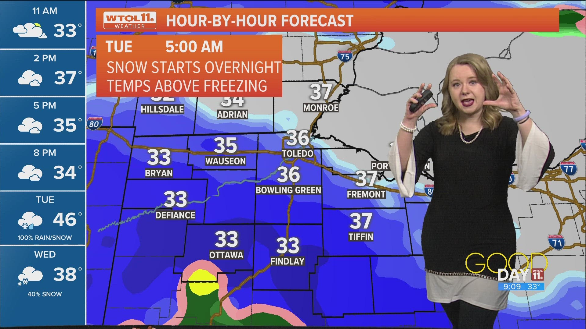
4 a.m. to 7 a.m. Tuesday: Snow showers begin with brief heavy snow possible at times. The temperature will hover just above freezing but the snow will fall fast enough to allow it to temporarily accumulate, especially on grass, parked cars and houses. A slushy accumulation on roads is possible. Travel with caution.
7 a.m. to 10 a.m. Tuesday: Snow quickly switches to cold rain. Any snow on the ground will begin to melt away as rain turns steady.
10 a.m. to 5 p.m. Tuesday: Scattered cold rain showers continue with the temperature slowly rising well into the 40s, even close to 50 degrees in places.
5 p.m. Tuesday to 12 a.m. Wednesday: Times of soaking rain showers with rain totals near or over 1 inch for the day.
After 12 a.m. Wednesday: Switch to light snow, minor accumulations less than 1 inch expected. Watch for icy spots that will dry to develop but a flash freeze is unlikely which means most roads will dry off.
Next winter storm coming Friday and Saturday
Tuesday's snow will hit the region three days before the next winter weather event, Friday night into Saturday.
WTOL 11's weather team has issued an ALERT DAY for Friday and Saturday because of this winter weather.
As a powerful low-pressure system rolls in from the southwest, snow chances will increase Friday, especially during the afternoon and evening.
Accumulating snow is likely Friday night into Saturday, coating roadways and slowing travel. In addition to sticking snow, gusty winds will develop as the storm arrives, possibly contributing to blowing and drifting.
Following the storm, significantly colder weather will hit the region. A frigid airmass will sweep in behind the storm system, dropping overnight lows to the teens. Furthermore, the fresh blanket of snow will enable overnight low temperatures to plummet.
More on WTOL: