
TOLEDO, Ohio — Dry and pleasant weather early Thursday evening will come to an end with rain chances that will increase and become more likely overnight and into Friday morning.
A few isolated thundershowers and brief downpours will be possible.


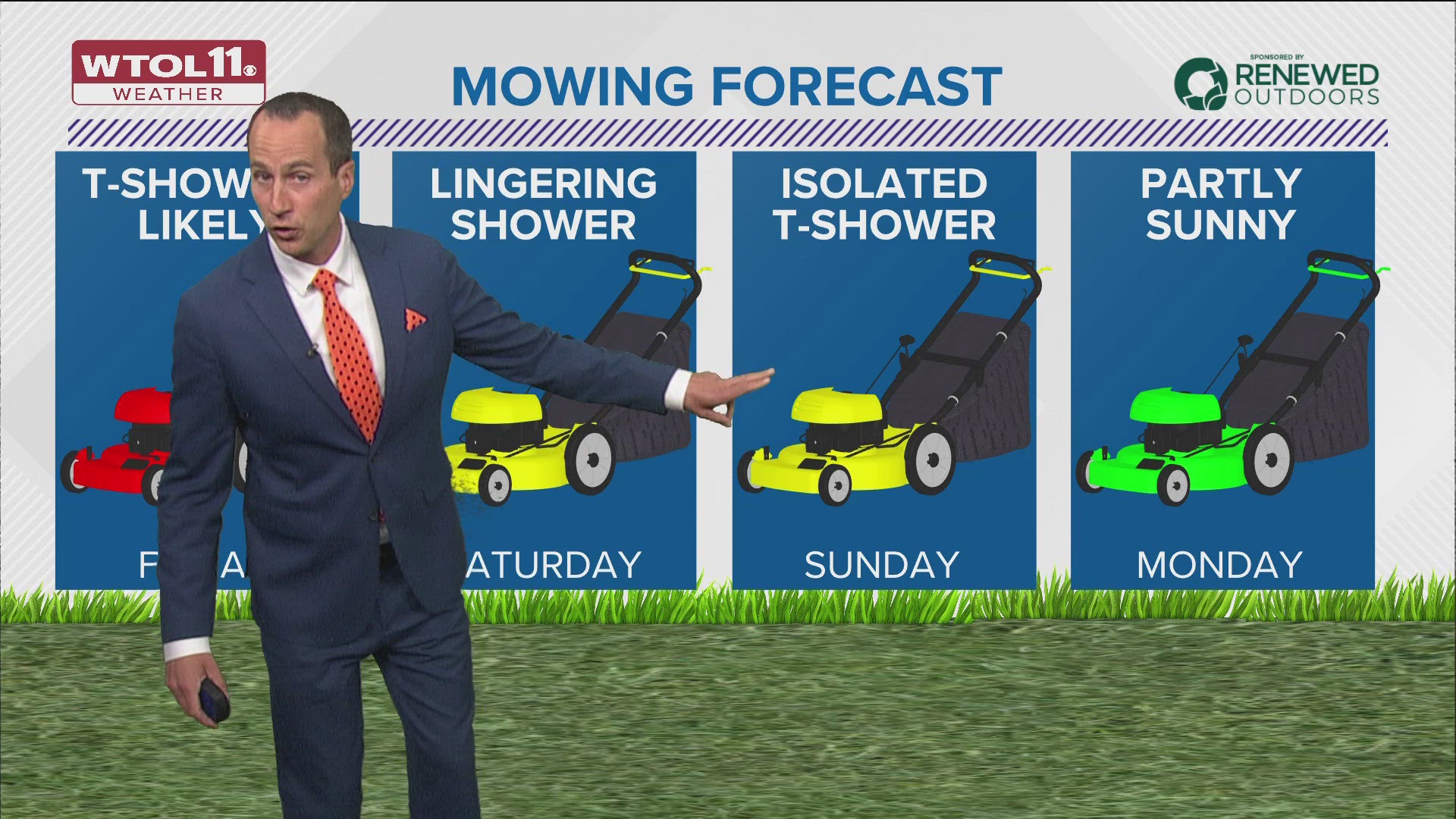
On-and-off rain chances continue into Friday afternoon with the arrival of a cold front. It will have a warmer and more humid feel on Friday with highs in the low and middle 70s.
Unfortunately, rain totals through Friday afternoon may be 1/4 inch to 1/2 inch or more in isolated areas.


Highs on Saturday will remain in the low and middle 70s.
Expect partly to mostly cloudy skies with the chance of a few passing rain showers on Saturday.
For the end of the weekend on Sunday, there will be a few isolated showers and a possible rumble of thunder. Otherwise, partly sunny skies and highs in the middle 70s.


Dry weather will be expected on Monday, before increasing chances of stormy and unsettled weather toward the middle of the week.
Highs will reach the upper 70s and low 80s through Wednesday.
The outlook through the middle and end of next week will be stormy and unsettled. The pattern may favor heavier and more widespread storm chances.


April showers smash the rainfall record
Toledo's April rainfall record has been smashed with the latest round of rain and downpours. The total now sits at 7.94 inches of rainfall for the month of April.


Records date back until 1871 and now 2024 holds the all-time record for the wettest April.


Download the free WTOL 11 Weather app
WTOL 11 meteorologist John Burchfield breaks down how the free WTOL 11 Weather app works for you:
MORE COVERAGE: More rainy and warm spring weather in northwest Ohio, southeast Michigan | Climate Friday
What's the weather like where you are?
Share your photos by tapping "Near Me" on the WTOL 11 News app navigation bar at the bottom of your screen! Be sure to give us your name and you may just see your photos on air.