
TOLEDO, Ohio — On the dawn of another winter season, the question always arises: will it be a cold and snowy winter? Seasonal outlooks are inherently challenging and involve many complex and sometimes unknown variables. One thing is clear, this winter season has a high likelihood of a strong to possibly historically strong El Niño pattern.
What exactly is an El Niño? This is generally referred to as an ocean and atmospheric phenomena with warmer than average equatorial Pacific waters off the coast of South America. Among other impacts, this domino effect of atmospheric events results in the reversal of the trade winds near the equator and displacement of the overall pattern of the jet stream globally.

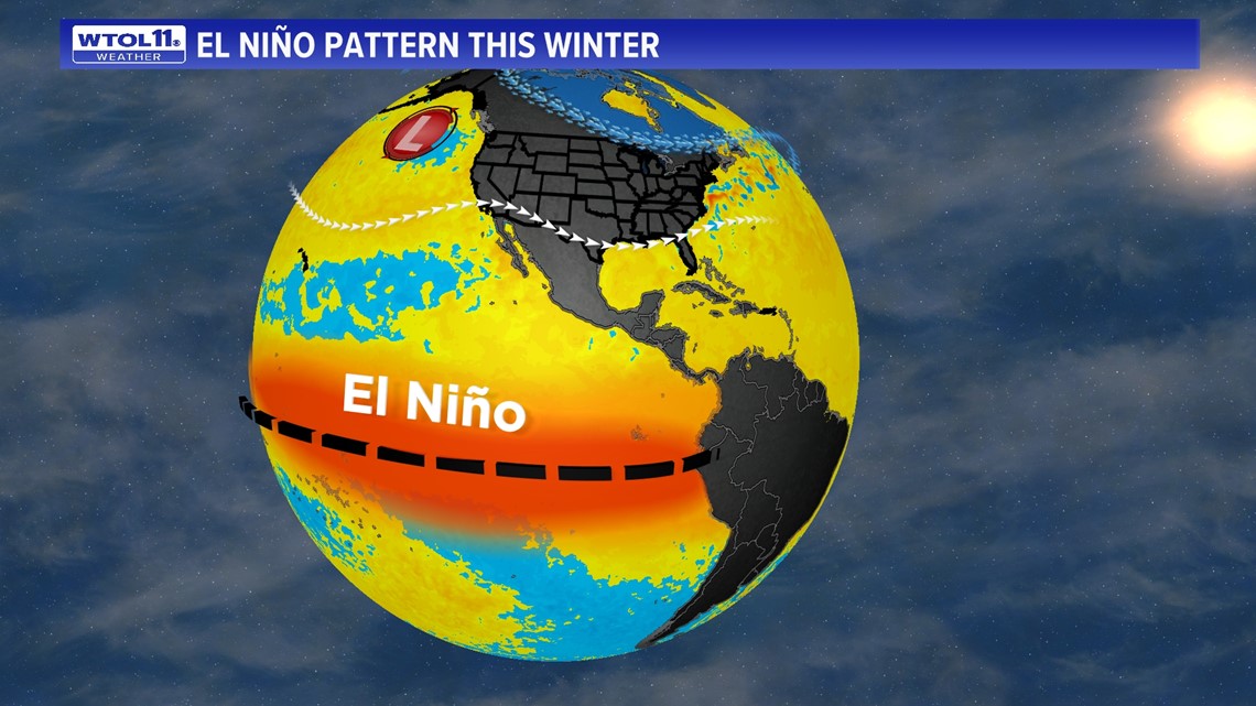
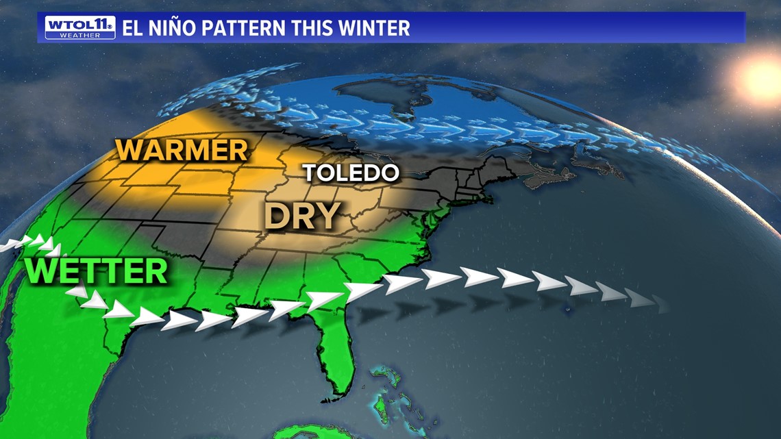
What does this mean locally? Across the United States, this frequently results in a more active subtropical jet stream across the southern tier of the United States with above-average precipitation. More frequent Pacific coast storms result in mild weather across the Northern Plains and Great Lakes region. Finally, drier than average weather across the Ohio Valley and Great Lakes is more favorable with the more active polar jet stream displaced farther north into Canada.

Let’s set the stage on what a “normal winter” looks like. Seven of the past eight winters have featured below average snowfall. This has the fingerprint of an overall warming climate. However, many will not soon forget the treacherous winters of 2013-2014 that brought record shattering snowfall of 86.3 inches. That’s far beyond what a normal winter snowfall of 37.4 inches would tally.
RELATED: Is our winter season shrinking?
Winter weather patterns can be highly variable, even in an overall warming climate. Recent trends have confirmed warmer winters with snowfall trending below average with less average days of measurable snowfall per winter. However, there are many other variable that influence a winter's outcome.

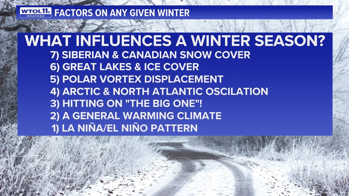
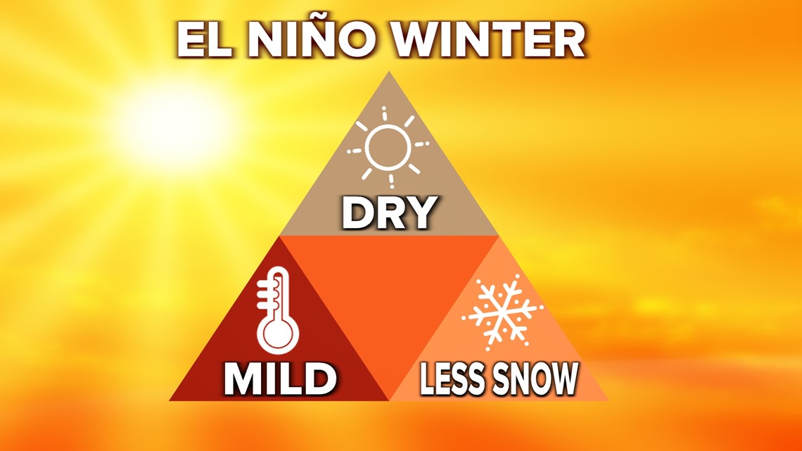
By far, the greatest effect on our upcoming winter has been welling up for months. It is the impact from a strong to historically strong El Niño. This pattern has been identified to have very close and direct impacts on our local weather through the winter season. Most noteworthy, the warming in an El Niño pattern and ultimate domino effect more frequently leads to the displacement of the polar jet stream north into Canada. The result is an overall warmer, drier and less snowy winter season.

The latest outlook remains steadfast on very high confidence of at least a strong El Niño, with a 35% chance of what could amount to an historically strong El Niño. An historically strong El Niño has only been recorded three times in recorded history, all with similar characteristics of very warm winter weather, below average snowfall and below average precipitation.

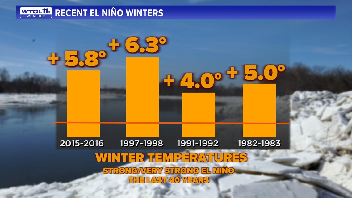
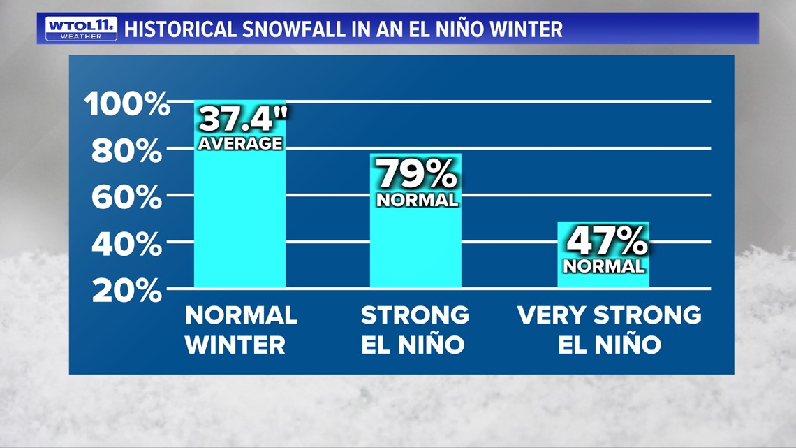
Snowfall during the last five strong El Niño winters comprised 79% of normal levels, and the total seasonal snowfall in the three historically strong El Niño winters on record was bleak, measuring at only 47% of normal. During the most recent very strong El Niño, December of 2015 had no measurable snow and was one of the warmest months of December in recorded history. In both January 1998 and 1983 our total monthly snowfall was less than 2 inches each month during the strong El Niño pattern.

What could make this outlook change? There are some early indications that this strong El Niño may not be fully acting like a strong El Niño. The Multivariate El Niño index can be a more comprehensive overview of the total atmospheric response and represents more variables within El Niño. The data here could be an indication that this winter may "act" more like a modest El Niño season, not a strong or very strong season.
Another factor is sudden stratospheric warming (SSW) event that results in the disruption of the Polar Vortex. Inevitably, this happens every winter and can result in periods of cold or very cold and snowy weather for at least a few weeks. It is safe to say this happens any given winter and would offer our best chance of at least a few weeks of cold and snowy weather.
RELATED: Winter weather pet safety tips
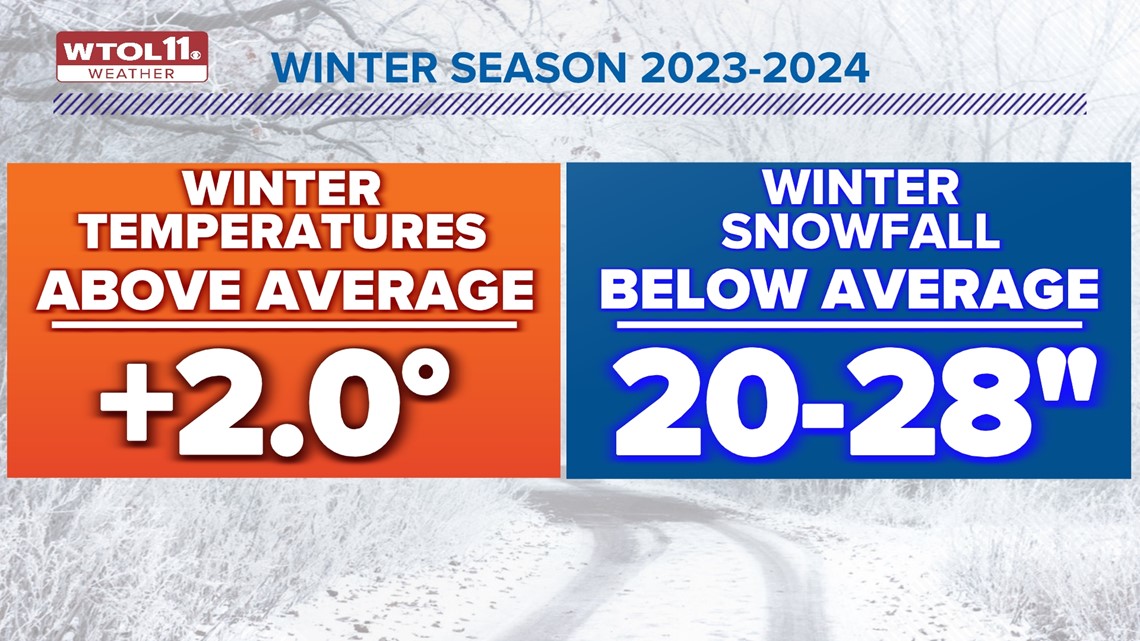
Overall, the winter season for 2023 to 2024 will likely be above average with temperatures and below average with snowfall. If it cooperates similar to a modest to strong El Niño, our overall winter temperatures could average 2 degrees or more warmer over the entire winter season. Snowfall would be below average in the range of 20-28 inches of total snow over the entire season.

Stay tuned to the WTOL 11 forecast daily as we venture into the upcoming winter season. While overall conditions may be bleak for frequent snow, history has shown that it can only take one good storm to create a memorable winter season.
MORE FROM WTOL 11