TOLEDO, Ohio — September began with summer heat as temperatures surged to the 90s multiple times this week. Now that the weekend is here, cooler weather has finally settled in. What can you expect heading into the second week of September? Meteorologist John Burchfield has the answer in this week's edition of Climate Friday.
First, let's recap the early September heat wave that impacted the area earlier this week. With several days with high temperatures in the 90s, September delivered exceptional heat for much of the country. The first five days of the month featured an average high temperature of 88 degrees in Toledo with three days in the 90s. Sept. 3, 4, and 5 all brought highs in the 90s with temperature observations of 90, 91 and 93 degrees respectively.
Though these high temperatures fell just shy of records, they surpassed normal September readings by over 10 degrees. Our average high for early September is around 80 degrees. By the end of the month, the normal high will fall to 72 degrees, a sign of the upcoming fall season.
September is a month of change, and usually brings vast drops in temperatures and humidity over the course of several weeks. You'll feel the difference this weekend as humidity levels and temperatures plummet.
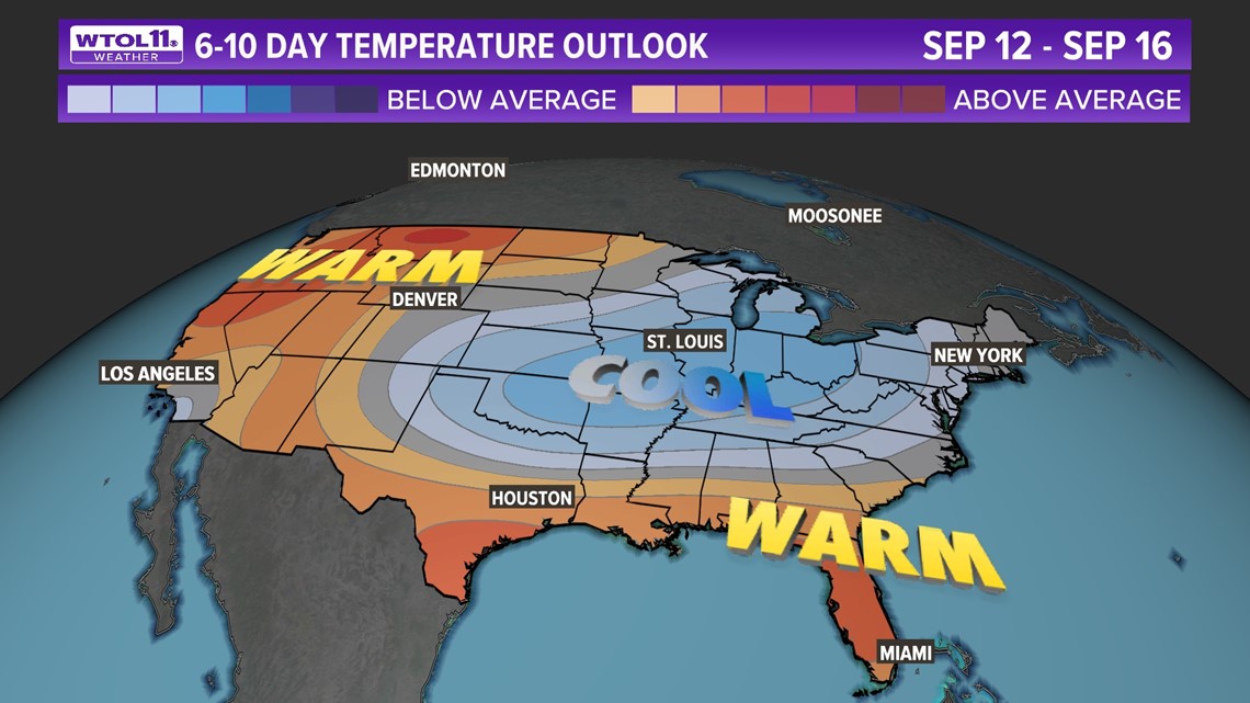
Most of the 10-day forecast features highs in the 60s and 70s, a sign of a cooler long-range weather pattern. Much of the Great Lakes and Midwest region will experience cooler-than-average conditions through the middle to latter half of September.

Though cooler weather is right around the corner, climate change has contributed to an overall uptick in temperatures. In the past decade alone, September temperatures have risen 2.3 degrees in the Toledo area, a trend even more pronounced looking at data over the past 50 years.
RELATED: Earth's hottest day in modern history likely recorded July 4; same record tied again on July 5
Since 1970, September temperatures have risen a whopping 3.9 degrees, a noticeable shift toward warmer late-summer and early autumn seasons. This change has occurred across most of the United States and data since 1970 has shown that 232 of 241 American cities have experienced an increase in temperatures with an average rise of 2.4 degrees. One third of cities, including Toledo, have warmed up by over 3 degrees during the last half-century.

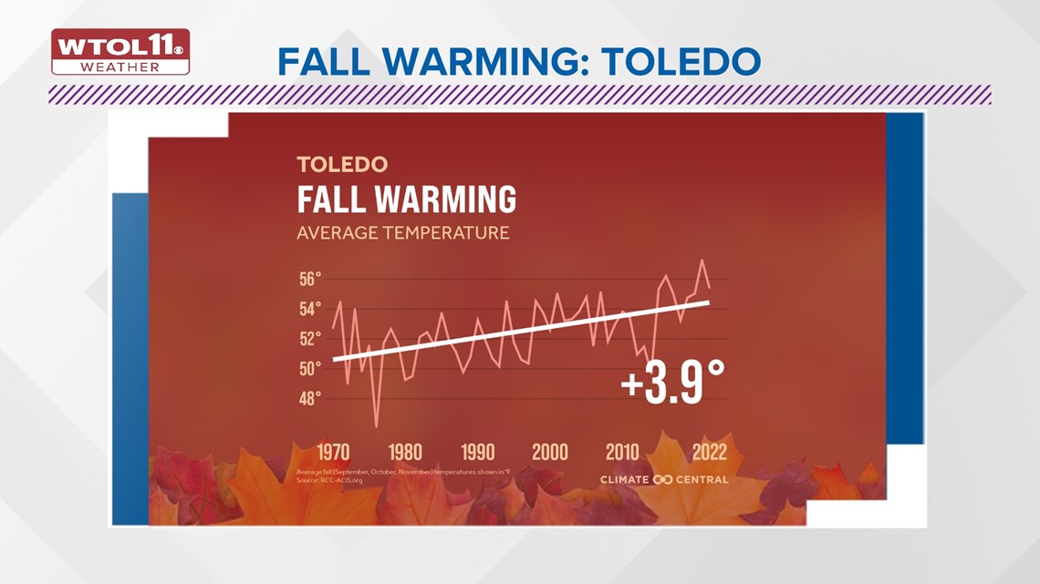
Toledo has not only seen an overall increase in late-summer and early autumn temperatures, but also a rise in unusually warm days. Since 1970, the number of fall days above normal has risen by 15, representative of more common and extreme late-season warmth. This trend will likely continue in the coming years, despite the brief cool spell forecast for mid-September.
Lastly, let's talk long-term weather patterns and the impacts they may have on the coming months. Though winter may seem like a long way away, the WTOL 11 Weather Team is already keeping an eye on global patterns that may shape our weather here at home. You may have heard of El Niño and La Niña, long-range patterns dependent on sea surface temperatures in the equatorial Pacific region.

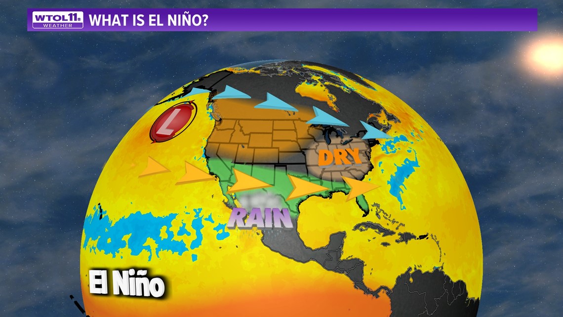
Confidence is extremely high (over 95%) that an El Niño pattern will continue into the winter season, which may impact our weather here at home. El Niño, characterized by warmer-than-average waters in the equatorial Pacific, is generally associated with drier and milder winters across the Great Lakes region. El Niño generally contributes to wet weather across the southern United States due to an active jet stream track. Meanwhile, milder air impacts the northern and western United States and drier conditions often keep precipitation below normal across the Great Lakes.

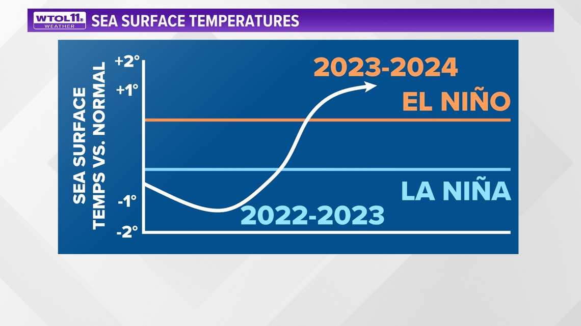
Though it's still far too soon to talk winter weather, it's worth noting that an El Niño pattern may affect our weather in the coming months. Stay tuned to the WTOL 11 Weather Team for the latest 10-day forecast and subscribe to the Climate Friday Newsletter for new content every week.
MORE EPISODES OF CLIMATE FRIDAY

