

TOLEDO, Ohio — Now that July is in the rearview mirror, it's time to recap the heavy rainfall and frequent thunderstorms that impacted the region last month. In this week's Climate Friday, Meteorologist John Burchfield breaks down how much rain we got in July and how the month stacks up in Toledo weather history.
Additionally, you'll learn about the origins of the Canadian wildfire smoke and why it continues to affect our air quality here at home. Subscribe for a new Climate Friday Newsletter every Friday.
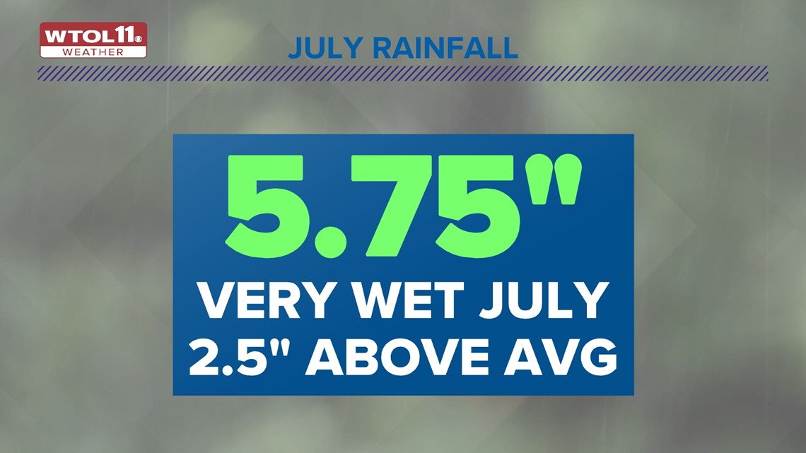
When you look back on July, you'll probably remember it as an incredibly wet month with numerous heavy downpours and severe thunderstorms. With 5.75 inches of rainfall, last month dumped out nearly double what you'd expect in July. Rainfall totals exceeded the average amounts by a whopping 2.5 inches.

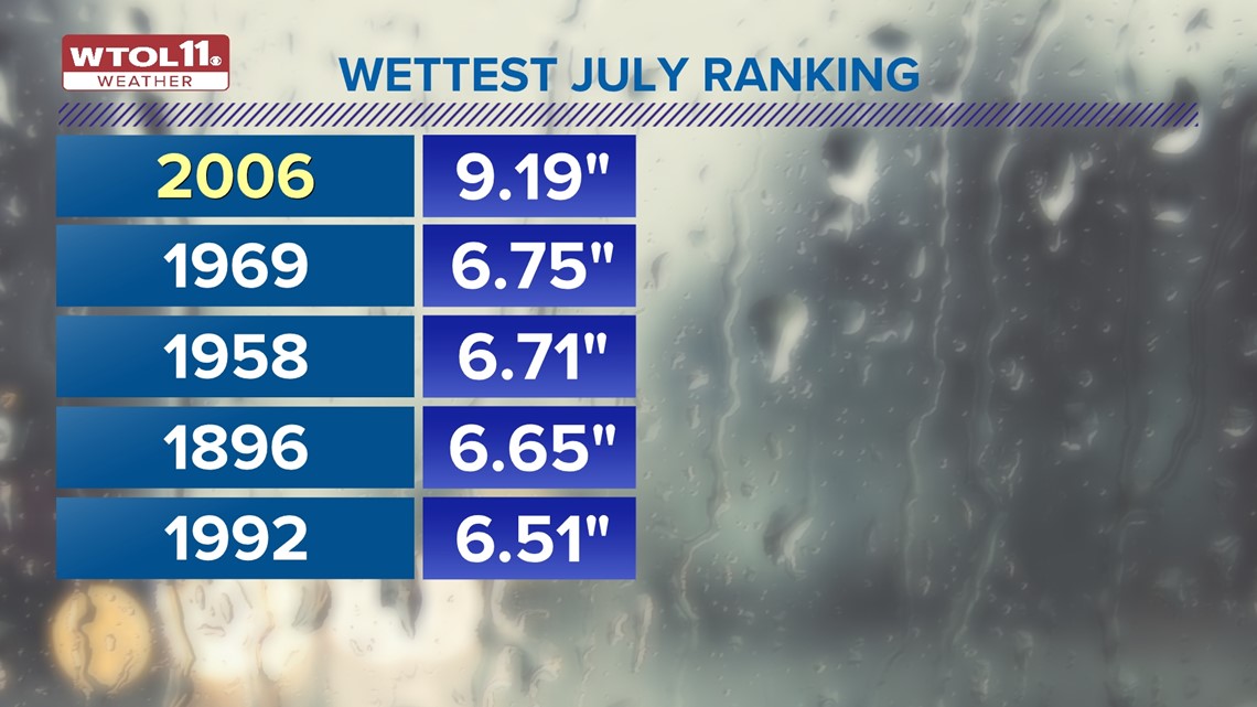
Some locations received even more rain than the Toledo Express Airport, including Hillsdale, which was frequently inundated with rainfall last month. July 2023 ranks as the 12th wettest July on record, impressive given that weather observations date back to the late-1800s.
Topping the list is July 2006 with produced an incredible 9.19 inches of rainfall!. Taking the second spot on the list is 1969, which delivered 6.75 inches of rain. A number of other Julys brought over half a foot of rainfall. This July will go down as one of the wettest on record.

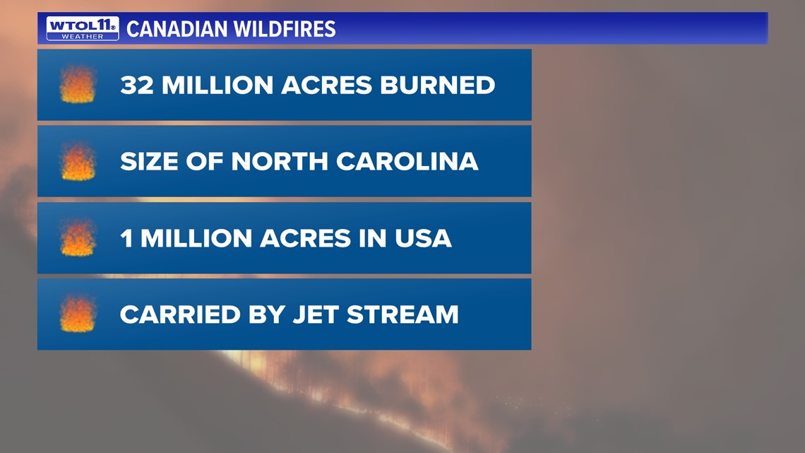
What about the wildfire smoke? You may have noticed hazy skies and obscured sunshine this week. Canadian wildfires once again impacted our air quality here at home. The jet stream, the conveyor belt that guides our weather patterns, delivered the smoke to Ohio and Michigan after a long journey from hundreds of miles to the northwest.
While the smoke initially remained thousands of feet up in the atmosphere, it eventually mixed down to Earth's surface, polluting air quality. The air quality index, or AQI, skyrocketed to the triple-digits this week, an unhealthy level for sensitive individuals. Smoky skies will gradually clear up Friday as a weak cold front sweeps in from the north.
So why have these Canadian wildfires continued to blaze? Many fires are located in remote locations that are inaccessible to firefighters. Tracking down and extinguishing these fires could incur an opportunity cost of putting out other fires that pose more of an imminent threat to life and property. With over 32 million acres burned, or the size of the state of North Carolina, firefighters have their work cut out for them.

Sometimes, putting out fires is like playing "whack-a-mole": the minute one fire is extinguished, another one develops. The cycle perpetuates, seemingly endlessly amid the hot and dry summer weather. Only a long-term shift in the weather pattern toward cooler and wetter conditions will provide long-term reprieve from the wildfires. The Canadian fires will likely ease up as fall gradually settles in.
The WTOL 11 Weather Team will keep you updated on the impacts of the Canadian wildfire smoke and the return of a rainy and stormy weather pattern. Subscribe to the Climate Friday Newsletter for new information from Meteorologist John Burchfield every Friday.
MORE FROM CLIMATE FRIDAY ON WTOL 11