

TOLEDO, Ohio — As we round the corner from summer to fall, the tropics are heating up, kicking off hurricane season. Hurricane Hilary, which has strengthened to a major hurricane, is poised to make landfall on the Pacific coast this weekend and has made national news for its impending impacts.
In this week's Climate Friday, Meteorologist John Burchfield will break down the forecast track, intensity and impacts of Hilary.
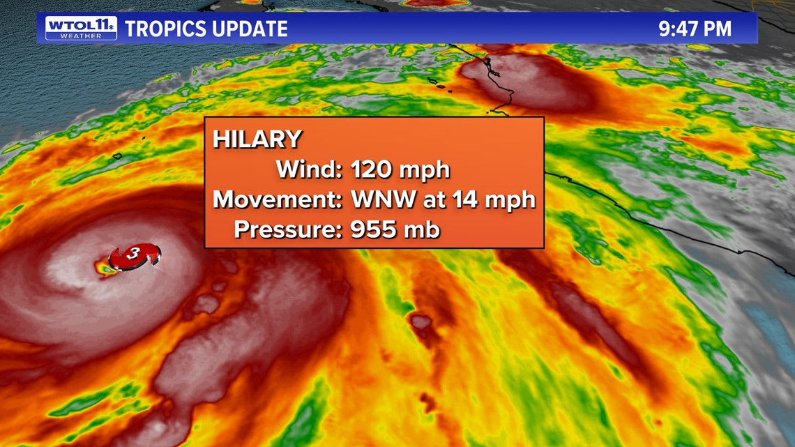
Over the past 24 hours, Hurricane Hilary has rapidly intensified due to the warm, open waters of the Pacific Ocean. Warmer sea surface temperatures have escalated tropical activity in recent years, and climate change is partly to blame. The pink color on this map shows you ocean temperatures warmer than average. The blue shade indicate cooler conditions.

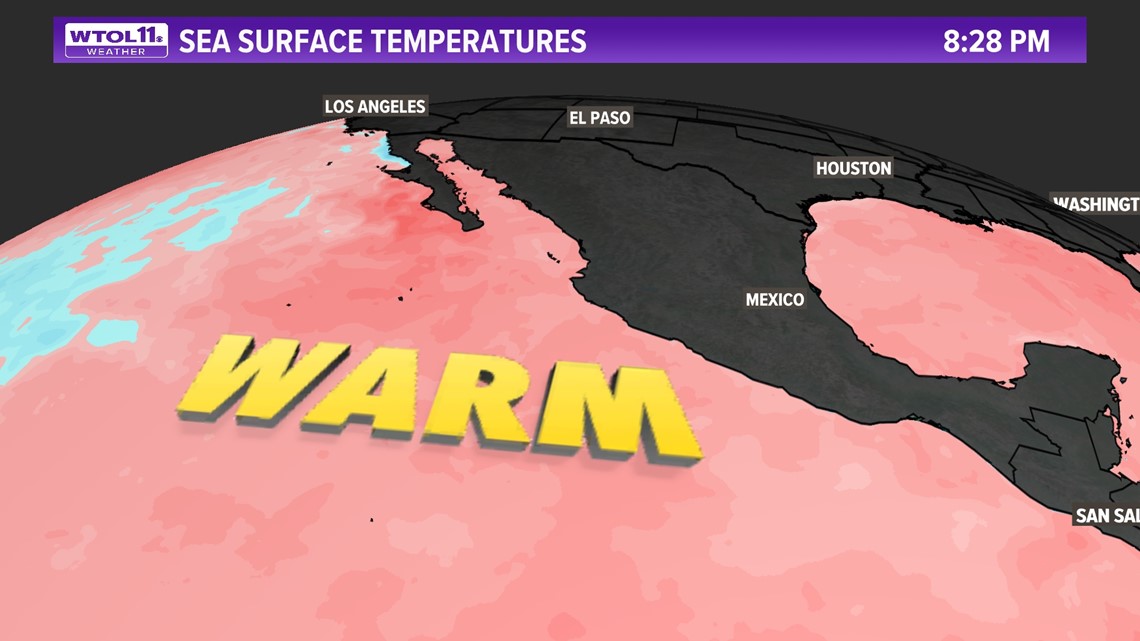
Most of the tropical waters of the Pacific Ocean and Gulf of Mexico are far warmer than average, a trend that has become more common due to global warming. As the planet heats up, the oceans absorb the brunt of the impact, and some studies have shown that the oceans absorb 93% of excess heat trapped on Earth.
This stored heat provides increased fuel for evaporation, precipitation, and intensification of tropical cyclones. Just as a pot of water boils more quickly when the burner is set to high, warmer ocean temperatures escalate the rate of evaporation and enhance the natural water cycle.
Rapid intensification of hurricanes and tropical storms has grown more common in recent decades. On Friday, Hurricane Hilary strengthened from a weak hurricane to a major Category 4, a representative of the trend in tropical activity in the era of climate change. Hurricane intensification will likely continue to speed up in the future as temperatures rise.

With Hurricane Hilary poised to make landfall this weekend, major impacts are expected across the southwestern United States. If Hilary makes landfall in the Baja Peninsula, it will likely weaken to tropical storm or depression status by the time it reaches southern California.

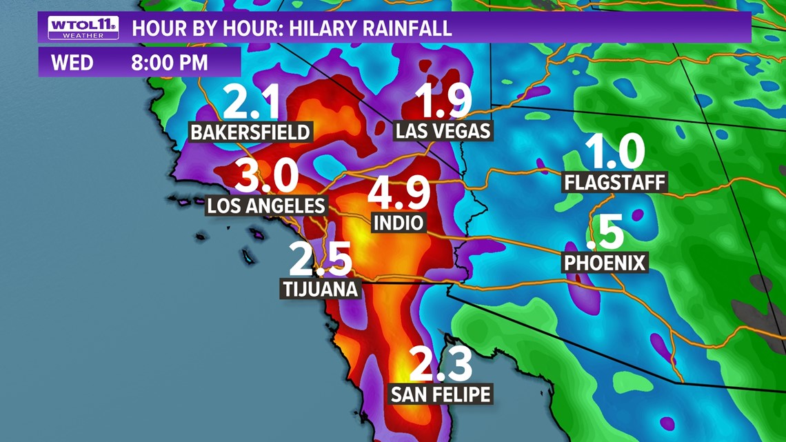
If a more westerly storm track verifies, Hilary could be the first tropical storm or hurricane to make landfall in southern California in 84 years. This tropical rarity would make Hilary the first Pacific tropical cyclone to make landfall in southern California since 1934. Most hurricanes and tropical storms make landfall on the Baja Peninsula, weakening during the trek north.
The WTOL 11 Weather Team will keep you updated on the tropics and the impacts of climate change on hurricane activity. Subscribe the Climate Friday Newsletter for new content every week!
MORE EPISODES OF CLIMATE FRIDAY