TOLEDO, Ohio — With Thanksgiving in the rearview mirror and December underway, winter snowfall may be on your mind. Though November failed to deliver much measurable snow, what can you expect as we round the corner into December? Meteorologist John Burchfield answers those questions and more in this week's edition of Climate Friday.
November only dealt out 0.2 inches of snow accumulation, far behind the monthly average of 1.7 inches. Snowfall varies significantly within the month of November, and year-to-year variation depends largely on the weather pattern. Topping the list of snowiest Novembers is 1966, which delivered a whopping 17.9 inches of accumulation. 1940 takes the second spot with 12.3 inches.

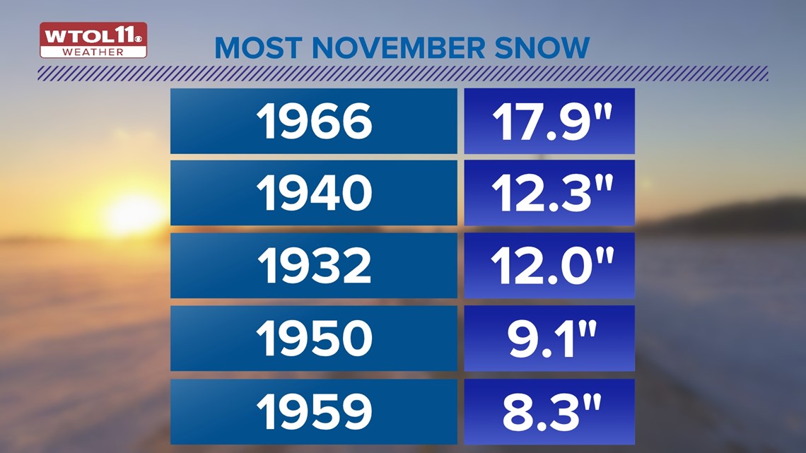
Going down the list, 1932 dosed out exactly one foot of snowfall, 1950 brought 9.1 inches, and 1959 rounds out the top five with 8.3 inches.
These historically snowy Novembers all share a few commonalities: they all happened in the mid-20th century. Is climate change making November weather less snowy? Let's take a deeper dive into the data.
The top 18 snowiest Novembers on record all occurred in the 20th century, and of the top 25, only two happened this century. A few recent noteworthy Novembers include 2019, which brought 4.1 inches of snow and 2021, which delivered 3.8 inches of early season accumulation.

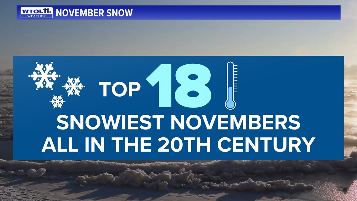
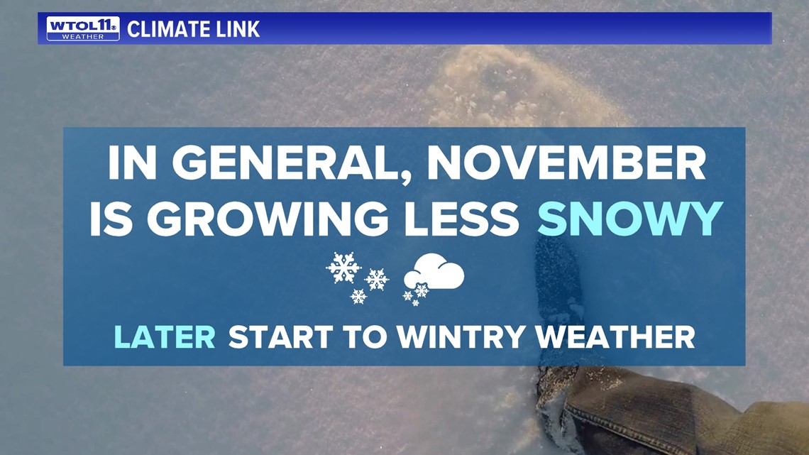
While these Novembers were well above-average in the snowfall department, they still fell far behind the aforementioned historic early season snowfalls. Though November snowfall is highly dependent on the weather pattern, observational data in the Toledo area, northwest Ohio, and southeast Michigan suggests that it's growing less frequent, a correlation that fits within the broader framework of climate change.
RELATED: Is our winter season shrinking?
Though our November snowfall this year fell far below-average, monthly temperatures checked in right around normal. With an average temperature of 43 degrees, this November featured a wide range of highs and lows spanning from 69 to 20 degrees respectively. This broad spectrum of temperatures represents this month of change, which often starts off with milder days and ends feeling more like winter.
November can be a wild card weather-wise, bringing balmy warmth, extreme cold, torrential rain and heavy snow. Temperature-wise, November has ranged from an average of 49 degrees (1931) all the way to 32 degrees (1976).

The wettest November on record was 2011, which dosed out 7.15 inches of precipitation. The snowiest on record was 1966, which brought in an incredible 17.9 inches. November can be a wild card weather-wise, and this year brought drier-than-normal conditions with average temperatures.
November is growing warmer for much of the country due to climate change, and 82% of all US cities have seen a rise in monthly temperatures since 1970. Data looking at 241 weather observation sites across the country shows that 202 have seen a rise in November temperatures and one third and warmed by over 2.5 degrees during that time frame. While November weather has grown warmer, December has seen an even greater impact from climate change.
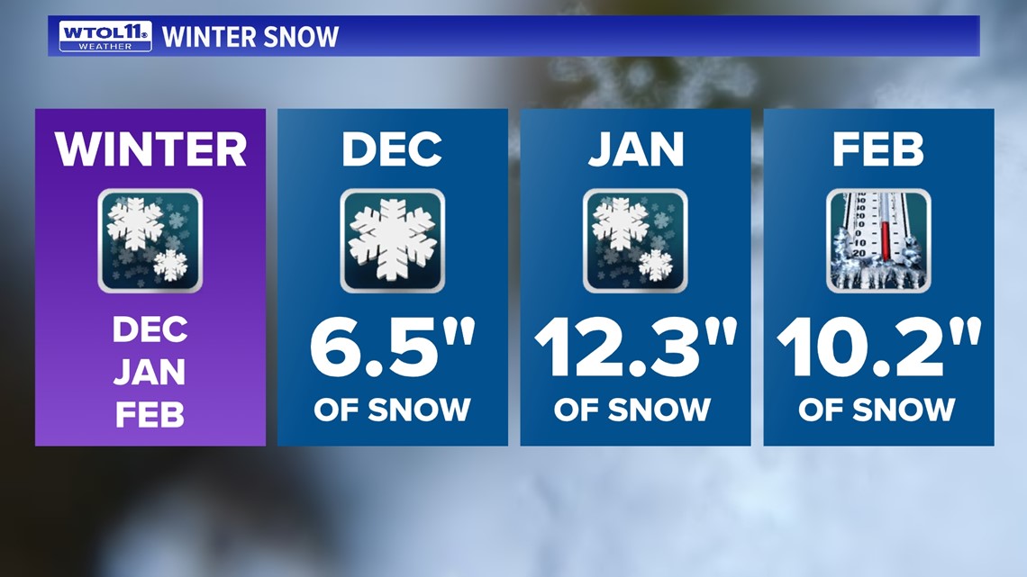
What can you expect as we round the corner from November into December? On average, December doses out 6.5 inches of snow accumulation, officially kicking off the winter season. With just over half a foot of accumulation, December is only the third snowiest month of the year, falling well behind January and February, which bring an average of 12.3 inches and 10.2 inches, respectively.

In terms of temperatures, December ushers in a much chillier feel with an average high of only 39 degrees. Though colder weather is inevitable, December is growing much milder as a result of climate change. Data from Toledo Express Airport shows that December is growing warmer at a faster rate than any other month, and the latest decade of weather data reflects a 3.1 degree increase in average temperature.
RELATED: Climate Friday | Only 1 in 4 days in the winter are sunny; here's what makes Ohio winters cloudy
This new data from the National Oceanic and Atmospheric Association shows a sizeable uptick in December temperature in Toledo and nationwide. Winter is the fastest warming season for the eastern two thirds of the United States. The blue shade on this map indicates states where winter is the fastest warming season.

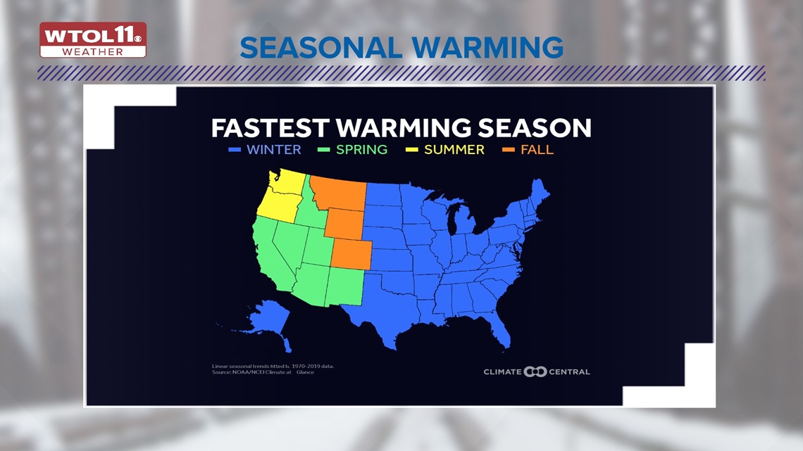
From the Great Plains to New England all the way down to Texas and Florida, winter is the season that is warming the most rapidly due to climate change. In Washington and Oregon, summer is warming the most rapidly. A number of western states have seen the biggest rise in temperatures during spring. And in Montana, Wyoming, and Colorado, fall is warming the fastest. For most the country, however, winter is the quickest warming season due to climate change, a trend that will continue to elevate temperatures and reduce snowfall in the future.
The WTOL 11 weather team is forecasting a milder-than-normal winter with snowfall totals below average, in part due to the El Niño weather pattern, but also because of climate change. Stay tuned to the Climate Friday Newsletter for updates as we enter December and move closer to winter and Christmas.
MORE FROM CLIMATE FRIDAY ON WTOL 11

