TOLEDO, Ohio — Now that we're over a week into December, you may be wondering when we'll see some snow. Snowfall has been hard to come by so far this season, and the WTOL 11 10-day forecast keeps us free of widespread accumulations through the middle of the month.
How is climate change impacting winter snowfall and what can you expect for the rest of December? Meteorologist John Burchfield answers those questions in this week's edition of Climate Friday.
The last time we picked up even 3 inches of snow was almost 11 months ago. Jan. 25, 2023 was the last time we reached this threshold, picking up 4.7 inches of snowfall. The last time we got half a foot of accumulation was nearly two years ago. Between Feb. 2 and 3, 2022, the atmosphere dosed out significant accumulations for the region, dumping 12.7 inches of snow on the Toledo metro.
The February prior - 2021 - dished out even bigger snowfall totals with 14.5 inches of accumulation between the 15th and 16th alone. Snowstorms like these seem like a distant memory, especially when last winter was relatively sparse in the snowfall department.

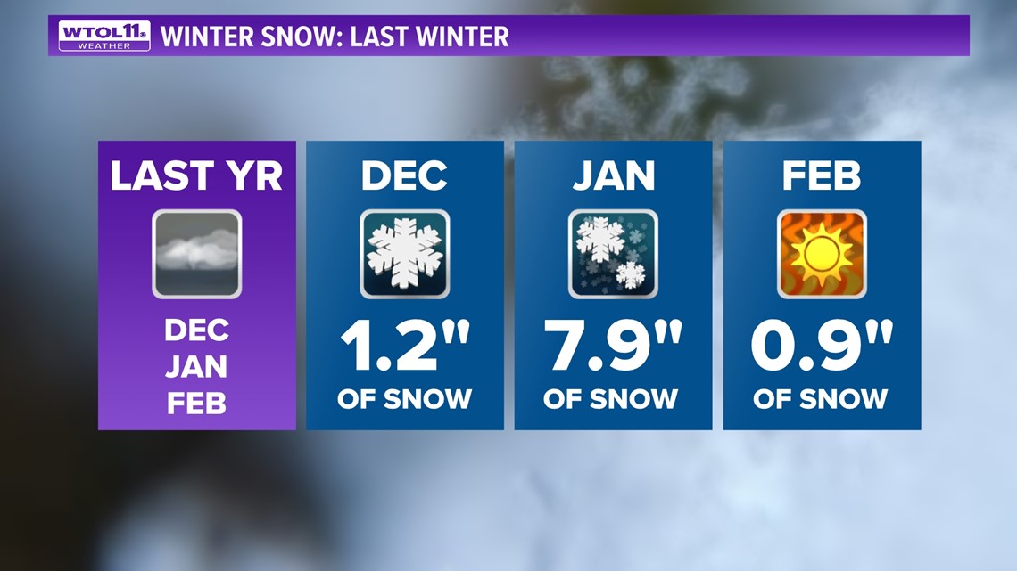
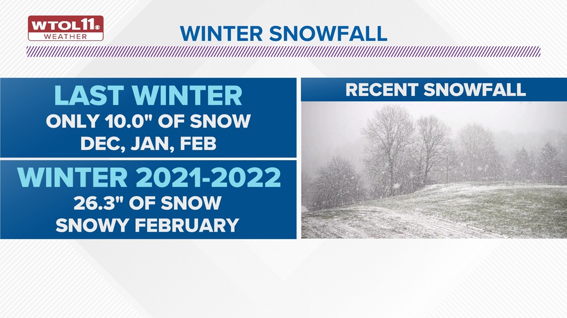
The winter of 2022-2023 only brought 10 inches of snowfall, less than one third of our seasonal average. The year prior at least delivered some snow, mainly late in the season, with 26.3 inches of total accumulation. Though the past few winters have been underwhelming in the snowfall department, northwest Ohio and southeast Michigan have seen their share of heavy snow.
The biggest snowstorm in Toledo history occurred from Feb. 28 to March 1, 1900, when 20.2 inches walloped the area. The previously mentioned February 2021 snowstorm checks in at number three on the list of snowiest winters. Other historic snowstorms occurred in 1912, 1974 and 2014.

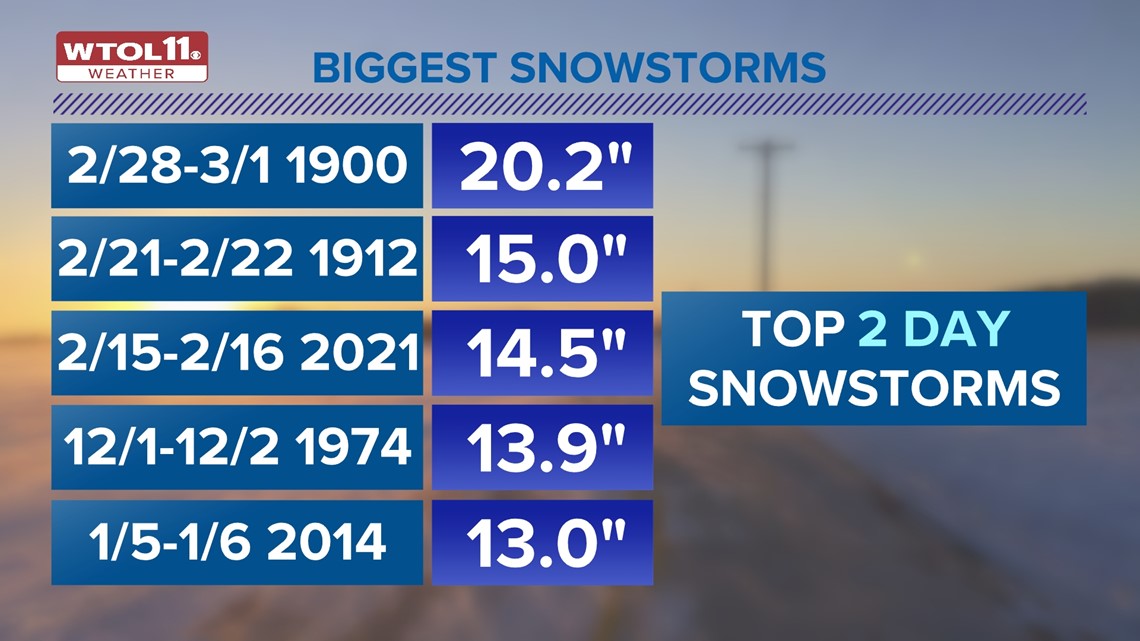
You may be wondering why the Blizzard of '78 isn't on the top five list of snowstorms. The snow from that historic blizzard occurred over three days, amounting to 13.3 inches. While snowfall measurements were impressive, it was the snow drifts that made the blizzard especially memorable: due to the 50 mph gusts, drifts stacked up as high as 10 feet. While there are multiple ways to measure snowfall and impacts, this particular list adds up the top two-day snowstorms in Toledo history.
So how is climate change impacting winter snow and what can you expect for the rest of the month? In general, winter is growing less snowy and wintry weather is starting later in the season. The past few winters have exemplified this trend with snowfall totals far below-average.

Much of the northern and central United States is receiving less snow and more rain during the winter. From New England to the Great Lakes and Pacific Northwest, around 70% of American cities are getting less snow and more rain during the winter. December has been especially susceptible to the impacts of climate change.
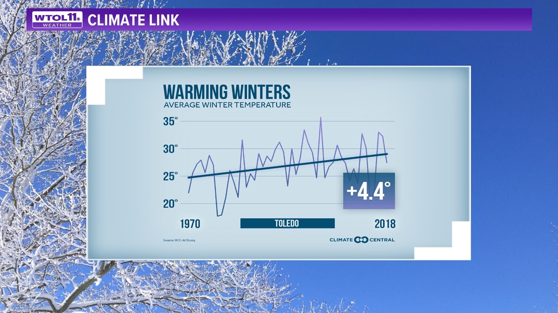
New data from NOAA shows a significant 3.1 degree warming trend in average December temperatures in the past decade alone. Since in the 1970s, winter temperatures in Toledo have risen by approximately 4.4 degrees, and despite year-to-year variation based on the weather pattern, the overall trend is unmistakable. Climate change has warmed up the winter season and hampered average snowfall amounts. This trend will likely continue to bring milder and less snowy winter conditions in the future.

Though December features an average of 6.5 inches of snow accumulation, the 10-day forecast remains relatively snow-free heading into the middle of the month. You'll see mainly sunny and dry days with no major snowstorms in the WTOL 11 forecast.
RELATED: Climate Friday | Only 1 in 4 days in the winter are sunny; here's what makes Ohio winters cloudy
Whatever weather Mother Nature has in store, you can trust the WTOL 11 weather team for the latest forecast. In next week's Climate Friday, Meteorologist John Burchfield will talk white Christmas chances and snowfall for the rest of December.
MORE FROM CLIMATE FRIDAY ON WTOL 11

