
TOLEDO, Ohio — Clouds are one of the fundamentals of how weather works across the world.
From shelf clouds to funnel clouds, each is unique and has scientific explanations as to how it is formed and what ingredients make up every cloud type.
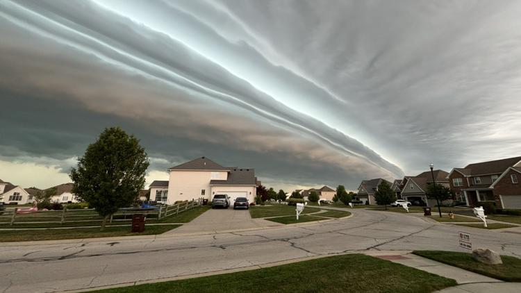
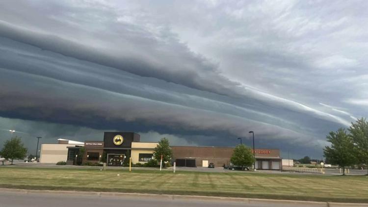
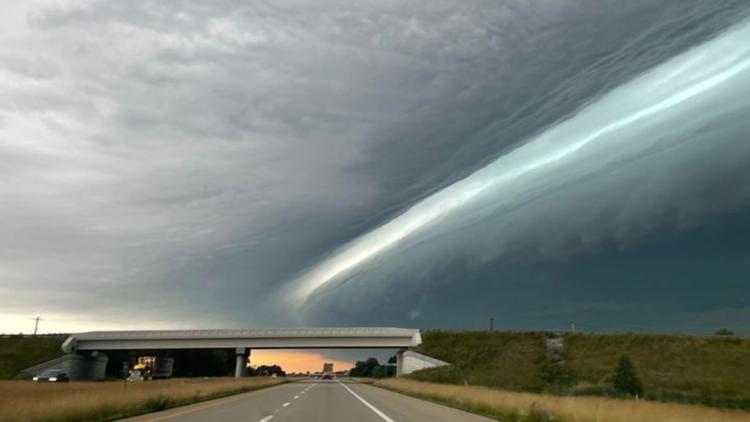
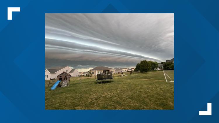
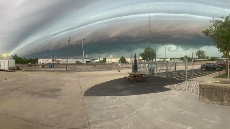
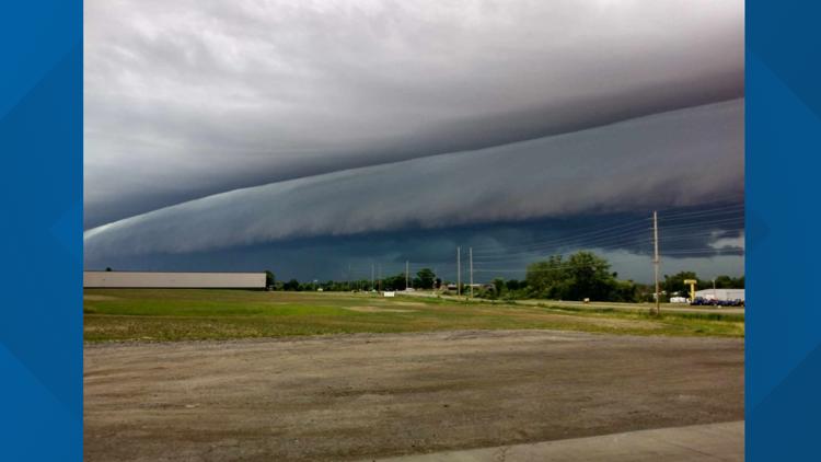
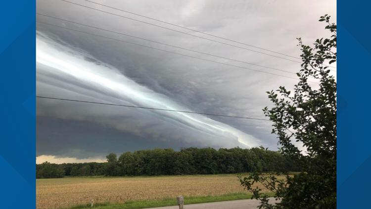
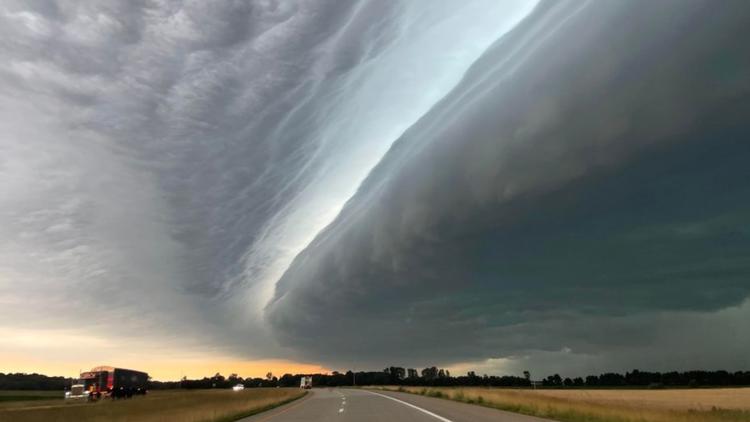
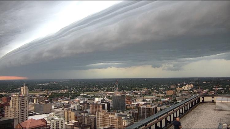
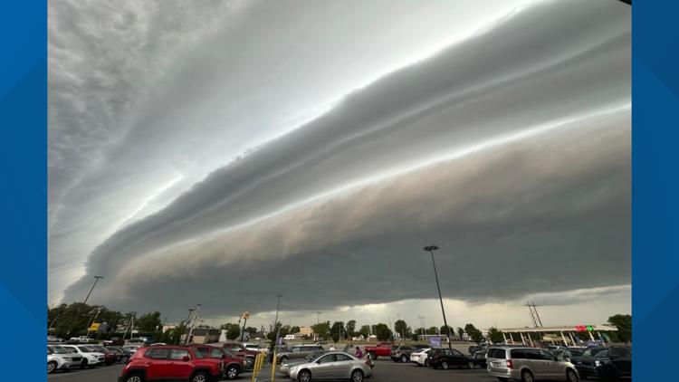
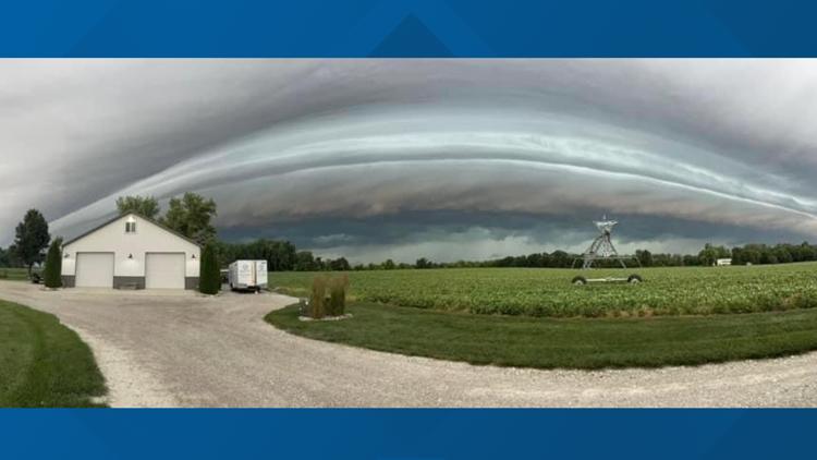
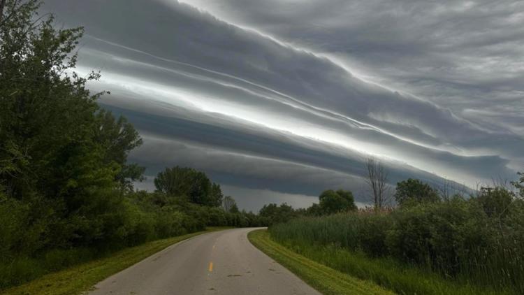
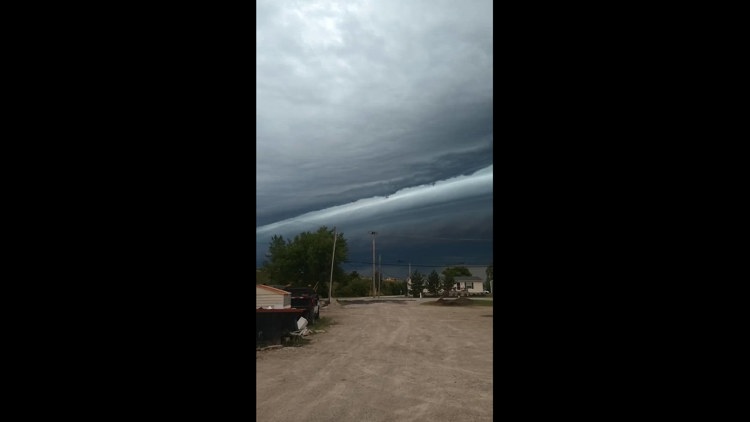
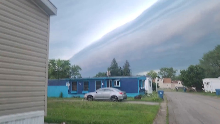
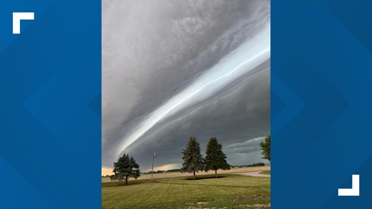
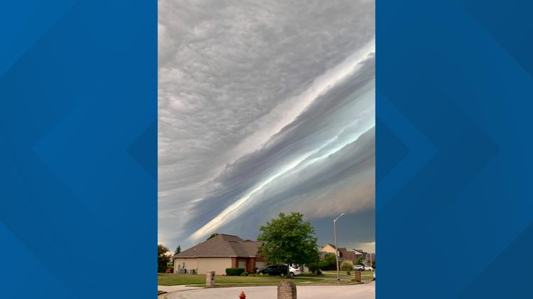
This past week, we experienced the rare phenomenon of a shelf cloud. This massive cloud captured the attention of many across northwest Ohio.
RELATED: WATCH: Video, photos show shelf cloud during severe weather in northwest Ohio, southeast Michigan
As many know, clouds come in all different shapes and forms, but to tell which clouds are which can be difficult to spot.
Have you ever wanted to identify the distinct types of clouds by just looking up? Well, here is a guide on spotting the different types of clouds we see in our everyday lives.

Before we dive into the details of different cloud types, it is key to break down how and why clouds form.
According to the National Weather Service, clouds form when the invisible water vapor in the air condenses into visible water droplets or ice crystals. For this to happen, the parcel of air must be saturated, meaning it is unable to hold all the water it contains in vapor form, so it starts to condense into a liquid or solid form.
Each must have the proper water vapor to form, but when you add different ingredients to the atmosphere, the shapes, sizes and severity begin to change to the smallest detail.
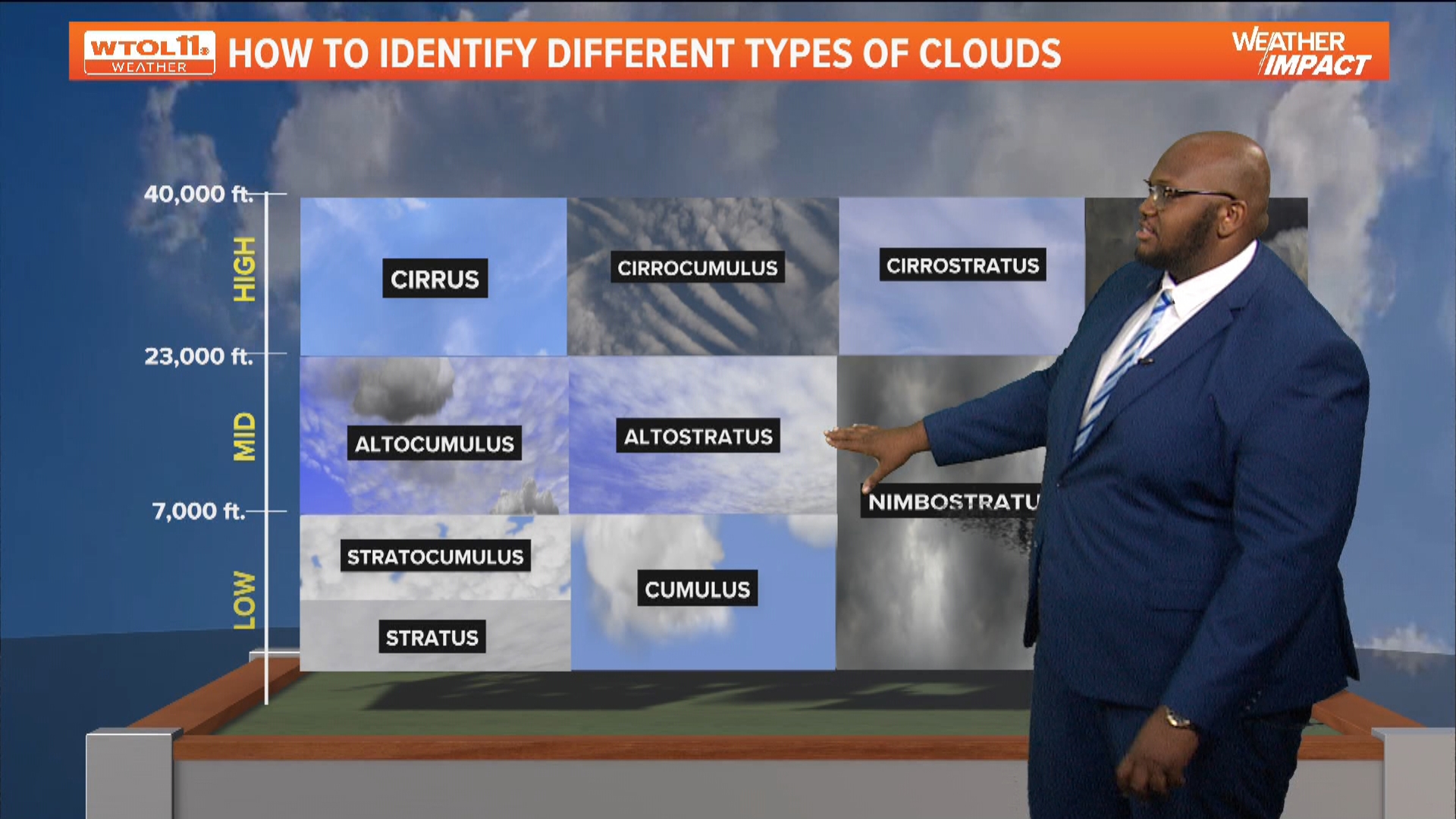
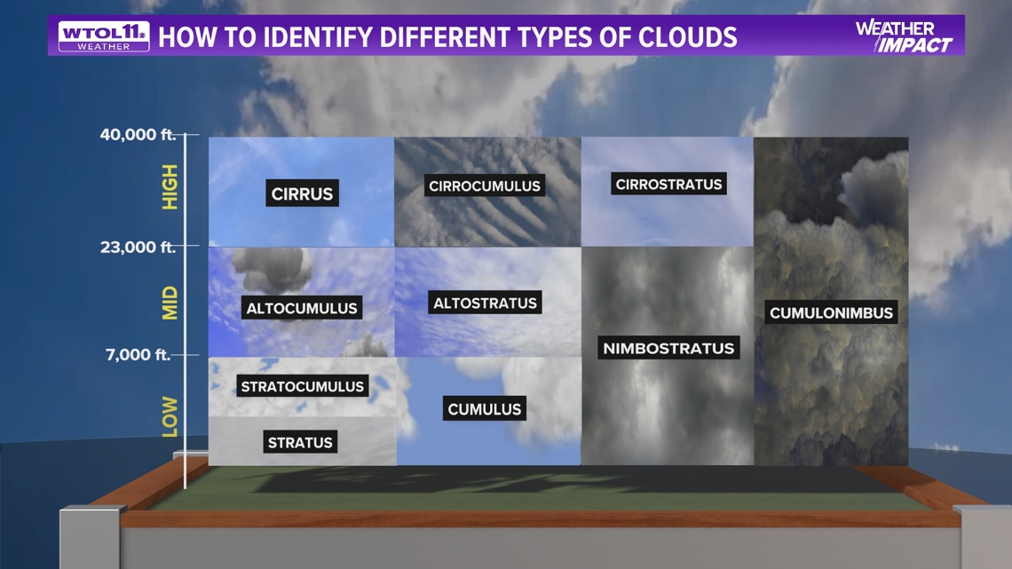
Every cloud type has a range in the atmosphere that they live in and typically thrive at its best. The sections where different clouds range in height are followed by a certain level in the atmosphere that distinguishes what type of cloud it is, but how did each cloud get its name?
Luke Howard, who was a pharmacist and an amateur meteorologist in the 1800s, was fascinated by clouds and decided that all clouds needed names, which paved the way for atmospheric sciences across the globe. He decided to name certain clouds based on the Latin meaning of each cloud.
According to the World Meteorological Organization Stratus from the Latin stratus, the past participle of the verb means to extend, to spread out, to flatten out, to cover with a layer.
About every cloud type that was named comes from Latin origin and continues to help scientists and meteorologists all around the world.
Low-Level Clouds
These are clouds that typically cause the most cloud cover out of all cloud types.
On days when the sun is barely visible, we classify these as "mostly cloudy" days.
These cloud types live mostly in the troposphere where the heights range from the surface up to 7,000 feet.
The clouds that live in this range are stratocumulus clouds, stratus clouds, and cumulus clouds. These clouds are associated with non-severe showers and light rain, and can also act as overcast skies on a cloudy day.
During the late winter months and early spring months, we get a lot of cloudy days and these clouds are typically what we see when we get consecutive cloudy days.
Low-level clouds tend to be more common clouds throughout northwest Ohio and southeast Michigan.
Mid-Level Clouds
Typically these types are located in the middle part of the troposphere and typically range from 7,000 feet to 23,000 feet.
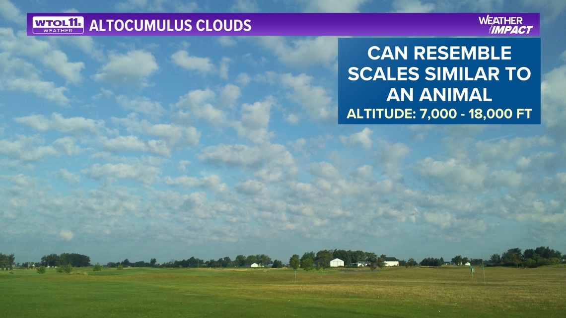
Clouds that are in this part of the atmosphere include altocumulus clouds and altostratus clouds.
These types of clouds tend to have a flat look to them, also in a well-organized pattern. Some may refer to the alto clouds as clouds that resemble the scales of an animal. Altostratus and altocumulus clouds are typically associated with warm fronts.
These clouds typically seem on partly cloudy days and are usually never associated with precipitation at all.
This type is visible during the morning or evening hours and will usually depict an incredible view as the sun reflects and shines off these clouds.

High-Level Clouds
The final layer of the atmosphere where this group of clouds is found is extremely high in the atmosphere.
The characteristics of these clouds can seem like high wispy clouds in the sky. The range where these clouds live is anywhere from 23,000 feet to 40,000 feet, making these the highest in the sky.
Due to these clouds being so high up in the atmosphere, they are almost all ice crystals.
Cirrocumulus clouds have a similar look to altocumulus, as they appear very spotty and in a pattern-shaped way.
According to the National Weather Service, unlike cirrus, cirrostratus clouds form more of a widespread, veil-like layer (similar to what stratus clouds do in low levels.) When sunlight or moonlight passes through the hexagonal-shaped ice crystals of cirrostratus clouds, the light is dispersed or refracted (similar to light passing through a prism) in such a way that a familiar ring or halo may form.
As a warm front approaches, cirrus clouds tend to thicken into cirrostratus, which may in turn thicken and lower into altostratus, stratus and even nimbostratus.
Since these clouds are so high in the atmosphere, precipitation cannot form.
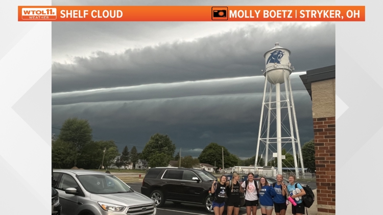
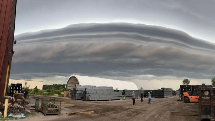
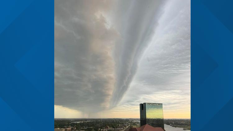
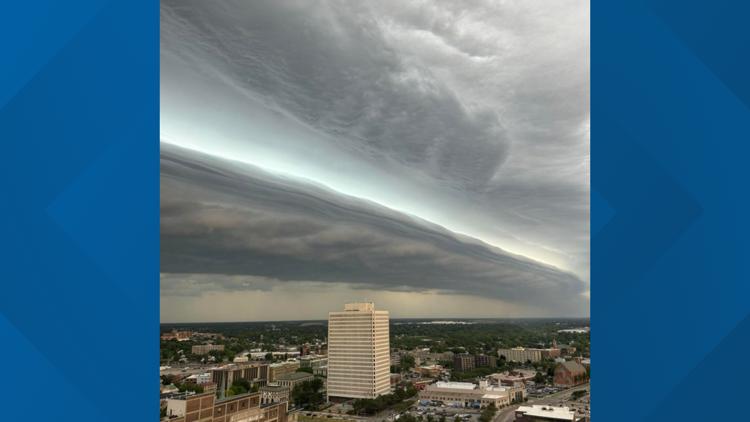
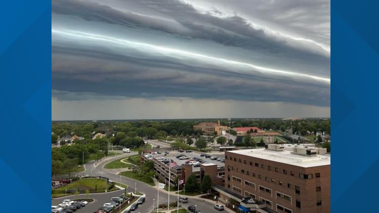
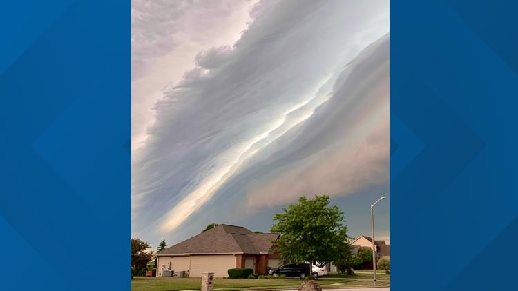
PHOTOS | Shelf cloud rolls through northwest Ohio during storm


Other rare and severe cloud formations
There are almost 100 different clouds in the world and some clouds are not seen in certain areas due to needing the proper elevation and topography of the land.
One type of cloud that will not be seen throughout the Midwest is lenticular clouds.
According to the UK Met Office, These lens-shaped orographic wave clouds form when the air is stable, and winds blow across hills and mountains from the same or similar direction at different heights through the troposphere.
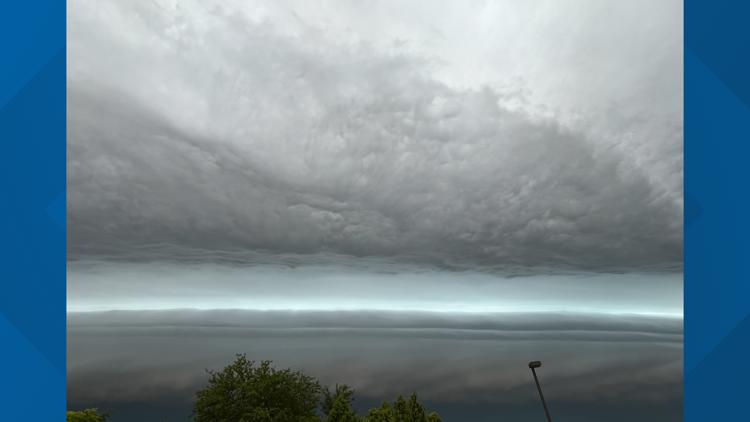
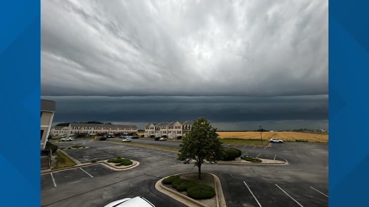
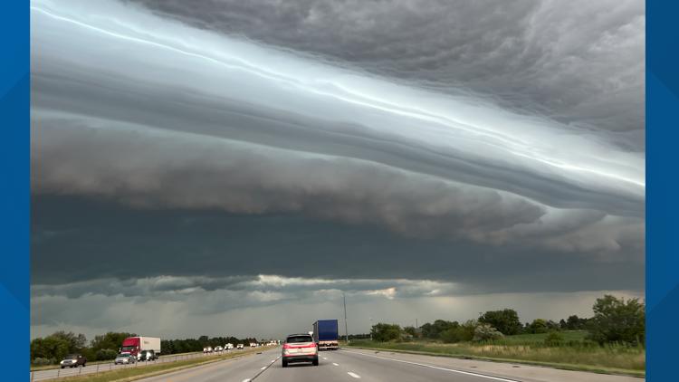
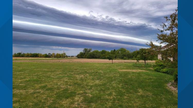
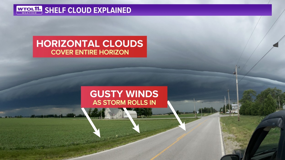
One of the more fascinating clouds we saw this past week was the massive shelf cloud. This type of cloud is associated with a leading front of strong to severe storms.
Typically, we see gusty winds out in front of the shelf cloud, eventually followed by the monstrous look shelf clouds, that are horizontal. These clouds typically move fast covering entire horizons. Behind these shelf clouds bring heavy rain.

Lastly, this cloud is one of the more common clouds that shows a clear sign of instability and updraft in the atmosphere. The cumulonimbus cloud is majority focused with showers and thunderstorms. Due to its fast rise and ability to produce torrential downpours, this cloud can range from 3,000 feet to exceeding 40,000 to 50,000 feet in the air.
According to the University of Illinois Urbana-Champaign, cumulonimbus clouds can exist as individual towers or form a line of towers called a squall line, fueled by vigorous convective updrafts sometimes in excess of 50 knots.
With so many diverse types of clouds, it is always fun and educational for all to know the difference between cloud types if you are interested in the world of weather.

MORE FROM WTOL 11 WEATHER IMPACT:
Want more from WTOL 11 News?
➡️ Download the WTOL 11 news app for Apple here or get it in the Google store here.
➡️ Get a fresh start to your morning and wrap up your day with the latest news and your WTOL 11 Weather forecast delivered right to your inbox!
WTOL 11's Your Morning Blast and Your Evening Blast deliver stories from northwest Ohio, southeast Michigan and beyond to keep you informed. Click here to get on the list!
➡️ Looking for the lowest current local gas prices? Check out the WTOL 11 gas price tracker, powered by Gas Buddy, here.
➡️ Stay up to date on what's happening in your community with a 24/7 live stream and on-demand content from WTOL 11+. Our free WTOL 11+ apps are available on Roku and Fire TV.
WTOL 11+ features the latest breaking news and weather, plus daily talk shows, coverage of your favorite sports teams from Locked On, fact-checking from VERIFY and the latest trending stories from Daily Blast Live.